If you’re involved in a property transaction in England or Wales, you’ll almost certainly need a Land Registry compliant plan. But which type? The two most common — title plans and lease plans — serve very different purposes, and confusing the two is one of the most frequent mistakes we see.
In this guide, we explain the difference between a title plan and a lease plan, cover when each is needed, what they must include, and how to make sure yours is accepted by HM Land Registry first time.
Quick answer: A title plan shows the general boundaries of a freehold property or piece of land on an Ordnance Survey map. A lease plan shows the precise internal extent of a leased area within a building — typically a flat, office, or commercial unit — at a much larger scale and with far more detail.
1. What Is a Title Plan?
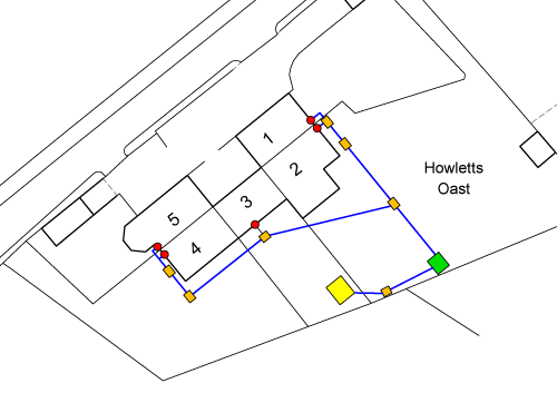
A title plan is the map-based element of a registered title. When HM Land Registry registers a property, they create a title plan based on Ordnance Survey mapping that shows the general extent of the land within a registered title.
Title plans are produced under the general boundaries rule (Section 60 of the Land Registration Act 2002), which means the red edging on a title plan shows the approximate position of the boundary — not the precise legal line. This is sufficient for the vast majority of property registrations.
Title plans are most commonly associated with freehold land and property — houses, land plots, development sites, and transfers of part. They show the external boundaries of the property at ground level, plotted against the OS map.
What a title plan typically includes:
- The property extent edged in red on an Ordnance Survey base map
- A north point for orientation
- A stated scale (usually 1:1250 in urban areas, 1:2500 in rural areas)
- Sufficient surrounding detail to locate the property on the OS map
- Colour references for easements, rights of way, or retained land where applicable
- T-marks or H-marks showing boundary ownership responsibilities where relevant
2. What Is a Lease Plan?
A lease plan is a detailed, scaled drawing showing exactly which part of a building is being leased to a tenant. It forms an integral part of the lease document itself and is required whenever a lease of more than seven years is being registered with HM Land Registry.
Unlike title plans, lease plans show the internal layout of the property in detail. They must precisely define the demised premises — the area the tenant is actually leasing — and clearly distinguish it from communal areas, the landlord’s retained structure, and any shared facilities.
Lease plans are most commonly needed for flats, apartments, commercial units, offices within larger buildings, and any situation where the leased area forms part of a bigger property.
What a lease plan typically includes:
- A detailed floor plan showing the internal layout of the leased area
- Red edging around the demised premises (internal or external walls depending on lease type)
- Clear identification of communal areas, often shown in a different colour
- A location plan showing the property’s position in the wider area
- A north point and stated scale (usually 1:100 or 1:200 for floor plans)
- Separate plans for each floor level where the lease spans multiple storeys
- Parking spaces, storage units, or roof terraces where included in the lease
3. Side-by-Side Comparison
| Feature | Title Plan | Lease Plan |
|---|---|---|
| Purpose | Shows the extent of a registered title | Shows the precise area being leased |
| Tenure | Typically freehold | Leasehold |
| What it shows | External boundaries on OS map | Internal layout and floor plans |
| Level of detail | General boundaries | Precise room-level detail |
| Typical scale | 1:1250 (urban) or 1:2500 (rural) | 1:100 or 1:200 (floor plans) |
| Base mapping | Ordnance Survey map | Measured survey or architect’s plans |
| Red edging position | Around the external boundary | Around internal or external walls of demise |
| Communal areas | Not usually shown | Must be clearly identified |
| When required | Sale, transfer, first registration | Lease of 7+ years being registered |
4. When Do You Need Each One?
You need a title plan when:
- Selling or transferring part of a freehold property (transfer of part)
- Applying for first registration of unregistered land
- Registering a new-build property with the Land Registry
- Dealing with a boundary query that requires a compliant plan
- Supporting a planning application where a Land Registry plan is needed
You need a lease plan when:
- Granting a new lease of more than seven years (e.g. a flat, office, or shop)
- Converting a freehold property into separate leasehold units (e.g. splitting a house into flats)
- Updating an outdated or non-compliant lease plan
- Registering a lease extension or variation that changes the demised area
- Selling a leasehold property where the existing plan does not meet current HMLR standards
Not Sure Which Plan You Need?
Send us your details and we’ll advise which plan type is right for your transaction — free of charge.
Get Free Advice →5. HMLR Requirements for Each Plan Type
Both title plans and lease plans must comply with Practice Guide 40 — HM Land Registry’s official guidance on plan preparation. However, the specific requirements differ significantly between the two.
Title plan requirements:
- Based on or referable to the current Ordnance Survey map
- Drawn to a recognised scale (1:500, 1:1250, or 1:2500)
- Property extent clearly edged in red
- North point shown
- Sufficient surrounding detail for HMLR to locate the property on the OS map
- No disclaimers such as “for identification purposes only” or “do not scale”
- Plan must be signed where it accompanies a deed
Lease plan requirements (in addition to the above):
- Detailed floor plan at a larger scale (typically 1:100 or 1:200)
- Red edging on the correct wall line — internal face for IRI leases, external face for FRI leases
- Communal areas clearly distinguished (usually coloured differently)
- Each floor shown on a separate plan where the lease covers multiple levels
- Rights of way, parking, and storage areas identified where included in the lease
- An accompanying location plan showing the building’s position
6. Common Mistakes That Cause Rejections
We see plans rejected by HMLR regularly — often because the wrong type of plan was submitted or key requirements were missed. Here are the most common errors for each type:
Title plan mistakes:
- Using a marketing floor plan instead of an OS-based plan
- Missing or incorrect scale bar
- No north point
- Boundaries that cannot be related to the Ordnance Survey map
- Including “do not scale” or similar disclaimers
- Plan printed from PDF at the wrong size (scaling to fit the paper)
Lease plan mistakes:
- Submitting a title plan when a lease plan is required
- Red edging on the wrong wall line (internal vs external)
- Communal areas not identified or poorly distinguished
- No floor level identification on multi-storey buildings
- Missing location plan alongside the floor plan
- Plan not signed alongside the deed
7. Cost Differences
Lease plans generally cost more than title plans because they require greater detail and often involve more preparation work. A lease plan needs a precise floor plan showing the internal layout, whereas a title plan is based primarily on Ordnance Survey mapping.
At Towers Richardson, both plan types are competitively priced and include full compliance checking against Practice Guide 40 requirements. We provide a fixed-price quote upfront so there are no surprises.
For a quote on either type of plan, contact us here — we respond within 1 hour during business hours.
8. Frequently Asked Questions
Can I use the same plan for both a title and a lease?
No. Title plans and lease plans serve different purposes and have different requirements. A title plan shows external boundaries on an OS map, while a lease plan shows the internal demise of a leased area. You cannot substitute one for the other.
Does a leasehold property have both a title plan and a lease plan?
Yes. Most leasehold properties will have a title plan (held by HMLR as part of the registered title) and a lease plan (attached to the lease document). The two work together but show different information.
What does FRI and IRI mean for lease plans?
FRI stands for Full Repairing and Insuring — the tenant is responsible for the entire property including structure. IRI stands for Internal Repairing and Insuring — the landlord retains responsibility for the structure. This affects where the red edging is drawn: on the external wall face for FRI leases, and on the internal wall face for IRI leases.
Do I need a lease plan for a lease under 7 years?
Leases of 7 years or less do not trigger compulsory registration with HMLR, so a Land Registry compliant lease plan is not strictly required. However, it is still good practice to include a clear plan with any lease to avoid disputes about the extent of the demised premises.
Can I prepare my own title plan or lease plan?
Technically yes, but we would not recommend it. Plans must meet strict HMLR requirements under Practice Guide 40, and non-compliant plans are one of the most common reasons for application rejections. A professional plan prepared by a specialist ensures first-time acceptance and avoids costly delays.
How long does it take to get a plan prepared?
At Towers Richardson, we offer a standard 24-hour turnaround on both title plans and lease plans. We can also accommodate urgent same-day requests where needed.
Need a Title Plan or Lease Plan?
At Towers Richardson, we have been preparing Land Registry compliant plans since 1994 — and we maintain a 100% HMLR acceptance rate. Whether you need a title plan for a freehold transfer or a lease plan for a new flat registration, we deliver plans that are right first time.
Every plan is prepared using licensed Ordnance Survey data, professional CAD software, and checked against Practice Guide 40 requirements before delivery.
Get in touch today:
📧 info@towers-richardson.co.uk
📞 01226 885040
💬 WhatsApp: 07543 434048
Or request a free quote online — we respond within 1 hour during business hours.