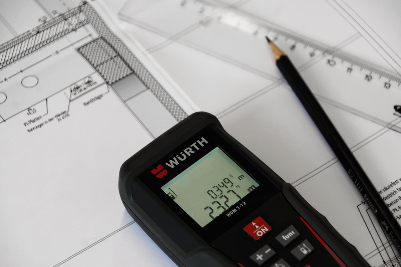
Whether you’re selling your home, checking your boundaries, or just want to see what the Land Registry holds about your property, getting a copy of your title deeds is straightforward — and you can do it online in minutes.
This guide explains exactly how to get a copy of your title deeds from HM Land Registry, what each document contains, what it costs, and what to do if your property is unregistered.
Important: HM Land Registry does not store original paper deeds. What they hold are digital records — specifically the title register and title plan. Together, these documents effectively replace the old-fashioned bundle of deeds for registered properties.
1. What Are Title Deeds?
Historically, title deeds were the physical documents that proved ownership of land and property — a bundle of paper records tracing the chain of ownership over decades, sometimes centuries. These included conveyances, transfers, mortgages, and any plans attached to those documents.
Since the introduction of compulsory land registration (phased in across England and Wales and fully national by 1990), the Land Registry has progressively replaced paper deeds with digital records. When a property is registered, HMLR creates two key documents: the title register and the title plan. These are the modern equivalent of title deeds for the vast majority of properties.
As of 2024, there are more than 26.7 million registered titles covering around 89% of the freehold land mass of England and Wales.
2. Title Register vs Title Plan — What’s the Difference?
People often talk about “title deeds” as a single thing, but the Land Registry actually holds two separate documents for each registered property:
| Document | What It Contains |
|---|---|
| Title Register | The written record of the property. Includes the owner’s name and address, the property description, the class of title, any mortgages or charges, restrictive covenants, easements, and other legal interests. |
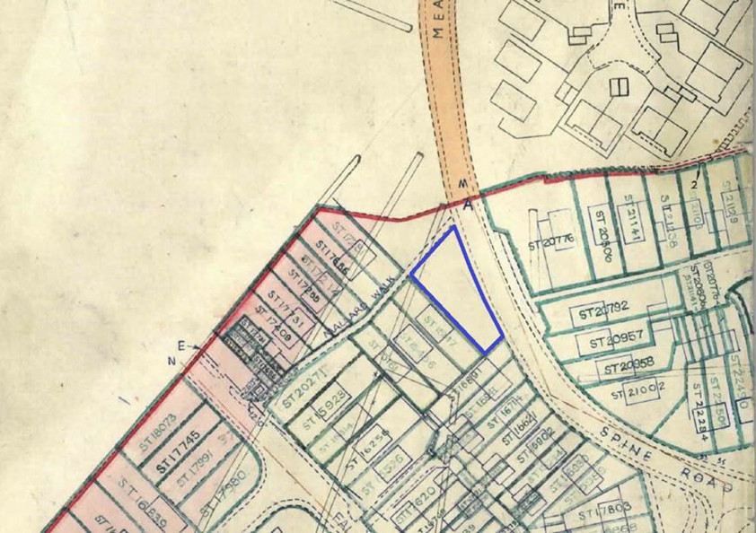
| Title Plan | The map-based record. Shows the general extent of the property’s boundaries drawn on an Ordnance Survey base map, edged in red. May also show rights of way, covenants, and other interests in different colours. |
The title register is divided into three sections: the Property Register (describing the land), the Proprietorship Register (identifying the owner), and the Charges Register (listing mortgages and other interests). Together with the title plan, these form the complete record of a registered title.
3. How to Download Your Title Deeds Online
You can download copies of the title register and title plan for any registered property in England and Wales — you do not need to own the property. Here’s how:
- Go to the GOV.UK search page: Visit Search for land and property information. This is the official HMLR service — always use the GOV.UK site rather than third-party resellers who charge more.
- Search for the property: Enter the postcode, or use the options below to search by street name, town, or map. If the property is registered, it will appear in the results.
- View the free summary: Click on the property to see a free summary showing the address, tenure (freehold or leasehold), and whether there are any covenants or easements on the register.
- Download the title register: Click to download the title register (PDF). This costs £7 and includes the full ownership details, charges, and any restrictions.
- Download the title plan: Click to download the title plan (PDF). This also costs £7 and shows the property’s boundaries on the Ordnance Survey map.
Tip: Downloads from the online service are not official copies — they cannot be used as proof of ownership in court. If you need official copies (e.g. for legal proceedings), you need to apply using form OC1. Official copies cost £7 each when ordered through the HMLR portal.
4. How Much Does It Cost?
HMLR fees were updated in December 2024. The current costs for the most common documents are:
| Document | Online (GOV.UK) | Notes |
|---|---|---|
| Title summary | Free | Basic info: address, tenure, covenants |
| Title register | £7 | Full ownership details |
| Title plan | £7 | Boundary map |
| Other filed documents (OC2) | £7 each | Copies of leases, transfers, etc. |
| Historical title register (HC1) | £7 per date | Shows who owned property at a specific date |
Be aware that third-party websites often charge significantly more than these official rates. Always use the GOV.UK service directly to avoid paying unnecessary premiums. HMLR has published guidance on this — some resellers package the same documents into “bundles” at inflated prices.
5. What You Can Find Out for Free
Before spending anything, you can find out quite a lot from the free title summary:
- The address and description of the property
- Whether it is freehold or leasehold
- Whether there are any restrictive covenants noted
- Whether there are any easements noted
- The title number
You can also access several free datasets from HMLR, including the UK House Price Index, data on properties owned by UK and overseas companies, and the INSPIRE Index Polygons that show the indicative position of registered freeholds across England and Wales.
Need a New Title Plan or Lease Plan?
The title plan you download from HMLR shows your existing boundaries. If you need a new compliant plan for a transaction, we can help.
Get a Free Quote →6. What If Your Property Is Unregistered?
If your property does not appear when you search the Land Registry, it is likely unregistered. This is still the case for around 11% of freehold land in England and Wales — often older properties that have not changed hands since registration became compulsory.
For unregistered property, ownership is proved by the original paper deeds (known as an “epitome of title”). These may be held by your solicitor, your mortgage lender, or yourself.
Options for unregistered property:
- Check with your mortgage lender — if a mortgage began before 1990, the lender may still hold the original deeds
- Check with the solicitor who handled the original purchase
- Apply for a search of the index map (form SIM) to confirm whether the land is registered under a different address or title number
- Consider voluntary first registration — HMLR offers a 25% discount on registration fees for voluntary applications, and aims to register all land by 2030
If you need to register unregistered land, you will need a compliant title plan. Read our complete guide to first registration for more details.
7. Getting Copies of Original Paper Deeds
For registered properties, HMLR may hold scanned copies of the original deeds that were submitted at the time of registration. These are marked as “filed” in the title register.
To request copies of filed deeds, download and complete the deeds request form from GOV.UK, include the property’s title number, and send it to HMLR’s Citizen Centre with the appropriate fee (£11 per document). Be aware that HMLR may not hold copies of all original deeds — your search may return no results.
8. Frequently Asked Questions
Can I view my title deeds online for free?
You can view a free title summary showing the address, tenure, and whether covenants or easements are noted. The full title register and title plan each cost £7 to download.
Can anyone look up my property on the Land Registry?
Yes. The Land Registry is a public register. Anyone can search for any registered property and download copies of the title register and title plan by paying the fee.
Are downloaded copies proof of ownership?
Downloads from the online service are informational copies — not official copies. For legal purposes such as court proceedings, you need to apply for official copies using form OC1.
How do I find out who owns a piece of land?
Search for the land on the GOV.UK service. If the land is registered, the title register will show the current owner’s name and address. If it is not registered, you may need to make enquiries through the local authority or seek legal advice.
My property doesn’t appear in the search — what should I do?
Your property may be unregistered, or it may be filed under a different address. Try searching by map rather than address. If it still does not appear, apply for a search of the index map (form SIM) to check whether the land is registered under a different title number.
What is the difference between the title register and the title deeds?
The title register is the modern digital record that replaced traditional paper title deeds for registered properties. It contains essentially the same ownership information but in a standardised format maintained by HM Land Registry.
Need a New Land Registry Plan?
The title plan you download from HMLR shows your existing registered boundaries. If you need a new compliant plan — for a transfer of part, first registration, lease, or boundary update — that is where we come in.
At Towers Richardson, we have prepared Land Registry plans since 1994 with a 100% HMLR acceptance rate. Every plan is checked against Practice Guide 40 requirements before delivery.
Get in touch today:
📧 info@towers-richardson.co.uk
📞 01226 885040
💬 WhatsApp: 07543 434048
Or request a free quote online — we respond within 1 hour during business hours.