Blog

  • HM Land Registry Increase Costs

    HM Land Registry Increase Costs

    On 9 December 2024, HM Land Registry increased the cost of its information services for the first time in over ten years. If you’re a solicitor, conveyancer, estate agent, or property owner who regularly accesses title plans, title registers, or official search results, you’ll now be paying more than double the previous price for electronic copies.

    The headline change is straightforward: electronic copies of title registers and title plans have increased from £3 to £7 each. But the full picture is broader than that, and there are some important details worth understanding — particularly if you’re involved in property transactions on a regular basis.

    Key Takeaway: The fee increase applies to information services — accessing documents and conducting searches. Registration services fees (Scale 1 and Scale 2 for registering transfers, leases, and mortgages) were last changed in January 2022 and remain unchanged by this update.

    1. What Changed on 9 December 2024

    The Land Registration Fee Order 2024 came into effect on 9 December 2024, updating the fees for HM Land Registry’s information services. These are the fees you pay when requesting copies of documents, conducting official searches, or inspecting the register.

    The changes affect three main areas:

    • Official copies — title registers, title plans, and filed documents (deeds, charges, conveyances)
    • Official searches — priority searches (OS1, OS2, OS3), home rights searches (HR3), and index map searches (SIM)
    • Agricultural Credits and Land Charges — registration and search fees under these separate registers

    HM Land Registry stated that the increase reflects the rising costs of running and improving their services, along with investment in digitalisation and data transformation. They also noted that even at the new prices, most customers are still paying less than they were in 1992.

    2. Information Services Fee Breakdown

    Here’s how the key fees compare before and after the December 2024 changes:

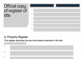
    Official Copies (Title Documents)

    Document Electronic (Portal/Gateway) Postal
    Title Register (OC1) £7 was £3 £11 was £7
    Title Plan (OC1) £7 was £3 £11 was £7
    Copy of a Filed Document (OC2) £7 was £3 £11 was £7
    Historical Edition of Register/Plan (HC1) £7 was £3 £11 was £7
    Exempt Information Document (EX2) £7 was £3 £11 was £7

    Official Searches

    Search Type Electronic (Portal/Gateway) Postal
    Priority Search — Whole Title (OS1) £7 was £3 £11 was £7
    Priority Search — Part Title (OS2) £7 was £3 £11 was £7
    Non-Priority Search — Whole Title (OS3) £7 was £3 £11 was £7
    Home Rights Search (HR3) £7 was £3 £11 was £7
    Index Map Search (SIM) — up to 5 titles £8 was £4
    Proprietors’ Name Search (PN1) £15 per name (post only)

    The pattern is consistent: electronic fees have moved from £3 to £7 (a 133% increase), and postal fees have moved from £7 to £11 (a 57% increase). The gap between electronic and postal pricing is designed to encourage digital submissions.

    Worth Noting: If you only need a title plan or register for your own property, the cheapest route is the Search for Land and Property Information service on GOV.UK — £7 per document, delivered electronically.

    3. Registration Services Fees

    It’s worth clarifying that the December 2024 changes only apply to information services. The fees for actually registering property transactions — known as Scale 1 and Scale 2 fees — were last increased on 31 January 2022 and remain unchanged.

    Scale 1 fees apply to registrations involving monetary consideration (property sales, new mortgages, first registrations). Scale 2 fees apply to transfers not for monetary value (assents following death, trustee changes, matrimonial transfers).

    These fees are based on the value of the property or consideration involved, ranging from £45 for properties up to £80,000 to several hundred pounds for high-value transactions. You can check the exact fee for any transaction using the HM Land Registry fee calculator.

    HM Land Registry has indicated that a more substantial review of their overall charging structure is planned following a consultation, but no timeline has been confirmed for further changes.

    4. What This Means for Property Transactions

    For a single property purchase or sale, the fee increase is modest — an extra £4 per document. But the costs add up quickly for professionals handling multiple transactions, and for certain types of work, the cumulative impact is significant.

    For Solicitors & Conveyancers

    A standard residential conveyancing transaction typically requires at minimum a title register, a title plan, and an OS1 priority search — that’s £21 in electronic fees where it was previously £9. Add in a copy of a filed document (lease, transfer deed, or plan) and an index map search, and the costs climb further. For firms handling hundreds of transactions a year, the annual increase is substantial.

    For Estate Agents

    Under the Material Information requirements, agents are increasingly expected to verify property details using Land Registry documents. At £7 per title plan and £7 per register, the cost of checking even basic details for each instruction has more than doubled.

    For Property Developers

    Development projects involving multiple plots, ransom strips, access rights, and neighbouring titles can require dozens of title searches. A development of 50 plots where each requires a title plan and register check now costs £700 in search fees alone — up from £300.

    For Homeowners

    If you need to check your own title plan or register — for example, to understand your property boundaries or check what’s registered against your title — the cost has increased from £3 to £7 per document. For a title register and title plan together, that’s £14.

    5. How to Avoid Overpaying

    One of the biggest issues with Land Registry document access is the number of third-party websites that repackage official Land Registry data at inflated prices. These sites often appear prominently in search results — sometimes above the official GOV.UK service — and charge significantly more than the official fees.

    Some of these sites charge £20, £30, or even more for a title plan that costs £7 directly from HM Land Registry. They’re accessing exactly the same data — there’s no added value.

    • Avoid paid search ads that mimic the official Land Registry service. The official GOV.UK site will never appear as a paid advertisement.
    • Check the URL — the official search service is at search-property-information.service.gov.uk. If the domain doesn’t end in .gov.uk, it’s a third-party reseller.
    • Verify the price before entering payment details. If you’re being charged more than £7 for an electronic title plan or register, you’re not on the official site.
    • Be cautious with bundled services. Some third-party sites bundle a title plan and register together with added “reports” and charge a premium. If all you need is the official document, go directly to GOV.UK.

    Quick Link: The official HM Land Registry search service is at search-property-information.service.gov.uk — bookmark it to avoid accidentally landing on a reseller site.

    6. Does This Affect Our Plan Prices?

    The HM Land Registry fee increase relates to the cost of accessing existing documents — title plans, title registers, and search results. It does not directly affect the cost of having a new Land Registry-compliant plan prepared.

    At Towers Richardson, our plans are prepared to meet the requirements of Practice Guide 40 and are submitted as part of your solicitor’s application to register a transaction. The Land Registry registration fee (Scale 1 or Scale 2) is paid separately by your solicitor as part of the application process.

    Our plan preparation fees start from £115 and remain unaffected by the information services fee increase. We continue to offer 24-hour turnaround as standard and maintain a 100% HM Land Registry acceptance rate.

    If you need a title plan, lease plan, transfer plan, or developer plan, get in touch for a free quote:

    📧 info@towers-richardson.co.uk
    📞 01226 885040
    💬 WhatsApp: 07543 434048

    Or request a free quote online — we respond within 1 hour during business hours.

    Frequently Asked Questions

    How much does a title plan cost from HM Land Registry?

    An official copy of a title plan costs £7 when ordered electronically through the HM Land Registry portal or Business Gateway. A postal copy costs £11. These prices came into effect on 9 December 2024.

    How much does a title register cost from HM Land Registry?

    An official copy of a title register costs £7 electronically or £11 by post, the same as a title plan. If you need both documents for the same property, the total cost is £14 electronically or £22 by post.

    When did HM Land Registry fees increase?

    Information services fees (title plans, registers, searches, and filed documents) increased on 9 December 2024 under the Land Registration Fee Order 2024. Registration services fees (Scale 1 and Scale 2 for property registrations) were last increased on 31 January 2022 and remain unchanged.

    Why did HM Land Registry increase their fees?

    HM Land Registry stated that the increase reflects the rising costs of running and improving their services, along with investment in digitalisation and data transformation. The information services fees had not been changed for more than ten years prior to this increase.

    Where is the official HM Land Registry search service?

    The official service is at search-property-information.service.gov.uk. Be cautious of third-party websites that appear in search results and charge more than the official £7 fee for electronic copies. If the website address doesn’t end in .gov.uk, it’s a reseller.

    Do the fee increases affect the cost of having a Land Registry plan prepared?

    No. The fee increase applies to accessing existing documents from HM Land Registry. The cost of having a new Land Registry-compliant plan prepared by a specialist like Towers Richardson is separate. Our plan preparation fees start from £115 and are unaffected by the information services fee change.

    Can I get a free title plan?

    HM Land Registry does not provide free title plans to the public. The minimum cost is £7 for an electronic copy. If you’re buying a property, your solicitor or conveyancer will obtain the title documents as part of the transaction — the cost is usually included in their disbursements. Some third-party sites advertise “free” title information but may only provide limited details or require a paid upgrade for the full document.

  • What is a POS Land Transfer Plan and Why is It Important?

    What is a POS Land Transfer Plan and Why is It Important?

    If you are involved in a housing development or land transfer that includes communal green space, you will likely need a POS Land Transfer Plan. These plans are essential for transferring Public Open Space from a developer to a local authority or management company — and getting them right is critical to avoiding delays in the process.

    In this guide, we explain what a POS Land Transfer Plan is, when you need one, what it must include, and how to make sure it complies with HM Land Registry requirements. We draw on over 30 years of specialist experience to help you get it right first time.

    Why trust this guide? Towers Richardson has prepared thousands of Land Registry plans since 1994, including POS Land Transfer Plans for major house builders and developers across England and Wales. We maintain a 100% HM Land Registry acceptance rate on every plan we produce.

    What Does POS Stand For?

    In the context of property development and land planning, POS stands for Public Open Space. These are areas within a development that are set aside for communal use. Parks, playgrounds, landscaped gardens, wildlife corridors and amenity grassland are all common examples of Public Open Space.

    Local authorities typically require developers to provide Public Open Space as a condition of planning permission. This requirement is often secured through a Section 106 agreement (a legal agreement between the developer and the local planning authority) that sets out the size, location and future management of the open space.

    Once the development is complete — or at an agreed trigger point — the developer must transfer ownership of the POS to the local council, a residents’ management company, or another designated body. That transfer requires a compliant plan.

    What Is a POS Land Transfer Plan?

    A POS Land Transfer Plan is a scaled drawing that clearly identifies the boundaries, extent and layout of Public Open Space within a development. It forms part of the legal documentation submitted to HM Land Registry when transferring ownership of the open space from the developer to the adopting body.

    In most cases, the POS Land Transfer Plan accompanies a TP1 transfer deed — the standard form used when part of a registered title is being transferred to a new owner. The plan must be precise enough for HMLR to update the Land Register and create a new title for the transferred land.

    These plans are more complex than a standard residential transfer plan. POS areas often have irregular boundaries, include multiple separate parcels, and border various individual plot boundaries. The plan must clearly show all of this while remaining compliant with Practice Guide 40 requirements.

    When Do You Need a POS Land Transfer Plan?

    A POS Land Transfer Plan is typically required at the following stages of a development project:

    • Transferring open space to a local authority — when the council adopts the POS as part of a Section 106 obligation
    • Transferring to a management company — when a residents’ management company or private estate management firm takes ownership of communal areas
    • Registering the POS as a separate title — HMLR requires a compliant plan to create a new registered title for the transferred land
    • Satisfying Section 106 conditions — the local authority will need evidence that the open space has been properly transferred
    • Developer exit and final plot disposals — transferring the POS is often one of the final steps before a developer can close out a site

    The timing of the transfer varies from site to site. Some Section 106 agreements require the POS to be transferred after a certain number of homes have been occupied. Others allow it at practical completion of the estate. Your solicitor will advise on the specific trigger for your project.

    Why Are POS Land Transfer Plans Important?

    Getting the POS Land Transfer Plan right matters for several reasons — and the consequences of getting it wrong can be significant.

    Clarity of Ownership

    The plan legally defines the precise boundaries and extent of the Public Open Space. Without a clear, compliant plan, there is scope for disputes about exactly which areas have been transferred and which remain with the developer.

    Compliance With HMLR Requirements

    HM Land Registry will reject any transfer application where the accompanying plan fails to meet the standards set out in Practice Guide 40. A rejected plan delays the transfer and can hold up the entire close-out of a development site.

    Efficient Property Transactions

    An accurate POS Land Transfer Plan speeds up the legal transfer process. Solicitors acting for both the developer and the adopting body can proceed with confidence when the plan is clear, compliant and consistent with the deed description.

    Community Benefits

    Properly transferred and registered Public Open Space ensures that communal areas are formally allocated, maintained and protected for the benefit of residents. Without a completed transfer, the long-term management and upkeep of these spaces can fall into uncertainty.

    Need a POS Land Transfer Plan?

    Specialist plans for developers and solicitors. 100% HMLR acceptance rate. Most plans delivered within 24–48 hours.

    Get a Free Quote

    What Should a POS Land Transfer Plan Include?

    A compliant POS Land Transfer Plan must meet the same core requirements as any plan submitted to HM Land Registry. However, there are additional considerations specific to open space transfers on development sites.

    Every POS Land Transfer Plan should include the following:

    • Based on the Ordnance Survey map — the plan must show sufficient OS detail for HMLR to locate the land accurately
    • Drawn to a stated metric scale — typically 1:500 or 1:1250 for development sites, with a scale bar included
    • A north point — confirming the orientation of the plan
    • Clear, continuous boundary edging — the POS boundary must form a complete, enclosed area with no gaps
    • Sufficient surrounding detail — neighbouring plots, roads, footpaths and other features must be visible so HMLR can pinpoint the location
    • Correct colouring conventions — colours must distinguish the POS land from the retained land and any rights of way
    • Date of preparation — providing a record of when the plan was produced
    • No prohibited phrases — wording such as “not to scale” or “for identification purposes only” must not appear on the plan
    • Consistency with the deed description — the plan must match the verbal description in the TP1 transfer deed

    Developer tip: POS areas often consist of multiple separate parcels spread across a site — landscaped buffers, play areas, balancing ponds, footpath corridors and amenity grassland. Each parcel must be clearly identified on the plan. If the parcels are widely spread, an inset location plan at a smaller scale may be needed alongside the detailed plan.

    Recommended Scales for POS Land Transfer Plans

    Scale Best Used For Coverage
    1:500 Small POS areas, play areas, individual parcels High detail — individual features clearly visible
    1:1250 Standard development sites, urban and suburban POS Most common scale for residential estate POS plans
    1:2500 Large rural developments, extensive open space areas Wider coverage for larger sites

    Colouring Conventions for POS Plans

    Colour is used on a POS Land Transfer Plan to distinguish the land being transferred from the land being retained. While HMLR does not mandate specific colours, the following conventions are standard practice:

    • Red edging — shows the extent of the POS land being transferred
    • Blue edging — identifies the retained land (plots and areas remaining with the developer)
    • Green colouring — sometimes used to highlight communal landscaped areas or amenity space within the POS
    • Brown colouring — used to indicate rights of way or easements benefiting the transferred land

    Colours must remain clearly distinguishable when printed. This is particularly important on POS plans, where multiple colours are often used in close proximity across a detailed site layout. We always check print clarity before issuing any plan.

    Common Issues With POS Land Transfer Plans

    POS Land Transfer Plans can be more prone to errors than straightforward residential transfer plans. The complexity of development sites — with multiple parcels, irregular boundaries and overlapping rights — creates several common pitfalls:

    • Boundaries that do not match the site layout plan — the POS boundary on the transfer plan must align with the approved planning layout, not an earlier draft
    • Gaps or overlaps with individual plot boundaries — the POS plan must fit precisely with the boundaries of adjacent sold plots to avoid unregistered strips of land
    • Multiple parcels not clearly identified — where POS consists of several separate areas, each must be clearly labelled and edged
    • Inconsistency with the Section 106 agreement — the plan should reflect the open space areas identified in the original planning obligation
    • Outdated base mapping — using OS data from before the development was built can result in buildings and roads not appearing on the plan
    • Prohibited phrases on the plan — wording such as “for identification purposes only” or “not to scale” will cause automatic rejection
    • Colours that are indistinguishable when printed — a frequent issue when multiple POS parcels and retained land areas are shown together

    When HMLR raises a requisition on a POS transfer, it can delay the entire close-out of a development site. For large house builders managing dozens of sites simultaneously, this creates a significant administrative burden. Getting the plan right first time avoids all of this.

    How Much Does a POS Land Transfer Plan Cost?

    The cost of a POS Land Transfer Plan depends on the complexity of the site, the number of separate POS parcels involved, and whether we are working from an existing site plan or need to plot the boundaries from scratch.

    For a straightforward POS transfer on a single development site, plans typically start from £115. Larger or more complex sites with multiple POS parcels are priced on a project basis — we will always confirm the cost upfront before any work begins.

    We provide fixed-price quotes with no hidden fees. If you are a developer or solicitor managing multiple sites, we can also offer volume pricing. Request a quote and we will respond within 1 hour during business hours.

    How Long Does It Take?

    We typically deliver completed POS Land Transfer Plans within 24 to 48 hours of receiving your instructions and supporting documents. Urgent same-day turnarounds are available when you need them.

    The main factors that affect timescales are the complexity of the site and the completeness of the information provided. If you can supply an approved site layout plan, the Section 106 plan and the existing title plan, we can usually work from these without needing to visit the site.

    For very large sites with numerous POS parcels, we will agree a realistic delivery schedule at the quoting stage so you know exactly when to expect the completed plans.

    How Towers Richardson Can Help

    At Towers Richardson, we specialise in Land Registry-compliant plans — and POS Land Transfer Plans are a core part of what we do. We work with major house builders, regional developers, solicitors and management companies across England and Wales to deliver plans that are accepted by HMLR first time, every time.

    Here is what sets us apart:

    • 100% HMLR acceptance rate — every plan we produce is checked against Practice Guide 40 requirements before delivery
    • Licensed Ordnance Survey data — we work directly with current OS MasterMap data in our CAD systems
    • 30+ years of specialist experience — we have been preparing Land Registry plans since 1994
    • Fast turnaround — most plans delivered within 24 to 48 hours, with same-day options available
    • Nationwide coverage — we serve clients across England and Wales from our base in South Yorkshire
    • Fixed-price quotes — no hidden fees, with costs confirmed upfront before any work starts

    Whether you need a single POS transfer plan or a full suite of plans for a multi-phase development, we have the experience and expertise to deliver.

    30+ Years. 100% Acceptance Rate.

    Trusted by solicitors, developers and property professionals across England and Wales since 1994.

    Request Your Free Quote

    Frequently Asked Questions

    What is a POS Land Transfer Plan?

    A POS Land Transfer Plan is a scaled drawing that shows the boundaries and extent of Public Open Space within a development. It is submitted to HM Land Registry as part of a transfer deed (TP1) when ownership of the open space moves from the developer to a local authority, management company or other adopting body.

    What does POS stand for in property development?

    POS stands for Public Open Space. These are communal areas within a development — such as parks, play areas, landscaped gardens and amenity grassland — that are set aside for the benefit of residents and the wider community.

    Why is a POS Land Transfer Plan important?

    The plan legally defines which areas of land are being transferred. Without a clear, HMLR-compliant plan, the transfer cannot be registered, which delays the close-out of the development site and can leave communal spaces in an uncertain ownership position.

    What scale should a POS Land Transfer Plan be?

    The most common scales are 1:500 for small areas and 1:1250 for standard development sites. Larger rural sites may use 1:2500. The scale must be stated on the plan, metrically accurate, and include a scale bar.

    How much does a POS Land Transfer Plan cost?

    Plans start from £115 for straightforward transfers. More complex sites with multiple POS parcels are priced on a project basis. We provide fixed-price quotes upfront — contact us for a personalised quote.

    How long does it take to get a POS Land Transfer Plan?

    We typically deliver plans within 24 to 48 hours. Same-day urgent turnarounds are available when needed. Complex sites with numerous POS parcels may take slightly longer, but we will confirm the timescale when quoting.

    Can I use a site layout plan as a POS Land Transfer Plan?

    A site layout plan from your architect or planning consultant is not the same as a Land Registry-compliant transfer plan. Site plans often carry prohibited phrases such as “not to scale” and are not based on Ordnance Survey data. A purpose-prepared POS Land Transfer Plan is needed for HMLR registration.

    What is a Section 106 agreement?

    A Section 106 agreement is a legal obligation between a developer and the local planning authority, made under the Town and Country Planning Act 1990. It often requires the developer to provide Public Open Space and to transfer it to an adopting body at an agreed stage of the development.

    Need Help With Your POS Land Transfer Plan?

    Towers Richardson has been preparing Land Registry-compliant plans since 1994. Whether you need a single POS transfer plan or a complete package of plans for a large development, we can help you get it right first time.

    Every plan is prepared using licensed Ordnance Survey data, professional CAD software, and checked against Practice Guide 40 requirements before delivery. We work with solicitors, house builders, developers and management companies across England and Wales.

    Get in touch today:

    📧 info@towers-richardson.co.uk
    📞 01226 885040
    💬 WhatsApp: 07543 434048

    Or request a free quote online — we respond within 1 hour during business hours.

  • Understanding Section 52 Agreements

    Understanding Section 52 Agreements

    If you are buying, selling or developing land that is subject to a planning obligation made before 1991, there is a good chance you will encounter a Section 52 agreement. Although these agreements were replaced by the Section 106 framework over 30 years ago, many remain active and legally enforceable today — and they can have a direct impact on property transactions.

    In this guide, we explain what a Section 52 agreement is, how it differs from a Section 106 agreement, why accurate plans matter when dealing with one, and how Towers Richardson can help you navigate the process.

    Why trust this guide? Towers Richardson has prepared Land Registry-compliant plans since 1994, working with solicitors, developers and local authorities on properties subject to both Section 52 and Section 106 agreements. We maintain a 100% HM Land Registry acceptance rate on every plan we produce.

    What Is a Section 52 Agreement?

    A Section 52 agreement is a legally binding obligation made under Section 52 of the Town and Country Planning Act 1971. It allowed local planning authorities to enter into formal agreements with landowners and developers, setting out specific conditions that had to be met as part of a planning permission.

    In practice, these agreements gave councils the ability to secure commitments that went beyond the standard conditions attached to a planning consent. For example, a Section 52 agreement might require a developer to build affordable housing, maintain open space, restrict the use of certain land, or make financial contributions towards local infrastructure.

    The Town and Country Planning Act 1971 was eventually replaced by the Planning and Compensation Act 1991, which introduced the Section 106 agreement as the new mechanism for planning obligations. However, the 1991 Act did not automatically cancel existing Section 52 agreements — many of them remain in force today.

    Key point: A Section 52 agreement runs with the land, not with the original parties. This means that if you buy property subject to a Section 52 agreement, you inherit the obligations — even if the agreement was made decades ago.

    What Did a Section 52 Agreement Typically Include?

    Every Section 52 agreement was different, but they commonly covered one or more of the following obligations:

    • Restrictions on land use — limiting how specific areas of a site could be used, such as preventing commercial development on certain parcels
    • Infrastructure contributions — requiring financial payments towards roads, schools, drainage or other local services
    • Provision of public open space — setting aside areas of a development for communal use, with obligations around maintenance and upkeep
    • Landscaping and conservation requirements — specifying tree planting, ecological mitigation or the preservation of particular features
    • Affordable housing obligations — requiring a percentage of new homes to be offered at below-market rates
    • Access and rights of way — securing public footpaths, cycle routes or vehicular access across the development land

    These obligations were typically accompanied by a plan attached to the agreement, showing the areas of land to which each obligation applied. Over time, those original plans may have become faded, unclear or difficult to reconcile with the current state of the land — which is where problems often arise.

    Are Section 52 Agreements Still Active?

    Yes. Many Section 52 agreements remain legally enforceable today. The introduction of Section 106 in 1991 did not automatically revoke or replace existing Section 52 agreements. Unless a Section 52 agreement has been formally discharged, varied or superseded by a new Section 106 agreement, its terms continue to bind the land and any subsequent owners.

    In practice, this means that properties developed in the 1970s and 1980s may still carry obligations that affect how the land can be used, transferred or developed further. Solicitors conducting due diligence on a property transaction should always check whether a Section 52 agreement is registered against the title.

    How to Find Out if a Section 52 Agreement Applies

    A Section 52 agreement will normally appear on the Charges Register of the property’s title at HM Land Registry. Your solicitor can identify it by ordering official copies of the title register and any associated documents. The agreement itself — including any plans attached to it — can usually be obtained from HMLR or from the local planning authority’s records.

    Section 52 vs Section 106 — What Changed?

    The transition from Section 52 to Section 106 was introduced by the Planning and Compensation Act 1991. While both mechanisms serve a similar purpose — securing planning obligations from developers — there are some important differences.

    Under Section 52, agreements could only be made between the local authority and the landowner. Section 106 broadened the scope, allowing developers to enter into unilateral undertakings — obligations that the developer could offer voluntarily without needing the council to be a party to the agreement.

    Section 106 also introduced clearer provisions for modifying or discharging planning obligations after a specified period, typically five years. Under Section 52, there was no equivalent statutory mechanism, which is one reason why some older agreements have persisted for decades without being updated.

    For anyone dealing with a pre-1991 development, it is important to understand that a Section 52 agreement is not simply an outdated version of a Section 106. It is a separate legal instrument with its own terms, and it requires careful handling — particularly when plans and documentation are involved.

    Dealing With a Section 52 Agreement?

    We prepare compliant plans for properties subject to planning obligations. 100% HMLR acceptance rate. Most plans delivered within 24–48 hours.

    Get a Free Quote

    How a Section 52 Agreement Affects Property Transactions

    If you are buying or selling property that is subject to a Section 52 agreement, the agreement will affect the transaction in several ways.

    During the Conveyancing Process

    Your solicitor will need to review the full terms of the agreement to understand what obligations run with the land. This includes identifying any restrictions on use, maintenance obligations, financial contributions that may still be outstanding, and any areas of land that are subject to specific requirements such as public access or open space provision.

    When Transferring Part of the Land

    If you are selling or transferring part of a site that is subject to a Section 52 agreement, the transfer plan must clearly show which areas of land carry which obligations. This is particularly relevant for older development sites where the original agreement covered a large area that has since been divided into multiple parcels.

    When Seeking to Vary or Discharge the Agreement

    In some cases, it may be possible to apply to the local authority to vary or discharge a Section 52 agreement — for example, if circumstances have changed significantly since it was made. Any application to modify the agreement will typically need to be supported by clear, accurate plans showing the land affected.

    When Developing or Redeveloping the Site

    If you are planning further development on land subject to a Section 52 agreement, you need to understand how the existing obligations interact with any new planning permission. In some cases, a new Section 106 agreement may be negotiated to replace or supplement the original Section 52 terms.

    Why Accurate Plans Matter for Section 52 Agreements

    Accurate, compliant plans play a central role whenever a Section 52 agreement is involved in a property transaction. There are several reasons why getting the plans right is essential.

    Identifying the Agreement Land

    The original plan attached to a Section 52 agreement may be decades old. Over time, paper plans can fade, boundaries can become unclear, and the physical landscape may have changed significantly since the agreement was made. A fresh, professionally prepared plan based on current Ordnance Survey data can clearly identify the land affected by the agreement in its present context.

    Supporting Transfer and Registration

    When transferring land that is subject to a Section 52 agreement, the plan accompanying the transfer deed must comply with HM Land Registry’s requirements under Practice Guide 40. This means it must be based on the OS map, drawn to a stated metric scale, include a north point, and show clear boundary edging with sufficient surrounding detail.

    Resolving Boundary Disputes

    Section 52 agreements on older developments can sometimes lead to disputes about exactly which areas of land are subject to which obligations. A precise, up-to-date plan helps resolve these disputes by providing clarity that the original documentation may lack.

    Supporting Applications to Vary or Discharge

    If you are applying to modify or discharge a Section 52 agreement, you will need to provide plans that clearly show the land in question. Both the local authority and HM Land Registry will expect these plans to meet current professional standards.

    Common Issues When Dealing With Section 52 Agreements

    After decades of working with properties subject to planning obligations, we regularly see the following issues arise:

    • Faded or illegible original plans — plans attached to Section 52 agreements from the 1970s and 1980s are often barely readable, making it difficult to determine the exact boundaries
    • Plans that do not match the current state of the land — the development may have changed significantly since the agreement was made, with new buildings, roads or boundaries that are not reflected on the original plan
    • Ambiguous boundary descriptions — the agreement may describe areas of land in vague terms that are open to interpretation without a clear plan
    • Obligations that overlap with newer agreements — where a Section 106 agreement has been made on the same land, it can be unclear which obligations still apply under the original Section 52
    • Missing or incomplete documentation — local authority records from the 1970s and 1980s are not always complete, and obtaining copies of original agreements and plans can take time
    • Transfer plans that fail to reflect the agreement boundaries — when selling part of a site, the transfer plan must align with both the title boundaries and the areas identified in the Section 52 agreement

    In each of these situations, a professionally prepared plan based on current OS data helps bring clarity to what can otherwise become a complicated and time-consuming process.

    How Towers Richardson Can Help

    At Towers Richardson, we work with solicitors, developers, local authorities and landowners to prepare Land Registry-compliant plans for properties subject to Section 52 agreements. Our experience covers everything from straightforward title plans to complex multi-parcel development sites with overlapping planning obligations.

    Here is what we offer:

    • Title plans — clearly showing ownership boundaries and any areas subject to the Section 52 agreement, prepared to HMLR standards
    • Transfer plans — for selling or transferring parts of a site, with clear distinction between the land being transferred and the retained land
    • Site plans for applications — supporting applications to vary, discharge or replace a Section 52 agreement
    • 100% HMLR acceptance rate — every plan we produce is checked against Practice Guide 40 before delivery
    • Licensed Ordnance Survey data — we work with current OS MasterMap data to ensure accuracy
    • Fast turnaround — most plans delivered within 24 to 48 hours, with same-day options available
    • Nationwide coverage — we serve clients across England and Wales from our base in South Yorkshire

    Whether you need a single plan for a conveyancing transaction or a suite of plans for a complex development site, we have the expertise to deliver.

    30+ Years. 100% Acceptance Rate.

    Trusted by solicitors, developers and property professionals across England and Wales since 1994.

    Request Your Free Quote

    Frequently Asked Questions

    What is a Section 52 agreement?

    A Section 52 agreement is a legally binding planning obligation made under Section 52 of the Town and Country Planning Act 1971. It allowed local authorities to secure commitments from developers and landowners as a condition of planning permission, covering matters such as land use restrictions, infrastructure contributions and open space provision.

    Are Section 52 agreements still enforceable?

    Yes. Unless a Section 52 agreement has been formally discharged, varied or replaced by a Section 106 agreement, its terms remain legally binding. The introduction of Section 106 in 1991 did not automatically cancel existing Section 52 agreements.

    What is the difference between Section 52 and Section 106?

    Both are mechanisms for securing planning obligations, but Section 52 was introduced under the 1971 Act and Section 106 replaced it under the 1991 Act. Section 106 broadened the scope to allow unilateral undertakings and introduced clearer provisions for modifying or discharging obligations.

    How do I find out if my property has a Section 52 agreement?

    A Section 52 agreement will normally appear on the Charges Register of the property’s title at HM Land Registry. Your solicitor can check this by ordering official copies of the title. The agreement and any attached plans can usually be obtained from HMLR or from the local planning authority.

    Can a Section 52 agreement be removed or changed?

    In some cases, yes. You can apply to the local planning authority to vary or discharge a Section 52 agreement if circumstances have changed. Alternatively, a new Section 106 agreement may be negotiated to replace the original terms. Legal advice is recommended before pursuing either route.

    Do I need a plan for a property with a Section 52 agreement?

    If you are buying, selling or transferring land that is subject to a Section 52 agreement, you will need a Land Registry-compliant plan that meets the requirements of Practice Guide 40. This is essential for registering the transaction with HMLR.

    How much does a plan cost for a Section 52 property?

    Plans start from £115 for standard title plans and transfer plans. Complex sites with multiple parcels are priced on a project basis. We provide fixed-price quotes upfront — contact us for a personalised quote.

    Need Help With a Section 52 Agreement Property?

    Towers Richardson has been preparing Land Registry-compliant plans since 1994. Whether you need a title plan for a conveyancing transaction, a transfer plan for a partial sale, or supporting plans for an application to vary a planning obligation, we can help you get it right first time.

    Every plan is prepared using licensed Ordnance Survey data, professional CAD software, and checked against Practice Guide 40 requirements before delivery. We work with solicitors, developers, local authorities and landowners across England and Wales.

    For more information about the original legislation, see Section 52 of the Town and Country Planning Act 1971 on the legislation website.

    Get in touch today:

    📧 info@towers-richardson.co.uk
    📞 01226 885040
    💬 WhatsApp: 07543 434048

    Or request a free quote online — we respond within 1 hour during business hours.

  • Contacting HM Land Registry

    Contacting HM Land Registry

    Last updated: February 2026

    At Towers Richardson, we often receive queries about HM Land Registry’s contact details and services. To make things easier for our clients, we have compiled this guide on all the different ways of contacting HM Land Registry. If you need help with Land Registry plans for your land or property, we are here to assist.

    HM Land Registry Services

    HM Land Registry provides vital services for property owners, buyers and professionals. Their online tools can help with common questions such as:

    • Finding property information — discover a property’s title number, ownership details, last sale price and exact location
    • Updating property records — change your contact details or name on the property register
    • Fraud protection — learn how to safeguard your property from fraudulent claims using the Property Alert service
    • Dealing with boundary issues — get guidance on resolving disputes or clarifying property boundaries
    • Handling property after a bereavement — understand the steps to transfer or manage ownership
    • Requesting expedited registrations — speed up an application when time-sensitive matters arise

    You can access many of these services directly through the HM Land Registry website.

    Phone Support

    HM Land Registry’s trained customer support caseworkers can assist you with a variety of queries by telephone.

    Customer Support Centre

    English language: 0300 006 0411

    Welsh language: 0300 006 0422

    Opening hours: Monday to Friday (excluding Bank Holidays), 8am to 4.30pm.

    The quietest time to call is between 8am and 9am. To maintain customer service and quality standards, calls may be recorded.

    When you call, you will hear a list of menu options. Select the appropriate option to be directed to someone who can help with your specific query. Full details of the phone menu options are available on GOV.UK.

    Specialist Phone Lines

    For specific types of enquiry, HM Land Registry operates dedicated phone lines:

    Local Land Charges

    0300 006 0444

    Bankruptcy Enquiries

    0300 006 6107

    Data Services

    0300 006 0478

    Land Charges

    0300 006 6616

    For information about reporting fraud or protecting your property, call 0300 006 0478 or use the Property Alert service.

    Online Contact Form

    If you prefer not to call, you can contact HM Land Registry through their online contact form. Select from a series of options to help route your enquiry to the right person.

    Submit an Enquiry Online

    Use the contact form for general enquiries, to report an error, or if you cannot find answers online.

    Go to HMLR Contact Form →

    HM Land Registry aim to reply on the same day where possible for urgent enquiries.

    Please note that HM Land Registry cannot accept messages marked as private and confidential or in confidence.

    Online Support Forum

    HM Land Registry also operates an online support forum where you can ask questions or find answers to general queries. You can search for an existing thread that covers the information you need, or start your own.

    The support forum is monitored for urgent enquiries and can be a useful alternative to calling, particularly for non-time-sensitive questions.

    HMLR Support Forum

    Visit the Support Forum →

    Postal Address

    All postal correspondence and applications should be sent to:

    HM Land Registry Citizen Centre

    PO Box 74

    Gloucester

    GL14 9BB

    Office Locations

    HM Land Registry operates 14 offices across England and Wales:

    Birkenhead Coventry Croydon Durham Fylde Gloucester Hull Leicester Nottingham Peterborough Plymouth Swansea Telford Weymouth

    HM Land Registry’s Head Office is located at its Croydon office. The IT department and Land Charges Department are based at the Plymouth office. Note that these are operational offices — all postal correspondence should still be sent to the Citizen Centre address in Gloucester shown above.

    Application Processing Times

    If you want to know how long your application might take to complete, HM Land Registry publishes current processing times on their website. Timescales vary depending on the type of application and its complexity.

    You can check the latest processing times on GOV.UK. If your application is urgent, you may be able to request an expedited registration.

    Scheduled Maintenance

    HM Land Registry carries out regular maintenance to their online services, typically on Sundays between 8am and 2pm. During these periods, services such as the portal and Business e-services may be unavailable.

    You can view upcoming maintenance dates on the HMLR service status page.

    Complaints & Feedback

    If you are unhappy with your experience of HM Land Registry, you can make a formal complaint. They will take steps to put things right wherever possible.

    To provide positive feedback or suggest improvements, use the HMLR feedback form.

    Need a Land Registry Plan?

    Towers Richardson prepare compliant Land Registry plans for solicitors and property professionals across England and Wales. 100% HMLR acceptance rate since 1994.

    Get a Free Quote
  • Land Registry Plans for Resolving Search of the Index Map Issues

    Land Registry Plans for Resolving Search of the Index Map Issues

    If you are dealing with unregistered land or investigating the ownership of a piece of land, you will almost certainly need to carry out a Search of the Index Map. This search tells you whether the land in question is already registered at HM Land Registry — and, if so, which titles affect it.

    In this guide, we explain what a Search of the Index Map is, how it works, what the results mean, and how a professionally prepared Land Registry plan can help when the results reveal issues that need resolving. We draw on over 30 years of specialist experience to help you understand the process.

    Why trust this guide? Towers Richardson has prepared Land Registry-compliant plans since 1994, regularly supporting solicitors and conveyancers with applications involving unregistered land and Index Map searches. We maintain a 100% HM Land Registry acceptance rate on every plan we produce.

    What Is a Search of the Index Map?

    A Search of the Index Map is an official search carried out by HM Land Registry against their Index Map — the master map that shows the extent of every registered title in England and Wales. The search reveals whether a specific piece of land falls within, or is affected by, any existing registered title.

    The formal name for the result is the Official Certificate of the Result of Search of the Index Map. Solicitors and conveyancers commonly refer to it as a SIM search or an Index Map search.

    Why Does the Index Map Exist?

    HM Land Registry maintains the Index Map as a visual record of all registered titles. Every registered property in England and Wales has a boundary shown on this map, linked to its title number. When you apply for a Search of the Index Map, HMLR checks the land you have identified against this map and tells you what it finds.

    This is particularly important for unregistered land. Not all land in England and Wales is registered — some parcels, particularly in rural areas or where land has not changed hands since compulsory registration was introduced, remain unregistered. A Search of the Index Map helps establish the registration status of any piece of land.

    When Do You Need a Search of the Index Map?

    A Search of the Index Map is typically carried out in the following situations:

    • First registration of unregistered land — before applying to register land for the first time, you need to confirm whether any part of it is already registered under an existing title
    • Buying or selling unregistered land — to verify the registration status of the land and identify any titles that may affect it
    • Investigating ownership — when the ownership of a piece of land is unclear, a Search of the Index Map reveals which registered titles, if any, cover the area
    • Resolving boundary disputes — the search can show whether neighbouring titles overlap with the land in question
    • Identifying cautions and other entries — the search reveals cautions against first registration, pending applications, and other entries that affect the land
    • Development projects on unregistered land — developers need to confirm the registration status of every parcel before proceeding with site assembly

    Your solicitor or conveyancer will advise whether a Search of the Index Map is needed for your specific transaction. In most cases involving unregistered land, it is a standard part of the due diligence process.

    How to Apply for a Search of the Index Map

    You apply for a Search of the Index Map by submitting Form SIM to HM Land Registry. The form requires you to identify the land you want searched — and this is where the quality of your plan becomes critical.

    What You Need to Submit

    Form SIM asks for a description of the land and, importantly, a plan showing the land in question. The plan must show the land clearly against sufficient surrounding detail — roads, buildings and other features — for HMLR to locate it accurately on the Index Map. Without a clear plan, HMLR may not be able to carry out the search or may return incomplete results.

    How to Submit

    You can submit a Search of the Index Map through the HM Land Registry portal (for account holders), by post using the paper Form SIM, or through the Business Gateway used by many conveyancing firms. The current fee for a Search of the Index Map is set by HMLR and is payable at the time of application.

    Turnaround Times

    Electronic applications through the portal or Business Gateway are typically processed within a few hours to a few working days. Postal applications take longer. The turnaround depends on HMLR’s current workload and the complexity of the search area.

    Important: The quality of the plan you submit with Form SIM directly affects the quality of the results you receive. If your plan is vague, hand-drawn, or does not include enough surrounding detail, HMLR may struggle to identify the correct area — leading to incomplete or misleading results.

    What Do the Results Show?

    When HMLR completes your Search of the Index Map, they return an Official Certificate that tells you whether the land you identified is affected by any registered titles. The results will typically show one or more of the following:

    • Registered title(s) affecting the land — the certificate will list the title number(s) of any registered properties that cover or touch the search area
    • Cautions against first registration — these are entries made by someone claiming an interest in unregistered land, warning that they want to be notified if anyone applies to register it
    • Pending applications — if someone has already submitted an application affecting the search area, this will be flagged
    • No registered titles found — confirming that the land appears to be unregistered, which is the expected result when preparing for a first registration

    The certificate is a snapshot in time. It tells you the position at the date and time of the search. If you are relying on the results for a transaction, your solicitor will advise on how long the results remain valid and whether a fresh search is needed before completion.

    Need a Plan for an Index Map Search?

    We prepare compliant plans for SIM applications and first registrations. 100% HMLR acceptance rate. Most plans delivered within 24–48 hours.

    Get a Free Quote

    Common Issues Revealed by Index Map Searches

    While a Search of the Index Map is a straightforward process, the results can sometimes reveal issues that need careful attention. After 30 years of supporting solicitors with these applications, we regularly see the following problems arise:

    • Boundary overlaps with existing titles — the search reveals that part of the land you thought was unregistered actually falls within a neighbouring registered title, creating an overlap that must be resolved before any application can proceed
    • Gaps between registered titles — narrow strips of unregistered land between two registered titles, often caused by historical mapping inaccuracies
    • Unexpected cautions against first registration — a third party has lodged a caution claiming an interest in the land, which must be addressed before registration
    • Unrecorded rights of way or easements — while the Index Map search itself does not reveal these directly, the title registers it identifies may contain entries for rights that affect the search land
    • Plans that do not match the current state of the land — the boundaries shown on existing title plans may reflect an earlier layout that no longer matches what is on the ground
    • Multiple titles affecting the same area — in complex situations, several registered titles may partially overlap with the search area, requiring careful analysis to untangle

    Each of these issues requires accurate plans to resolve. Whether you are correcting a boundary, applying for first registration of a gap site, or dealing with a caution, the plan you submit to HMLR must be clear, compliant and precise.

    How Land Registry Plans Help Resolve Index Map Issues

    When a Search of the Index Map reveals a problem, the next step almost always involves preparing a compliant Land Registry plan. Here is how professional plans help in the most common scenarios.

    First Registration of Unregistered Land

    If your Search of the Index Map confirms that the land is unregistered, you can proceed with a first registration application. This requires a title plan that meets all of HMLR’s requirements under Practice Guide 40 — based on current Ordnance Survey data, drawn to a stated metric scale, with a north point, clear boundary edging and sufficient surrounding detail.

    Resolving Boundary Overlaps

    When the search reveals that the land overlaps with an existing registered title, an accurate plan is essential for identifying exactly where the overlap occurs. This allows solicitors to engage with the neighbouring title holder and HMLR to resolve the discrepancy. The plan must show both the search land and the boundaries of the affected registered title clearly.

    Registering Gap Sites

    Strips of unregistered land between registered titles — known as gap sites — are a common finding from Index Map searches. Registering these gaps requires a precise plan that shows the exact extent of the unregistered strip in relation to the surrounding registered boundaries.

    Supporting Caution Proceedings

    If a caution against first registration has been lodged, any application to proceed with registration (or to cancel the caution) will need to be supported by a clear plan showing the land affected. The plan helps HMLR and all parties understand exactly which area is in dispute.

    Providing the Plan for the SIM Application Itself

    The quality of the plan you submit with your Form SIM directly affects the usefulness of the results. A professionally prepared plan based on OS data ensures that HMLR can accurately identify the search area, giving you reliable results to work from.

    Plan Requirements for Index Map Applications

    Whether you are submitting a plan with your Form SIM or preparing a plan for a subsequent application based on the search results, the plan must meet HMLR’s standards. The key requirements are:

    • Based on the Ordnance Survey map — showing sufficient OS detail for HMLR to locate the land accurately
    • Drawn to a stated metric scale — typically 1:1250 for urban areas or 1:2500 for rural land, with a scale bar
    • A north point — confirming the orientation of the plan
    • Clear boundary identification — the search area must be clearly outlined, typically edged in red
    • Sufficient surrounding detail — roads, buildings and neighbouring features must be visible to provide context
    • No prohibited phrases — wording such as “not to scale” or “for identification purposes only” must not appear
    • Date of preparation — confirming when the plan was produced

    For first registration applications that follow a Search of the Index Map, the title plan must also comply with any additional requirements specific to the type of registration. Your solicitor will advise on the exact documentation needed.

    How Much Does It Cost?

    There are two costs to consider: the HMLR fee for the Search of the Index Map itself, and the cost of the professional plan.

    HMLR Search Fee

    HM Land Registry charges a fee for processing a Search of the Index Map. The current fee is published on the GOV.UK website and varies depending on whether you apply electronically or by post.

    Plan Preparation Cost

    At Towers Richardson, plans for Index Map search applications start from £115. The final cost depends on the complexity of the site and whether additional plans are needed for subsequent applications such as first registration. We provide fixed-price quotes with no hidden fees — contact us for a personalised quote.

    Turnaround Time

    We typically deliver completed plans within 24 to 48 hours. Urgent same-day turnarounds are available when you need them. For solicitors managing time-sensitive transactions, our fast turnaround helps keep things on track.

    How Towers Richardson Can Help

    At Towers Richardson, we regularly prepare plans for solicitors and conveyancers dealing with Search of the Index Map applications and the issues that arise from them. Whether you need a plan to accompany your Form SIM, a title plan for a first registration, or a boundary plan to resolve an overlap, we have the experience and expertise to deliver.

    Here is what we offer:

    • 100% HMLR acceptance rate — every plan is checked against Practice Guide 40 before delivery
    • Licensed Ordnance Survey data — we work directly with current OS MasterMap data in our CAD systems
    • 30+ years of specialist experience — we have supported solicitors with Index Map applications since 1994
    • Fast turnaround — most plans delivered within 24 to 48 hours, with same-day options available
    • Nationwide coverage — we serve clients across England and Wales from our base in South Yorkshire
    • Fixed-price quotes — no hidden fees, with costs confirmed before any work starts

    30+ Years. 100% Acceptance Rate.

    Trusted by solicitors, developers and property professionals across England and Wales since 1994.

    Request Your Free Quote

    Frequently Asked Questions

    What is a Search of the Index Map?

    A Search of the Index Map is an official search carried out by HM Land Registry that reveals whether a specific piece of land is affected by any registered titles. It is applied for using Form SIM and returns an Official Certificate showing the registration status of the land.

    When do I need a Search of the Index Map?

    You typically need one when dealing with unregistered land — for example, before applying for first registration, when investigating ownership of a parcel, or when checking whether neighbouring titles affect the land in question.

    What form do I use for a Search of the Index Map?

    You use Form SIM, which is submitted to HM Land Registry along with a plan showing the area of land you want searched. The form can be submitted electronically through the HMLR portal or by post.

    Do I need a professional plan for a Search of the Index Map?

    While it is possible to submit your own plan with Form SIM, using a professionally prepared plan based on current Ordnance Survey data ensures that HMLR can accurately identify the search area. A vague or inaccurate plan can lead to incomplete or misleading results.

    How long does a Search of the Index Map take?

    Electronic applications are typically processed within a few hours to a few working days. Postal applications take longer. The turnaround depends on HMLR’s current workload.

    What does a Search of the Index Map cost?

    HM Land Registry charges a fee for the search, which varies depending on the submission method. A professional plan to accompany the application starts from £115. Contact us for a personalised quote.

    What happens if the search reveals a problem?

    Common issues include boundary overlaps with existing titles, unexpected cautions against first registration, and gaps between registered titles. Each of these requires an accurate, HMLR-compliant plan to resolve. We regularly help solicitors prepare plans for exactly these situations.

    What is a caution against first registration?

    A caution against first registration is an entry made by someone claiming an interest in unregistered land. It alerts them if anyone applies to register the land for the first time, giving the cautioner the opportunity to object to the application.

    Need Help With a Search of the Index Map?

    Towers Richardson has been preparing Land Registry-compliant plans since 1994. Whether you need a plan to accompany your Form SIM application, a title plan for a first registration, or a boundary plan to resolve an issue identified by an Index Map search, we can help you get it right first time.

    Every plan is prepared using licensed Ordnance Survey data, professional CAD software, and checked against Practice Guide 40 requirements before delivery. We work with solicitors, conveyancers and property professionals across England and Wales.

    Get in touch today:

    📧 info@towers-richardson.co.uk
    📞 01226 885040
    💬 WhatsApp: 07543 434048

    Or request a free quote online — we respond within 1 hour during business hours.

  • HM Land Registry Public Guidance

    HM Land Registry Public Guidance

    HM Land Registry publishes a wide range of HM Land Registry guidance to help property professionals, landowners and the general public understand the registration process. From official practice guides to video tutorials, these resources explain how applications should be prepared, what forms to use, and what standards HMLR expects.

    In this guide, we summarise the key HM Land Registry guidance resources available, explain what each one covers, and highlight the guidance that is most relevant if you need to submit plans as part of a property transaction. We also explain how Towers Richardson can help when guidance alone is not enough and you need a professionally prepared, compliant plan.

    Why trust this guide? Towers Richardson has worked to HM Land Registry guidance and standards since 1994. We prepare every plan in accordance with Practice Guide 40 and maintain a 100% HMLR acceptance rate across all plan types.

    What Is HM Land Registry Guidance?

    HM Land Registry guidance is the collective term for the official documents, practice guides, forms, videos and online resources that HMLR publishes to explain how the land registration system works. This guidance covers everything from how to complete application forms to the technical standards that plans must meet.

    The guidance is freely available on the GOV.UK website and through HMLR’s YouTube channel. It is aimed at solicitors, conveyancers, surveyors, developers and members of the public who need to interact with the Land Registry.

    Why Does HMLR Guidance Matter?

    Every application submitted to HM Land Registry is assessed against the standards set out in their guidance. If your application — or the plan accompanying it — does not meet these standards, HMLR will raise a requisition. This means they will write to the applicant’s solicitor asking for corrections, which causes delays and additional costs.

    Understanding the relevant HM Land Registry guidance before you submit an application significantly reduces the risk of requisitions. For plans in particular, the guidance is very specific about what HMLR expects, and non-compliance is one of the most common reasons for applications being held up.

    Practice Guides — The Official Standards

    HMLR’s practice guides are the most detailed and authoritative source of HM Land Registry guidance. There are over 80 practice guides covering every aspect of land registration, from first registrations to leases, transfers, charges and more.

    For property professionals, the most frequently referenced practice guides include:

    Practice Guide What It Covers
    PG1 First registrations — how to apply to register unregistered land for the first time
    PG2 General boundaries — the legal position on boundary ownership and the general boundary rule
    PG40 Plans for Land Registry applications — the technical requirements for all plans submitted to HMLR
    PG40S2 Supplement 2 to PG40 — detailed specifications for plan preparation
    PG25 Leases — how to register new leases and what plans are required
    PG31 Transfers of part — requirements when selling or transferring part of a registered title

    All practice guides are available free of charge on the GOV.UK practice guides page. They are updated periodically by HMLR, so it is always worth checking you are working from the latest version.

    Tip: Practice guides are written in formal language and can be lengthy. If you are a solicitor or conveyancer, the practice guides are essential reading. If you are a property owner dealing with a one-off transaction, the key points are often easier to understand through HMLR’s video guides or by consulting a specialist.

    Practice Guide 40 — Plans for Land Registry Applications

    Of all the HM Land Registry guidance available, Practice Guide 40 is the most relevant for anyone submitting a plan with a Land Registry application. This is the document that sets out exactly what HMLR expects from every plan, and it is the standard against which every submission is assessed.

    What Practice Guide 40 Requires

    Practice Guide 40 and its Supplement 2 set out the following core requirements for plans:

    • Based on the Ordnance Survey map — every plan must show sufficient OS detail for HMLR to locate the property accurately
    • Drawn to a stated metric scale — the scale must be clearly stated on the plan and must be accurate, with a scale bar included
    • A north point — confirming the orientation of the plan
    • Clear boundary edging — the property boundary must form a complete, continuous enclosure with no gaps
    • Sufficient surrounding detail — roads, buildings and neighbouring features must provide context
    • No prohibited phrases — wording such as “not to scale” or “for identification purposes only” must not appear
    • Date of preparation — a record of when the plan was produced

    Practice Guide 40 also covers specialist situations including airspace plans, subsoil plans, and plans for properties in multi-storey buildings. For standard residential transactions, the requirements listed above cover the essentials.

    You can read the full guidance on the GOV.UK Practice Guide 40 page.

    HMLR Public Guidance Videos

    In addition to written practice guides, HM Land Registry maintains a Public Guidance playlist on YouTube. These videos offer step-by-step walkthroughs of common processes, making the HM Land Registry guidance more accessible for people who prefer a visual format.

    Topics Covered in the Video Playlist

    The HMLR Public Guidance playlist covers a range of practical topics, including:

    • How to find information about your property boundaries — explains how to access and interpret boundary data held by HMLR
    • Lodging an application with HM Land Registry — a step-by-step guide to submitting applications correctly
    • How to update your address for service — explains how to keep your contact details current on the register
    • How to complete Form AP1 — the application form used for most changes to the register
    • How to complete Form TR1 — the standard transfer form used when ownership of a property changes hands
    • How to complete Form AS1 — used when transferring the whole of a registered title
    • How to complete Form ID1 — the identity verification form required for certain applications
    • What is happening with my application — explains how to check the progress of a pending application

    You can access the full playlist on the HM Land Registry YouTube channel. The videos are short, clear and free to watch.

    Worth noting: The HMLR video guides are useful for understanding forms and application processes. However, they do not cover the technical detail of plan preparation in depth. For plans, Practice Guide 40 remains the definitive source of HM Land Registry guidance.

    Need a Compliant Land Registry Plan?

    We prepare every plan to Practice Guide 40 standards. 100% HMLR acceptance rate. Most plans delivered within 24–48 hours.

    Get a Free Quote

    Key Land Registry Forms Explained

    HM Land Registry guidance covers dozens of forms used for different types of application. Here are the ones you are most likely to encounter in property transactions that require plans:

    Form Purpose Plan Required?
    AP1 Application to change the register (most common application form) Usually — depends on the change
    FR1 Application for first registration of unregistered land Yes — a title plan is required
    TR1 Transfer of whole of registered title Not usually for whole transfers
    TP1 Transfer of part of registered title Yes — a transfer plan is required
    AS1 Assent of whole of registered title Not usually for whole assents
    Form SIM Search of the Index Map Yes — a plan identifying the search area
    ID1 Identity verification for private individuals No

    For any application that requires a plan, that plan must comply with Practice Guide 40. Submitting a non-compliant plan — even if the rest of the application is perfect — will result in a requisition.

    Common Mistakes When Following HMLR Guidance

    The HM Land Registry guidance is comprehensive, but it does not prevent mistakes. After 30 years of working alongside solicitors and conveyancers, we regularly see the following issues:

    • Using estate agent plans instead of compliant Land Registry plans — marketing brochure plans almost always carry prohibited phrases like “for identification purposes only” and are not based on OS data
    • Submitting architect’s drawings with “not to scale” disclaimers — preliminary drawings are not suitable for Land Registry applications, regardless of how detailed they appear
    • Not checking the latest version of the practice guide — HMLR updates their guidance periodically, and requirements can change
    • Assuming a plan from a previous transaction can be reused — if the boundaries have changed, the OS mapping has been updated, or the plan does not match the current deed description, a new plan may be needed
    • Overlooking the plan requirements for lease applications — lease plans have additional requirements beyond standard title plans, including detailed floor plans showing the demised area
    • Using outdated Ordnance Survey data — plans must be based on current OS mapping, not data from years ago that may not reflect new buildings, roads or boundary changes

    Each of these mistakes leads to a requisition, which delays the transaction and creates additional work for everyone involved. Following the HM Land Registry guidance carefully — and using a specialist plan provider — avoids these problems.

    When You Need Professional Help

    HM Land Registry guidance gives you the rules. However, understanding the rules and producing a plan that meets them are two different things. Here are the situations where professional plan preparation is strongly recommended:

    • Any application requiring a plan — title plans, transfer plans and lease plans all need to comply with Practice Guide 40 and be based on licensed OS data
    • First registrations — the title plan must show the property’s boundaries precisely against the OS map, which requires professional CAD software and an OS data licence
    • Transfers of part — the plan must clearly distinguish the land being transferred from the retained land, with correct colouring and boundary treatment
    • Lease plans — these require both a location plan and detailed floor plans, often at different scales
    • Complex or unusual boundaries — irregular shapes, multiple parcels, airspace and subsoil all require specialist expertise
    • Replacing a rejected plan — if HMLR has raised a requisition on your plan, a professional replacement is the fastest way to resolve it

    The HM Land Registry guidance itself recommends that applicants use plans prepared by qualified professionals where the property or transaction is complex. For straightforward applications, a competent person with the right tools may be able to produce an acceptable plan — but for anything beyond the basics, professional preparation is the safer option.

    How Towers Richardson Can Help

    At Towers Richardson, we prepare every plan in strict accordance with HM Land Registry guidance, particularly Practice Guide 40 and its supplements. We have done so since 1994, and our 100% HMLR acceptance rate reflects that commitment.

    Here is what we offer:

    • 100% HMLR acceptance rate — every plan is checked against Practice Guide 40 before delivery
    • Licensed Ordnance Survey data — we work directly with current OS MasterMap data in our CAD systems
    • 30+ years of specialist experience — we have been preparing Land Registry plans since 1994
    • All plan types — title plans, lease plans, transfer plans and developer plans
    • Fast turnaround — most plans delivered within 24 to 48 hours, with same-day options available
    • Nationwide coverage — we serve clients across England and Wales from our base in South Yorkshire
    • Fixed-price quotes — no hidden fees, with costs confirmed before work begins

    Whether you need a single title plan for a house sale or a full suite of plans for a development project, we can deliver compliant plans that meet HM Land Registry guidance first time, every time.

    30+ Years. 100% Acceptance Rate.

    Trusted by solicitors, developers and property professionals across England and Wales since 1994.

    Request Your Free Quote

    Frequently Asked Questions

    Where can I find HM Land Registry guidance?

    All official HM Land Registry guidance is published free of charge on the GOV.UK website. This includes practice guides, forms and detailed instructions. HMLR also maintains a Public Guidance video playlist on YouTube covering common application processes.

    What is Practice Guide 40?

    Practice Guide 40 is HM Land Registry’s official guidance on preparing plans for registration applications. It sets out the technical requirements that all plans must meet, including scale, orientation, boundary treatment and prohibited phrases. Supplement 2 contains the detailed specifications.

    Do I need a professional plan for a Land Registry application?

    For any application that requires a plan — including first registrations, transfers of part and lease registrations — the plan must comply with Practice Guide 40. While it is possible to prepare your own plan, most non-specialist plans contain errors that lead to requisitions. Professional preparation is recommended.

    What forms require a plan?

    The most common forms that require an accompanying plan are FR1 (first registration), TP1 (transfer of part), lease applications, and Form SIM (Search of the Index Map). The plan must comply with Practice Guide 40 in each case.

    Does HMLR have video guidance?

    Yes. HM Land Registry maintains a Public Guidance playlist on YouTube covering topics such as lodging applications, completing key forms, finding boundary information and updating your address for service. The videos are free to watch.

    Why was my Land Registry plan rejected?

    The most common reasons for plan rejection include insufficient surrounding detail, missing north point or scale, gaps in boundary edging, prohibited phrases such as “not to scale”, and plans based on outdated mapping. All of these are covered in Practice Guide 40.

    How much does a Land Registry plan cost?

    Plans start from £115 for standard title plans and transfer plans. Lease plans and complex projects are priced on a project basis. We provide fixed-price quotes upfront — contact us for a personalised quote.

    Need a Plan That Meets HMLR Standards?

    Towers Richardson has been preparing Land Registry-compliant plans since 1994. Whether you need a title plan, transfer plan, lease plan or a plan to accompany a Form SIM application, we prepare every plan in accordance with HM Land Registry guidance and check it against Practice Guide 40 before delivery.

    We work with solicitors, conveyancers, developers and property professionals across England and Wales.

    Get in touch today:

    📧 info@towers-richardson.co.uk
    📞 01226 885040
    💬 WhatsApp: 07543 434048

    Or request a free quote online — we respond within 1 hour during business hours.

  • What is a Title Register

    What is a Title Register

    When a property is registered with HM Land Registry, it’s assigned a unique title number and two key documents are created: the title register and the title plan. Together, these form the official record of ownership for that property.

    The title register is the written record. It contains the names of the legal owners, describes the property, records the class of title, and details any mortgages, restrictions, rights of way, or covenants that affect the land. If you’re buying, selling, remortgaging, or simply trying to understand what’s registered against your property, the title register is where you’ll find the answers.

    This guide explains what a title register contains, how it’s structured, and how to read each section — so you can make sense of your own register or understand what you’re looking at during a property transaction.

    Key Takeaway: The title register is divided into three sections — A (Property Register), B (Proprietorship Register), and C (Charges Register). Not every register has a Section C. Together with the title plan, these documents provide the complete official record of a registered property in England and Wales.

    1. What Is a Title Register?

    A title register — formally known as the “Official Copy of Register of Title” — is the legal record of a registered property held by HM Land Registry. It’s an electronic document that records:

    • A description of the property (usually the postal address)
    • Whether the property is freehold or leasehold
    • The names and addresses of the legal owners (proprietors)
    • The class of title granted by the Land Registry
    • The price paid for the property (if recorded)
    • Any rights that benefit the property, such as rights of way
    • Any burdens on the property — mortgages, restrictive covenants, easements, and other third-party interests
    • Any restrictions on the owner’s ability to deal with the property

    Every registered property in England and Wales has a title register. Approximately 87% of land in England and Wales is now registered with HM Land Registry. For the remaining unregistered properties, the original title deeds serve as the record of ownership instead.

    The title register is a public document — anyone can request a copy for any registered property, not just the owner. This is one of the fundamental principles of the land registration system: transparency of ownership.

    2. Title Register vs Title Plan

    People often confuse the title register and the title plan, but they serve different purposes:

    Title Register Title Plan
    Written record of ownership, rights, and restrictions Map showing the property’s extent and boundaries
    Contains names, addresses, mortgages, covenants Shows the property edged in red on Ordnance Survey mapping
    Records the class of title and any restrictions May show coloured areas referenced in the register
    Text document Visual/map document
    £7 electronic / £11 postal £7 electronic / £11 postal

    While it’s useful to read them separately, the title register and title plan are designed to work together. Entries in the register often refer to areas shown on the title plan — for example, “the land edged blue on the title plan” or “the area shaded green”. To fully understand your property’s legal position, you need both documents.

    For more on title plans and what the boundary lines actually mean, see our guide on how to find your land boundaries.

    3. How a Title Register Is Structured

    Every title register follows the same format. At the top, you’ll find the header information:

    • Title Number — the unique reference for this registered property (e.g., WYK123456)
    • Edition Date — the date the register was last updated. Any change to the register — a sale, new mortgage, restriction, or notice — generates a new edition

    Below the header, the register is divided into three sections, universally referred to as A, B, and C:

    • Section A — Property Register: Describes the property and any rights it benefits from
    • Section B — Proprietorship Register: Names the owners and records any restrictions on their power to deal with the property
    • Section C — Charges Register: Records mortgages, covenants, easements, and other burdens affecting the property

    Not every register has a Section C. If there are no mortgages, charges, or third-party interests registered against the property, Section C simply won’t appear.

    Each entry within the register is dated — the date in brackets indicates when that particular entry was added. The order of entries matters, particularly in Section C, because earlier entries take priority over later ones.

    4. Section A — The Property Register

    The Property Register describes the land included in the title. The first entry will always contain:

    • Whether the property is freehold or leasehold
    • The postal address (where one exists)
    • A reference to the title plan — usually worded as “the land shown edged with red on the plan of the above title”
    • The date of first registration

    If the property benefits from any rights — such as a right of way over a neighbour’s land, a right to run drainage pipes through adjoining property, or a shared access — these will be recorded here as additional entries.

    Leasehold Properties

    For leasehold properties, Section A will also contain the short particulars of the lease — the date of the lease, the parties involved, the term (length), and any ground rent payable. This is essential information for anyone buying a leasehold property, as the remaining term and ground rent can significantly affect the property’s value and mortgageability.

    Section A may also note where land has been removed from the title — for example, where part of the original property has been sold off and registered under a new title number.

    5. Section B — The Proprietorship Register

    The Proprietorship Register records who owns the property and any limitations on their ability to deal with it. This is the section most people turn to first.

    It contains:

    • Class of title — the level of guarantee HM Land Registry provides (see Classes of Title below)
    • Names and addresses of the proprietors — the legal owners. Up to four individuals can be registered as joint proprietors
    • Date of registration — when the current owners were registered (usually a few weeks after completion)
    • Price paid — recorded for most properties purchased after April 2000

    Restrictions

    Section B is also where you’ll find any restrictions registered against the title. A restriction limits the owner’s ability to deal with the property unless certain conditions are met. Common examples include:

    • Joint proprietor restrictions — preventing one owner from selling without the other’s involvement. This is standard on jointly owned properties.
    • Mortgage lender restrictions — requiring the lender’s consent before certain transactions can be completed
    • Indemnity covenant restrictions — requiring a new owner to enter into a covenant to observe existing obligations on the land
    • Court order restrictions — preventing dealings with the property as directed by a court, for example during divorce proceedings or bankruptcy

    Restrictions are important to understand early in any property transaction. If a restriction exists, the conditions it specifies must be satisfied before HM Land Registry will register a new transfer, lease, or charge.

    6. Section C — The Charges Register

    The Charges Register records interests that burden the property — things that affect how the land can be used or that give third parties rights over it. Not every title register has a Section C; it only appears when there are relevant entries to record.

    Common entries in Section C include:

    • Mortgages (legal charges) — recorded when a lender has a secured interest in the property. The register won’t show the amount borrowed, only the lender’s name and the date the charge was registered. The order of charges matters — earlier charges have priority over later ones.
    • Restrictive covenants — obligations that limit what the owner can do with the land. For example, a covenant not to build above a certain height, not to use the property for business purposes, or not to erect fences above a specified level.
    • Positive covenants — obligations requiring the owner to do something, such as maintain a shared boundary wall or contribute to the upkeep of a private road.
    • Easements (as burdens) — rights that others hold over the property. For example, a neighbour’s right of way across your garden, or a utility company’s right to access and maintain pipes running under your land.
    • Notices — protecting various interests, including home rights notices (giving a spouse or civil partner occupation rights), contracts for sale, or charging orders imposed by courts.
    • Leases — where the property is subject to a lease granted to a tenant, details will appear here or in a schedule of leases.

    When entries in the Charges Register refer to specific documents — such as the original conveyance containing the covenants — you can request a copy of that filed document from HM Land Registry (£7 electronic, £11 postal) using form OC2.

    7. Classes of Title

    When HM Land Registry first registers a property, it grants a class of title based on the strength of the evidence of ownership provided. The class of title is recorded in Section B and determines the level of guarantee the state provides.

    There are six classes of title — three for freehold and three for leasehold:

    Freehold

    • Absolute — the strongest class. The owner’s title is guaranteed by the state, subject only to entries on the register and overriding interests. This is the most common class for freehold properties.
    • Qualified — rare. Granted where there’s a specific defect in the title that the Land Registry has identified. The guarantee is subject to that defect.
    • Possessory — granted where the applicant’s claim is based on possession (adverse possession) or where original deeds have been lost. The guarantee doesn’t cover issues arising before the date of registration.

    Leasehold

    • Absolute — the strongest class for leasehold. Guarantees both the lease and the landlord’s right to grant it.
    • Good Leasehold — guarantees the lease itself but not the landlord’s right to have granted it. Common where the freehold title hasn’t been examined.
    • Qualified / Possessory — as with freehold, granted where there are specific defects or the claim is based on possession.

    Worth Knowing: The vast majority of residential properties have absolute title. If you see “qualified” or “possessory” on a register, it’s worth taking legal advice — some mortgage lenders won’t lend against anything less than absolute title.

    8. How to Get a Copy of Your Title Register

    Anyone can obtain a copy of the title register for any registered property in England and Wales. You don’t need to be the owner.

    There are two ways to access it:

    Online — GOV.UK (Recommended)

    Visit the Search for Land and Property Information service on GOV.UK. You can search by property address or title number. An electronic copy of the title register costs £7. The title plan is a separate £7 if you want both.

    By Post

    Complete form OC1 and send it to HM Land Registry with a fee of £11 per document. Postal copies take longer to arrive and cost more — the electronic route is faster and cheaper.

    Avoid Third-Party Resellers: Many websites repackage official Land Registry data at inflated prices — sometimes charging £20 or more for a document that costs £7 from GOV.UK. Always check that the URL ends in .gov.uk before paying. See our guide on the recent HM Land Registry fee increase for more detail on current costs.

    9. Why the Title Register Matters

    The title register is the single most important document in any property transaction. It serves different purposes for different people:

    For Buyers

    The register confirms who you’re buying from, whether they have the right to sell, and what restrictions, covenants, or charges come with the property. Your solicitor will examine the register as part of the conveyancing process and raise enquiries on anything that could affect your use or enjoyment of the property.

    For Sellers

    An up-to-date register is essential for a smooth transaction. If details are outdated — for example, a former owner’s name still appears, or a discharged mortgage hasn’t been removed — it can cause delays. It’s worth checking your register before putting your property on the market.

    For Solicitors & Conveyancers

    The register is the foundation of due diligence. It reveals mortgages that need to be discharged, restrictions that must be satisfied, covenants that need to be disclosed, and rights that need to be protected. Where the register references filed documents, these will need to be examined too.

    For Mortgage Lenders

    Lenders use the register to assess risk. They need to confirm clear title, check for prior charges that would take priority over their mortgage, and ensure there are no restrictions that could prevent repossession and sale if the borrower defaults.

    Where entries on the register reference specific areas on the title plan — for example, land subject to a right of way or an area excluded from the title — a Land Registry-compliant plan may be needed to clarify the position for the transaction.

    Need a Land Registry Plan?

    At Towers Richardson, we’ve been preparing Land Registry-compliant plans since 1994 with a 100% acceptance rate. If your property transaction requires a new plan — whether it’s a title plan, lease plan, transfer plan, or developer plan — we can help.

    Plans from £115 with 24-hour turnaround as standard.

    📧 info@towers-richardson.co.uk
    📞 01226 885040
    💬 WhatsApp: 07543 434048

    Or request a free quote online — we respond within 1 hour during business hours.

    Frequently Asked Questions

    What is a title register?

    A title register is the official written record of a registered property held by HM Land Registry. It records who owns the property, describes the land, and details any mortgages, restrictions, rights of way, or covenants that affect it. It is divided into three sections: A (Property Register), B (Proprietorship Register), and C (Charges Register).

    How much does a title register cost?

    An official copy of a title register costs £7 when ordered electronically through the GOV.UK search service, or £11 by post. The title plan is a separate document at the same price. These fees were updated on 9 December 2024.

    What is the difference between a title register and title deeds?

    Title deeds are the original paper documents (conveyances, transfers, leases) that recorded property transactions before electronic registration. When a property is registered with HM Land Registry, the information from the deeds is recorded on the title register and title plan, which become the official record. For registered properties, the title register has replaced the need to rely on the original deeds for most purposes — though the deeds can still contain useful detail, particularly about boundaries.

    Can anyone access a title register?

    Yes. Title registers are public documents. Anyone can request a copy of the register for any registered property in England and Wales — you don’t need to be the owner or have any connection to the property. This is a fundamental principle of the land registration system.

    What are the three sections of a title register?

    Section A (Property Register) describes the property and any rights it benefits from. Section B (Proprietorship Register) names the owners, records the class of title, and lists any restrictions on their power to deal with the property. Section C (Charges Register) records mortgages, covenants, easements, and other burdens — it only appears if there are relevant entries.

    What does “absolute title” mean on a title register?

    Absolute title is the highest class of title granted by HM Land Registry. It means the state guarantees the owner’s title, subject only to entries on the register and any overriding interests. It’s the most common class for both freehold and leasehold properties and is the class that mortgage lenders typically require.

    What does it mean if there is no Section C on my title register?

    If your title register has no Section C (Charges Register), it means there are no registered mortgages, charges, covenants, or other third-party interests recorded against your property. This is a positive sign — it typically means the property is mortgage-free with no registered burdens.

    How do I update my title register?

    Changes to the title register are made by submitting an application to HM Land Registry — usually through a solicitor or conveyancer. Common updates include recording a change of name, removing a discharged mortgage, adding or removing a proprietor, or noting a new restriction. Each application has a separate fee, and some changes require supporting documentation.

  • Laser Measurement Devices

    Laser Measurement Devices

    A laser measure is one of the most important tools in property surveying. Whether you are measuring internal room dimensions for a lease plan, checking the extent of a building for a title plan, or surveying a commercial property for a floor layout, a reliable laser measure delivers the speed and accuracy that professional plan preparation demands.

    In this guide, we look at the different types of laser measure available, explain how they are used in property surveying, highlight the features that matter most for producing Land Registry-compliant plans, and share what we have learned from using these tools on site for over 30 years.

    From our experience: At Towers Richardson, we use professional-grade laser measure devices on every measured survey we carry out. The accuracy of the laser measure directly affects the accuracy of the finished plan — which is why choosing the right tool and knowing how to use it properly matters so much.

    What Is a Laser Measure?

    A laser measure — also known as a laser distance meter or laser rangefinder — is a handheld device that calculates distance by emitting a laser beam at a target and measuring the time it takes for the beam to return. The result is displayed instantly on a digital screen, giving you an accurate measurement in seconds.

    Modern laser measure devices can record distances from around 0.05 metres up to 200 metres or more, depending on the model. Most professional units are accurate to within 1 to 2 millimetres, which is more than sufficient for the vast majority of property surveying tasks.

    For property professionals, the laser measure has largely replaced the traditional tape measure for internal surveys. It is faster, more accurate over longer distances, and can be operated by a single person — making it an essential tool for anyone carrying out measured surveys for lease plans, floor plans and building layouts.

    How Laser Measures Are Used in Property Surveying

    In the context of property surveying and plan preparation, a laser measure is used for several key tasks.

    Measured Surveys for Lease Plans

    When preparing a lease plan for HM Land Registry, detailed floor plans showing the internal layout of the property are required. A laser measure allows the surveyor to quickly and accurately record room dimensions, wall thicknesses, corridor widths and the positions of doors and windows. These measurements are then used to produce scaled floor plans in CAD software.

    Checking Building Dimensions for Title Plans

    While title plans are primarily based on Ordnance Survey mapping data, there are situations where a surveyor needs to verify building dimensions on the ground — for example, where a new extension does not yet appear on the OS map. A laser measure provides a fast way to check these measurements on site.

    Commercial Property Surveys

    Commercial properties — offices, retail units, warehouses and industrial premises — often require detailed measured surveys for lease plans, floor area calculations and property management purposes. A laser measure is the primary tool used for capturing these measurements efficiently.

    Development Site Surveys

    On development sites, a laser measure can be used to check plot dimensions, building setbacks and the positions of key features. While larger-scale site surveys typically use GPS and total station equipment, a laser measure is invaluable for quick on-site checks and internal measurements.

    Types of Laser Measure

    There are several categories of laser measure on the market. The right choice depends on what you are using it for and the level of precision you need.

    Point-and-Shoot Laser Measures

    These are the most common type. You point the device at the target surface, press a button, and the distance appears on the screen. Most models in this category have a range of 20 to 60 metres, which is sufficient for measuring rooms and internal spaces. They are compact, affordable and easy to use, making them a good starting point for basic property measurement tasks.

    Professional Laser Distance Meters

    Designed for surveyors, construction professionals and architects, these devices offer longer ranges (typically 100 to 200 metres), higher accuracy (often ±1.0 mm) and additional functions such as area calculation, volume calculation, indirect height measurement and Pythagoras functions. Professional models from manufacturers such as Leica, Bosch and Stabila are widely used in property surveying.

    Bluetooth-Enabled Laser Measures

    Many modern laser measure devices include Bluetooth connectivity, allowing you to send measurements directly to a smartphone, tablet or laptop. This is particularly useful when working with survey apps or CAD software on site, as it reduces the risk of transcription errors and speeds up the data capture process.

    Laser Measures With Camera Viewfinders

    For outdoor use or long-range measurements where the laser dot becomes difficult to see, some models include a built-in camera with a digital viewfinder. This allows you to see exactly where the laser is pointing on screen, even at distances of 100 metres or more. These are useful for surveying large buildings, facades and open sites.

    Laser Levels With Distance Measurement

    Some devices combine laser measuring with laser levelling functions in a single unit. While these are more commonly used in construction for setting out levels and alignments, they can be useful for surveyors who need both measuring and levelling capability on the same site visit.

    Practical tip: For property surveying and lease plan preparation, a professional laser distance meter with Bluetooth is the best all-round choice. The Bluetooth function saves significant time when you are recording dozens of measurements in a single survey, and the professional accuracy ensures your finished plans are reliable.

    Key Features to Look For

    If you are choosing a laser measure for property surveying work, the following features are worth prioritising:

    • Accuracy of ±1.5 mm or better — professional surveying demands precision, and this level of accuracy ensures your measurements translate reliably into scaled plans
    • Range of at least 60 metres — sufficient for most internal and external property measurements, though 100+ metres is better for commercial and outdoor work
    • Bluetooth connectivity — allows direct transfer of measurements to your phone, tablet or laptop, reducing manual errors
    • Area and volume calculation — built-in functions that save time when surveying rooms and calculating floor areas
    • Indirect measurement (Pythagoras function) — useful for measuring heights and distances that cannot be reached directly
    • Robust build quality — a rubberised casing and IP54 dust and water protection are essential for site use
    • Clear digital display — a backlit screen with large, readable digits makes a difference when working in dim or bright conditions
    • Measurement from back edge — the ability to measure from the back of the device (rather than the front) is important when measuring into corners

    Need a Measured Survey or Lease Plan?

    We carry out professional measured surveys using calibrated laser measure equipment. 100% HMLR acceptance rate on every plan.

    Get a Free Quote

    Laser Measure vs Traditional Tape Measure

    The traditional tape measure is still a useful tool, but for professional property surveying it has largely been replaced by the laser measure. Here is how they compare:

    Feature Laser Measure Tape Measure
    Accuracy ±1.0 to ±1.5 mm (professional models) ±1 to ±3 mm (depends on technique)
    Range Up to 200+ metres Typically 5 to 8 metres
    One-person operation Yes — point and shoot Often requires two people for longer distances
    Speed Instant readings Slower, especially over longer distances
    Data transfer Bluetooth to phone, tablet or CAD Manual recording only
    Curved surfaces Not suitable Better for curved or irregular surfaces
    Cost £50 to £500+ depending on model £5 to £30

    In practice, most surveyors carry both. A laser measure handles the vast majority of measurements, while a short tape measure is useful for small details, curved surfaces and situations where a flat surface to reflect the laser is not available.

    How Accurate Is a Laser Measure?

    The accuracy of a laser measure depends on the model, the conditions and how it is used. Professional-grade devices are typically accurate to within ±1.0 to ±1.5 mm over their full range. Entry-level consumer models may be accurate to within ±2.0 to ±3.0 mm.

    Factors That Affect Accuracy

    Several factors can influence the accuracy of a laser measure reading:

    • Target surface — the laser works best against flat, solid surfaces. Rough, dark or highly reflective surfaces can affect the reading
    • Bright sunlight — strong ambient light can make the laser dot difficult to see and may reduce accuracy at longer distances
    • Temperature extremes — very hot or cold conditions can affect the internal electronics of the device
    • Obstructions — dust, rain or obstacles in the laser path will give incorrect readings
    • Reference point — you need to know whether the device is measuring from its front edge or back edge, and set it accordingly for the situation

    For property surveying, the accuracy of a good-quality laser measure is more than sufficient. The tolerances involved in producing lease plans and floor plans are well within the capabilities of professional devices, provided they are used correctly and maintained properly.

    Common Mistakes When Using a Laser Measure

    Even with a reliable laser measure, errors can creep in if the device is not used carefully. Here are the most common mistakes we see:

    • Measuring to the wrong surface — if the laser hits a door frame, skirting board or piece of furniture instead of the wall, the reading will be wrong
    • Not checking the reference point setting — most devices can measure from the front or back edge, and selecting the wrong one adds or subtracts the length of the device itself
    • Forgetting to account for wall thickness — when measuring between rooms, you need to add the wall thickness to get the overall building dimension
    • Taking readings at an angle — the laser must be perpendicular to the target surface for an accurate distance reading, as measuring at an angle gives a longer result
    • Not recording measurements systematically — on a complex survey with dozens of readings, it is easy to lose track of which measurement relates to which room or dimension
    • Relying on a single measurement — good practice is to take at least two readings for each dimension and check they agree before recording the measurement

    These are basic errors, but they can lead to inaccurate floor plans and, in the worst case, plans that do not reflect the true layout of the property. On a lease plan submitted to HM Land Registry, accuracy matters — an incorrect plan can lead to disputes about the extent of the demised premises.

    What We Use at Towers Richardson

    At Towers Richardson, we use professional-grade laser measure devices on every measured survey. Our equipment is calibrated regularly and maintained to ensure consistent accuracy across all of our work.

    We combine laser measure data with professional CAD software and licensed Ordnance Survey mapping to produce plans that meet HM Land Registry standards under Practice Guide 40. The accuracy of our laser measure equipment is a critical part of that process.

    Here is what we offer:

    • Professional measured surveys — using calibrated laser measure equipment for accurate room dimensions and building layouts
    • Lease plans — detailed floor plans showing the demised area, communal spaces and access routes, prepared for HMLR registration
    • Title plans and transfer plans — based on licensed OS data and verified with on-site measurements where needed
    • 100% HMLR acceptance rate — every plan is checked against Practice Guide 40 before delivery
    • Fast turnaround — most plans delivered within 24 to 48 hours, with same-day options available
    • Nationwide coverage — we carry out measured surveys and prepare plans across England and Wales

    30+ Years. 100% Acceptance Rate.

    Trusted by solicitors, developers and property professionals across England and Wales since 1994.

    Request Your Free Quote

    Frequently Asked Questions

    What is a laser measure?

    A laser measure is a handheld device that calculates distance by emitting a laser beam at a target surface and measuring the time it takes for the beam to return. It displays the result instantly on a digital screen, providing fast and accurate distance measurements.

    How accurate is a laser measure?

    Professional-grade laser measure devices are typically accurate to within ±1.0 to ±1.5 mm. Entry-level consumer models may have an accuracy of ±2.0 to ±3.0 mm. For property surveying and plan preparation, professional models provide more than sufficient precision.

    Can I use a laser measure for a lease plan survey?

    Yes. A laser measure is the primary tool used for carrying out measured surveys for lease plans. It allows the surveyor to record room dimensions, wall positions and building layouts quickly and accurately. The measurements are then used to produce scaled floor plans in CAD software.

    Which laser measure is best for property surveying?

    For professional property surveying, look for a laser measure with an accuracy of ±1.5 mm or better, a range of at least 60 metres, Bluetooth connectivity and a robust build. Professional models from Leica, Bosch and Stabila are widely used in the industry.

    Do I need a laser measure to prepare a Land Registry plan?

    Not always. Title plans and transfer plans are primarily based on Ordnance Survey data and do not require a site visit in most cases. However, lease plans that include internal floor layouts require a measured survey, and a laser measure is the standard tool for capturing those measurements.

    Is a laser measure better than a tape measure?

    For most property surveying tasks, yes. A laser measure is faster, more accurate over longer distances and can be operated by one person. However, a traditional tape measure is still useful for small details, curved surfaces and situations where a flat target surface is not available. Most surveyors carry both.

    How much does a measured survey cost?

    The cost of a measured survey depends on the size and complexity of the property. We provide fixed-price quotes with no hidden fees — contact us with details of your property and we will confirm the cost before any work begins.

    Need a Measured Survey or Compliant Plan?

    Towers Richardson has been carrying out measured surveys and preparing Land Registry-compliant plans since 1994. We use professional-grade laser measure equipment on every survey and produce plans that meet Practice Guide 40 standards. Whether you need a lease plan, title plan or transfer plan, we can help.

    We work with solicitors, estate agents, developers and property professionals across England and Wales.

    Get in touch today:

    📧 info@towers-richardson.co.uk
    📞 01226 885040
    💬 WhatsApp: 07543 434048

    Or request a free quote online — we respond within 1 hour during business hours.

  • Land Registry TP1 & TP2 Transfer Plans

    Land Registry TP1 & TP2 Transfer Plans

    If you are selling part of your property, splitting a title, or transferring land to a new owner, you will almost certainly need a transfer plan. This plan accompanies the transfer deed — typically a Form TP1 or TP2 — and shows HM Land Registry exactly which land is being transferred and which is being retained.

    In this guide, we explain what a transfer plan is, when you need one, the difference between TP1 and TP2 transfers, what the plan must include, and the common mistakes that lead to rejections. We draw on over 30 years of preparing transfer plans for solicitors, developers and property professionals across England and Wales.

    Why trust this guide? Towers Richardson has prepared thousands of transfer plans since 1994. Every plan we produce is drafted to the standards set out in Practice Guide 40 and we maintain a 100% HM Land Registry acceptance rate.

    What Is a Transfer Plan?

    A transfer plan is a scaled drawing that identifies the land being transferred from one registered title to another. It forms part of the transfer deed submitted to HM Land Registry and must show clearly which part of the existing title is being moved to a new owner — and which part the seller is keeping.

    Every registered property has a title plan held by HMLR. When the whole of a title changes hands, a new transfer plan is not usually required — the existing title plan serves the purpose. However, when only part of a title is being transferred, a transfer plan is essential. Without it, HMLR cannot determine which area of land the transfer relates to.

    The transfer plan accompanies either a Form TP1 (transfer of part of a registered title) or a Form TP2 (transfer of part where a new charge is created). In both cases, the plan must meet HMLR’s requirements under Practice Guide 40.

    When Do You Need a Transfer Plan?

    A transfer plan is required whenever part of a registered title is being separated and transferred to a new owner. The most common situations include:

    • Selling part of your garden or land — for example, selling a building plot at the side of your house while keeping the rest of the property
    • Splitting a title between two or more buyers — when a property is divided into separate parcels, each needs its own transfer plan
    • Transferring land to a family member — gifting part of your land requires the same documentation as a sale
    • Developer plot sales — each individual plot sold on a development site requires a transfer plan showing the plot boundaries
    • Transferring public open space or communal areas — developers transferring POS or estate roads to local authorities or management companies
    • Adding land to an existing title — transferring a parcel from one title to be merged with an adjacent registered title
    • Boundary adjustments between neighbours — where two landowners agree to realign their boundary, both titles need updating

    If you are selling or transferring the whole of your registered title, a new transfer plan is not usually needed — the existing HMLR title plan is sufficient. Your solicitor will advise whether a new plan is required for your particular transaction.

    Key distinction: A transfer plan is only needed for a transfer of part. If the entire title is changing hands, the standard transfer form (TR1) is used and the existing title plan remains unchanged.

    TP1 vs TP2 — What Is the Difference?

    When transferring part of a registered title, you will use either Form TP1 or Form TP2. Both forms require a transfer plan, but they serve different purposes.

    Form TP1 — Transfer of Part

    Form TP1 is the standard transfer deed used when part of a registered title is being transferred to a new owner. It is the most commonly used form for partial transfers and covers the vast majority of situations — garden land sales, building plot transfers, boundary adjustments and developer plot disposals.

    The transfer plan attached to a TP1 must clearly identify the land being transferred, typically edged in red, along with the retained land, typically edged in blue. Any rights of way, easements or other interests affecting the land should also be shown on the plan.

    Form TP2 — Transfer of Part With a New Charge

    Form TP2 is used in the same circumstances as a TP1, but with an additional element: it includes a new mortgage or charge over the transferred land. In practical terms, this means the buyer is purchasing part of the seller’s title with the help of a mortgage, and the lender’s charge needs to be registered at the same time as the transfer.

    The transfer plan requirements for a TP2 are identical to those for a TP1. The only difference is in the deed itself, which includes additional clauses relating to the new charge.

    Feature Form TP1 Form TP2
    Purpose Transfer of part of a registered title Transfer of part with a new mortgage/charge
    Transfer plan required? Yes Yes
    Plan requirements Practice Guide 40 compliant Identical to TP1
    When to use Most partial transfers When buyer has a mortgage on the transferred land

    Transfer Plan Requirements

    Every transfer plan submitted to HMLR must comply with Practice Guide 40. The key requirements are:

    • Based on the Ordnance Survey map — the transfer plan must show sufficient OS detail for HMLR to locate the land accurately and identify it against the existing title plan
    • Drawn to a stated metric scale — the scale must be clearly stated on the plan and must be accurate, with a scale bar included
    • A north point — confirming the orientation of the plan
    • Clear boundary edging — the land being transferred must be edged in a continuous colour with no gaps, forming a complete enclosure
    • Distinction between transferred and retained land — different colours must clearly show which land is being transferred and which is being kept
    • Sufficient surrounding detail — roads, buildings and neighbouring features must be visible to provide context for HMLR
    • No prohibited phrases — wording such as “not to scale,” “for identification purposes only” or “subject to survey” must not appear
    • Date of preparation — a record of when the plan was produced
    • Consistency with the deed description — the plan must match the verbal description of the land in the TP1 or TP2 transfer deed

    The transfer plan must also be consistent with the existing title plan. HMLR will compare the two, and any significant discrepancy between the boundaries shown on the transfer plan and those on the existing title will raise a requisition.

    Need a Transfer Plan?

    We prepare compliant transfer plans for TP1 and TP2 applications. 100% HMLR acceptance rate. Most plans delivered within 24–48 hours.

    Get a Free Quote

    Colouring Conventions for Transfer Plans

    Colour is essential on a transfer plan. It tells HMLR — and the parties to the transaction — exactly which land is being transferred and which is being retained. While HMLR does not mandate specific colours, the following conventions are standard practice:

    • Red edging — shows the land being transferred to the new owner
    • Blue edging — shows the retained land (the part being kept by the seller)
    • Brown colouring — indicates a right of way or easement benefiting the transferred or retained land
    • Green colouring — indicates communal areas or shared access routes

    The colours must remain clearly distinguishable when printed. This is especially important when the transferred and retained areas share a common boundary — if the red and blue edging merge or become difficult to tell apart, HMLR will raise a requisition.

    Practical tip: If the transfer involves rights of way or easements (for example, a right of access over the retained land to reach the transferred land), these must be clearly shown on the transfer plan using a different colour from the boundary edging. Your solicitor will confirm which rights need to be shown.

    Recommended Scales

    The scale of a transfer plan depends on the size of the land involved. The plan must be detailed enough for HMLR to identify the boundaries clearly, but at a scale that fits the area practically on the page.

    Scale Best Used For
    1:200 or 1:500 Small areas — individual flats, garden plots, car parking spaces
    1:1250 Urban and suburban properties — the most common scale for residential transfer plans
    1:2500 Rural land, farms and larger sites
    1:10000 or smaller Very large rural areas or infrastructure routes

    For most residential transfers — selling a garden plot, splitting a title between two houses, or transferring a building plot — 1:1250 is the standard scale. The scale must be stated on the plan and must be metrically accurate.

    Common Reasons Transfer Plans Get Rejected

    Transfer plans are one of the most common types of plan we are asked to prepare — and one of the most common to be rejected when prepared by non-specialists. After 30 years of experience, these are the issues we see most often:

    • The boundary does not form a complete enclosure — gaps in the red edging mean HMLR cannot determine the full extent of the transferred land
    • Insufficient surrounding detail — the plan only shows the transfer boundary with no roads, buildings or other features to help HMLR locate it
    • Not based on the Ordnance Survey map — hand-drawn sketches, estate agent plans or architect’s drawings without an OS base are rejected
    • Prohibited phrases on the plan — “not to scale,” “for identification purposes only,” “approximate boundary” and similar wording will cause automatic rejection
    • Plan does not match the deed description — the verbal description in the TP1 refers to land that does not correspond with what is shown on the plan
    • Transfer boundary conflicts with the existing title plan — the new boundary does not align with the boundaries already recorded on the seller’s title
    • Colours not distinguishable when printed — similar colours used for transferred and retained land that merge on paper
    • Missing north point or scale — basic requirements that are sometimes overlooked
    • Rights of way not shown — if the deed grants or reserves rights over the land, these should be identifiable on the plan

    When HMLR rejects a transfer plan, they raise a requisition — a formal request for corrections. This delays the transaction, typically by several weeks at minimum, and may require a replacement plan to be prepared from scratch. Getting the transfer plan right first time avoids all of this.

    How the Transfer Process Works

    Understanding where the transfer plan fits into the wider process helps explain why accuracy matters. Here is how a typical transfer of part works.

    1. The Solicitor Prepares the Transfer Deed

    The seller’s solicitor drafts the TP1 or TP2 transfer deed, setting out the terms of the transfer — the land being transferred, the purchase price, any new rights or reservations, and any covenants. The transfer plan is attached to this deed as a visual reference for the land described.

    2. The Transfer Plan Is Prepared

    A compliant transfer plan is prepared showing the land being transferred (edged red) and the retained land (edged blue). The plan must match the deed description and be based on current OS data. At Towers Richardson, we work directly with the solicitor to ensure the plan and deed are consistent.

    3. The Deed Is Completed and Submitted

    Once the transaction completes, the buyer’s solicitor submits the transfer deed, the transfer plan and an application form (AP1) to HM Land Registry for registration.

    4. HMLR Reviews the Application

    HMLR examines the transfer deed, the plan and the application form. They compare the transfer plan against the existing title plan to verify the boundaries. If everything is in order, they register the transfer and create a new title for the transferred land.

    5. New Title Created

    Once HMLR is satisfied, they update the register. The transferred land receives its own title number with a new title plan, and the seller’s existing title plan is updated to remove the transferred area.

    How Much Does a Transfer Plan Cost?

    The cost of a transfer plan depends on the complexity of the site and the amount of detail required. As a general guide, a straightforward transfer plan for a residential property starts from £115.

    More complex transfer plans — for example, those involving multiple parcels, rights of way, shared access arrangements or large development sites — are priced on a project basis. We always confirm the cost upfront before any work begins.

    We provide fixed-price quotes with no hidden fees. Request a quote and we will respond within 1 hour during business hours.

    Value tip: The cost of a rejected transfer plan is not just the fee for a replacement — it is the delay to your transaction, the additional solicitor time, and the frustration for all parties. Getting the transfer plan right first time with a specialist is almost always the most cost-effective approach.

    How Long Does It Take?

    At Towers Richardson, we typically deliver completed transfer plans within 24 to 48 hours of receiving your instructions. Urgent same-day turnarounds are available for time-critical transactions.

    For most standard transfer plans, we can work from the existing title plan, the deed description and OS data without needing to visit the property. If a site visit is required — for example, where new features are not yet shown on the OS map — we will confirm this at the quoting stage.

    How Towers Richardson Can Help

    At Towers Richardson, transfer plans are one of our core services. We prepare them every day for solicitors, developers and property professionals dealing with transfers of part across England and Wales.

    Here is what we offer:

    • 100% HMLR acceptance rate — every transfer plan is checked against Practice Guide 40 before delivery
    • Licensed Ordnance Survey data — we work directly with current OS MasterMap data in our CAD systems
    • 30+ years of specialist experience — we have been preparing transfer plans since 1994
    • TP1 and TP2 expertise — we understand the specific requirements for both types of transfer
    • Fast turnaround — most transfer plans delivered within 24 to 48 hours, with same-day options available
    • Nationwide coverage — we serve clients across England and Wales from our base in South Yorkshire
    • Fixed-price quotes — no hidden fees, with costs confirmed before any work starts

    Whether you need a single transfer plan for a garden land sale or a full suite of plans for a multi-plot development, we have the experience to deliver.

    30+ Years. 100% Acceptance Rate.

    Trusted by solicitors, developers and property professionals across England and Wales since 1994.

    Request Your Free Quote

    Frequently Asked Questions

    What is a transfer plan?

    A transfer plan is a scaled drawing that identifies the land being transferred from one registered title to another. It accompanies the transfer deed (Form TP1 or TP2) and must show the transferred land and the retained land clearly, based on the Ordnance Survey map and compliant with Practice Guide 40.

    When do I need a transfer plan?

    You need a transfer plan whenever you are transferring part of a registered title — for example, selling part of your garden, splitting a title, or transferring individual plots on a development site. If you are transferring the whole of a title, a new plan is not usually required.

    What is the difference between TP1 and TP2?

    Form TP1 is the standard transfer of part deed. Form TP2 is used when the transfer of part also involves a new mortgage or charge over the transferred land. The transfer plan requirements are identical for both forms.

    What colours should a transfer plan use?

    By convention, the land being transferred is edged in red and the retained land is edged in blue. Rights of way are typically shown in brown, and communal areas in green. The colours must remain clearly distinguishable when printed.

    How much does a transfer plan cost?

    Transfer plans start from £115 for standard residential properties. More complex plans are priced on a project basis. We provide fixed-price quotes upfront — contact us for a personalised quote.

    How long does a transfer plan take?

    We typically deliver transfer plans within 24 to 48 hours. Same-day urgent turnarounds are available when needed.

    Why was my transfer plan rejected?

    The most common reasons include gaps in the boundary edging, insufficient surrounding detail, prohibited phrases on the plan, the plan not matching the deed description, and the transfer boundary conflicting with the existing title plan. If your plan has been rejected, we can prepare a compliant replacement — often within 24 hours.

    Can I draw my own transfer plan?

    You can attempt to, provided the plan meets all of HMLR’s requirements under Practice Guide 40 — including being based on current OS data, drawn to a stated metric scale, with a north point and clear boundary edging. In practice, most DIY transfer plans contain errors that lead to rejection. Professional preparation is recommended.

    Need a Transfer Plan?

    Towers Richardson has been preparing Land Registry-compliant transfer plans since 1994. Whether you need a transfer plan for a garden land sale, a boundary adjustment, or a multi-plot development site, we can help you get it right first time.

    Every plan is prepared using licensed Ordnance Survey data, professional CAD software, and checked against Practice Guide 40 requirements before delivery. We work with solicitors, developers, estate agents and property professionals across England and Wales.

    Get in touch today:

    📧 info@towers-richardson.co.uk
    📞 01226 885040
    💬 WhatsApp: 07543 434048

    Or request a free quote online — we respond within 1 hour during business hours.

  • Land For Sale Near Me

    Land For Sale Near Me

    Whether you are looking for a building plot, a rural smallholding or a development opportunity, finding land for sale in the right location is the first step. However, once you find a plot, there is a legal process to navigate — and accurate Land Registry plans play a crucial part in making sure your purchase goes through smoothly.

    In this guide, we cover the best websites for searching for land for sale across the UK, explain what to check before buying, and set out the Land Registry plans you will need when your transaction reaches the conveyancing stage.

    Why we wrote this guide: Towers Richardson has prepared Land Registry plans for land purchases since 1994. We regularly work with buyers, solicitors and developers who need compliant title plans and transfer plans for land transactions. This guide brings together the search resources and the practical plan advice in one place.

    The best place to start looking for land for sale is online. There are several property portals and specialist websites that list land, building plots and development sites across England, Wales, Scotland and Northern Ireland.

    We have grouped the most useful search resources into categories below. Some focus on residential building plots, others specialise in rural land, woodland or commercial development opportunities. Using a combination of these sites gives you the broadest view of what is available in your target area.

    Main Property Portals

    The major property portals all include land listings alongside residential and commercial property. These are the best starting points for finding land for sale in any part of the UK.

    Website What It Covers
    Rightmove The UK’s largest property portal — search for land and building plots by location, price and size
    OnTheMarket A growing portal with a dedicated land section, including development sites
    Your Move National estate agency chain listing land and plots alongside residential property
    PropertyPal The leading property portal for Northern Ireland, including land and sites

    These portals aggregate listings from local and national estate agents, giving you a wide range of land for sale from a single search. You can filter results by location, price range, plot size and land type.

    Specialist Land Search Websites

    If you are specifically looking for building plots or development land, these specialist websites focus exclusively on land for sale rather than general property.

    Website What It Covers
    PlotFinder Specialist portal for self-build plots and building land across the UK
    AddLand Land marketplace with detailed mapping tools showing ownership boundaries, planning history and environmental data
    Woods4Sale Specialist in woodland and forest plots, with land for sale across England, Scotland and Wales
    Tustins Land and property auctioneers, often listing development sites and plots at auction

    Search tip: AddLand is particularly useful for due diligence. It overlays Land Registry title boundaries, planning application data and environmental information on a map, giving you a detailed picture of any plot before you even visit it.

    Rural Land, Farms and Woodland

    If you are looking for agricultural land, farmland, estates or woodland for sale, these specialist agents and portals focus on the rural property market.

    Website What It Covers
    UK Land and Farms Specialist portal for farms, rural estates and agricultural land
    Knight Frank Leading estate agent for country houses, farms and rural estates
    Strutt & Parker Rural property specialists with farm, estate and land listings across England, Scotland and Wales
    Fox & Sons Regional estate agent covering the South of England, with rural land and property listings
    Woodlands.co.uk Small woodland plots for sale across England, Scotland and Wales — ideal for conservation, recreation or investment
    Forests.co.uk Larger forest and woodland properties, including commercial forestry and estate plantations
    Savills Major national agent with a strong rural and estates division covering farms, development land and rural commercial property

    Rural land purchases often involve larger areas, complex boundaries and unregistered land — all of which can require specialist Land Registry plans to complete the transaction.

    Found Land for Sale? Need a Plan?

    We prepare compliant title plans and transfer plans for land purchases. 100% HMLR acceptance rate. Most plans delivered within 24–48 hours.

    Get a Free Quote

    Estate Agents and Land Agents

    Not all land for sale appears on the major online portals. Local estate agents and specialist land agents often have plots available that are not widely advertised — particularly smaller parcels, infill plots and off-market opportunities.

    If you are searching in a specific area, it is worth contacting local agents directly and asking to be added to their mailing list for land and plots. Many agents will notify you of new listings before they appear online, giving you an early opportunity to view and make an offer.

    For development land and larger sites, specialist land agents and commercial property firms such as Savills, Knight Frank and Strutt & Parker often handle sales that are marketed exclusively through their own networks.

    What to Check Before Buying Land

    Finding land for sale is the exciting part. However, before committing to a purchase, there are several important checks that you or your solicitor should carry out.

    • Title and ownership — is the land registered at HM Land Registry? Who owns it? Are there any charges, restrictions or covenants on the title?
    • Planning status — does the land have planning permission for your intended use? If not, what are the prospects of obtaining it?
    • Access — does the land have legal access from a public highway? If access is across third-party land, is there a formal right of way?
    • Boundaries — are the boundaries clear and agreed? Do they match what is shown on the title plan?
    • Services — is the land connected to mains water, electricity, gas and drainage? If not, what are the costs of connection?
    • Environmental considerations — is the land in a flood zone, conservation area, or subject to tree preservation orders or ecological designations?
    • Local authority searches — these reveal planned developments, road schemes and other matters that could affect the value or use of the land
    • Unregistered land — if the land is not registered at HMLR, additional investigations are needed to establish ownership and any existing rights over the land

    Your solicitor or conveyancer will carry out the detailed legal checks as part of the conveyancing process. However, understanding these issues early helps you avoid costly surprises later.

    Planning tip: Land with full planning permission is almost always more expensive than land without. However, buying land without planning permission carries the risk that consent may not be granted. If you are buying land for sale with the intention of building on it, check the planning status carefully before exchanging contracts.

    What Land Registry Plans Do You Need?

    When you buy land, the conveyancing process will require one or more Land Registry-compliant plans depending on the nature of the transaction. Here are the most common scenarios.

    Buying the Whole of a Registered Title

    If you are buying land that is already registered and you are purchasing the entire title, a new plan is not usually required. The existing title plan held by HMLR will remain in place, and ownership simply transfers to you.

    Buying Part of a Registered Title

    If you are buying part of someone else’s land — for example, a building plot carved out of a larger title — a transfer plan is required. This accompanies the TP1 transfer deed and shows HMLR exactly which part of the title is being transferred to you and which part the seller is keeping.

    First Registration of Unregistered Land

    If the land you are buying is unregistered (it does not currently have a title number at HMLR), your solicitor will need to apply for first registration after completion. This requires a title plan showing the boundaries of the land you are registering.

    Land With Complex Boundaries or Multiple Parcels

    For larger purchases involving multiple fields, parcels or access routes, several plans may be needed — potentially at different scales — to clearly show all of the land being acquired and any rights being granted or reserved.

    In every case, the plan must comply with HM Land Registry’s requirements under Practice Guide 40. Plans that do not meet these standards will be rejected, causing delays to your transaction.

    Common Issues With Land Purchases

    Land transactions can be more complex than standard house purchases. After 30 years of preparing plans for land buyers and their solicitors, we regularly see the following issues arise:

    • Boundaries on the ground do not match the title plan — fences, hedges and walls may not align with the registered boundary, creating uncertainty about exactly what you are buying
    • The land is unregistered — with no HMLR title, establishing ownership requires a chain of deeds and may involve a Search of the Index Map to check for any existing registrations
    • Access is unclear — the land may not have a formal right of way, or the access route may cross land owned by a third party
    • Existing plans are non-compliant — estate agent sales particulars and marketing plans often carry prohibited phrases like “not to scale” and cannot be used for Land Registry purposes
    • Overlapping titles — in some cases, parts of the land may already be included in a neighbouring registered title, creating a conflict that needs resolving
    • Planning restrictions or covenants — restrictions on the title may limit what you can do with the land, even if it appears to have development potential

    Each of these issues requires careful handling — and in most cases, accurate Land Registry plans are part of the solution. Whether it is a fresh title plan for a first registration or a transfer plan to resolve a boundary issue, getting the plan right is essential for completing the transaction.

    How Towers Richardson Can Help

    At Towers Richardson, we prepare Land Registry-compliant plans for land purchases across England and Wales. Whether you are buying a small building plot, a large rural parcel or a multi-plot development site, we have the experience to deliver the plans your solicitor needs.

    Here is what we offer:

    • Title plans — for first registrations of unregistered land
    • Transfer plans — for purchases of part of a registered title (TP1 transfers)
    • 100% HMLR acceptance rate — every plan is checked against Practice Guide 40 before delivery
    • Licensed Ordnance Survey data — we work directly with current OS MasterMap data in our CAD systems
    • 30+ years of specialist experience — we have been preparing plans for land transactions since 1994
    • Fast turnaround — most plans delivered within 24 to 48 hours, with same-day options available
    • Nationwide coverage — we serve clients across England and Wales from our base in South Yorkshire
    • Fixed-price quotes — no hidden fees, with costs confirmed before any work starts

    Plans start from £115. Request a quote and we will respond within 1 hour during business hours.

    30+ Years. 100% Acceptance Rate.

    Trusted by solicitors, developers and property professionals across England and Wales since 1994.

    Request Your Free Quote

    Frequently Asked Questions

    Where can I find land for sale near me?

    The best starting points are the major property portals — Rightmove and OnTheMarket — which both have dedicated land sections. For specialist searches, PlotFinder focuses on self-build plots, AddLand offers detailed mapping and ownership data, and rural agents like Knight Frank and Strutt & Parker list farms, estates and woodland.

    Do I need a Land Registry plan when buying land?

    It depends on the transaction. If you are buying the whole of an already-registered title, a new plan is not usually needed. If you are buying part of a title or the land is unregistered, you will need a compliant plan — either a transfer plan or a title plan for first registration.

    What checks should I do before buying land?

    Key checks include confirming ownership and title status, planning permission, legal access, boundary accuracy, service connections, flood risk and any restrictions or covenants on the land. Your solicitor will carry out these checks as part of the conveyancing process.

    What is unregistered land?

    Unregistered land is land that does not currently have a title registered at HM Land Registry. When you buy unregistered land, your solicitor must apply for first registration, which requires a compliant title plan showing the boundaries of the land being registered.

    How much does a Land Registry plan cost for a land purchase?

    Plans start from £115 for standard title plans and transfer plans. More complex sites involving multiple parcels or large areas are priced on a project basis. We provide fixed-price quotes upfront — contact us for a personalised quote.

    Can I use the estate agent’s plan for Land Registry purposes?

    No. Estate agent plans are typically marked “for identification purposes only” or “not to scale,” which are prohibited phrases under HMLR’s requirements. A purpose-prepared Land Registry plan based on Ordnance Survey data is needed for registration.

    How long does a Land Registry plan take?

    We typically deliver plans within 24 to 48 hours. Same-day urgent turnarounds are available when needed.

    Buying Land? We Can Help With the Plans.

    Towers Richardson has been preparing Land Registry-compliant plans since 1994. Whether you have found land for sale and need a title plan for first registration or a transfer plan for a partial purchase, we prepare every plan to Practice Guide 40 standards and deliver with a 100% HMLR acceptance rate.

    We work with solicitors, buyers, developers and property professionals across England and Wales.

    Get in touch today:

    📧 info@towers-richardson.co.uk
    📞 01226 885040
    💬 WhatsApp: 07543 434048

    Or request a free quote online — we respond within 1 hour during business hours.