Category: Land Registry Guides

  • Land Registry Plan: The Complete Guide to Compliant Plans | Towers Richardson

    Land Registry Plan: The Complete Guide to Compliant Plans | Towers Richardson

    Last updated: February 2026 — by Towers Richardson, Land Registry Plan Specialists since 1994

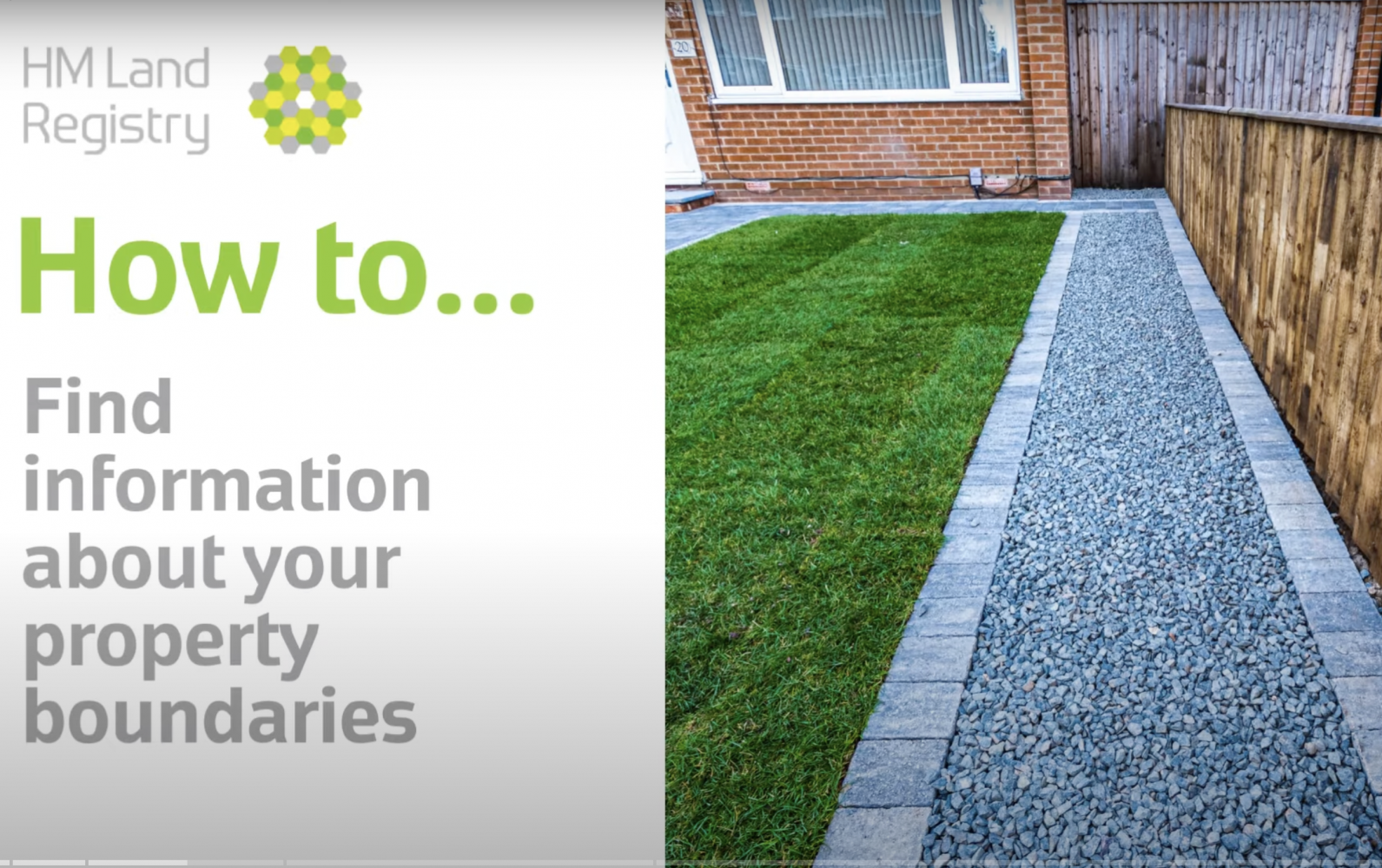
    Whether you are buying, selling, transferring or leasing property, there is a strong chance you will need a Land Registry plan. These plans are a fundamental part of property transactions across England and Wales, yet the requirements for producing a compliant plan catch many people — and even some professionals — off guard.

    In this guide, we draw on over 30 years of specialist experience preparing Land Registry plans to explain exactly what is required, the different types of plan available, common reasons for rejection, and how to ensure your plan is accepted first time.

    Why trust this guide? Towers Richardson has prepared thousands of Land Registry plans since 1994 and maintains a 100% HM Land Registry acceptance rate. Every plan we produce is drafted to the standards set out in Practice Guide 40 and the RICS Code of Measuring Practice.

    What Is a Land Registry Plan?

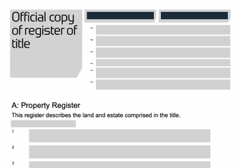
    A Land Registry plan is a scaled drawing that shows the boundaries and extent of a property or parcel of land. It forms part of the legal documentation submitted to HM Land Registry (HMLR) when registering ownership, transferring property, granting a lease, or updating an existing title.

    Every registered property in England and Wales has an associated title plan held by HMLR. This plan is based on the Ordnance Survey map and shows the general position of the property’s boundaries using coloured edging. When you buy, sell, lease or split a property, the deed plan submitted with your application must be sufficiently clear and accurate for HMLR to update (or create) the title plan accordingly.

    In practical terms, if the plan accompanying your application fails to meet HMLR’s standards, your application will be raised as a requisition — causing delays, additional costs and frustration for all parties involved.

    When Do You Need a Land Registry Plan?

    A Land Registry-compliant plan is required in a wide range of property transactions. The most common scenarios include:

    • Selling or buying a property — a transfer plan (Form TP1) showing the extent of land being transferred, particularly when only part of a title is being sold
    • Granting a new lease of 7 years or more — a lease plan is mandatory for HMLR registration of the lease
    • First registration of unregistered land — a title plan must accompany the application to establish the registered extent
    • Splitting an existing title — when dividing land into separate parcels, each new title requires its own plan
    • Lease extensions and variations — updated plans may be required to reflect changed terms
    • Correcting or updating an existing title plan — where boundaries have been inaccurately recorded
    • Developer and infrastructure projects — housing estates, pipelines, and transport schemes all require compliant plans at scale

    If you are unsure whether your transaction requires a Land Registry plan, your solicitor or conveyancer will advise — or you can contact us directly for guidance.

    Types of Land Registry Plan

    There is no single “one size fits all” Land Registry plan. The type of plan you need depends on the nature of your transaction.
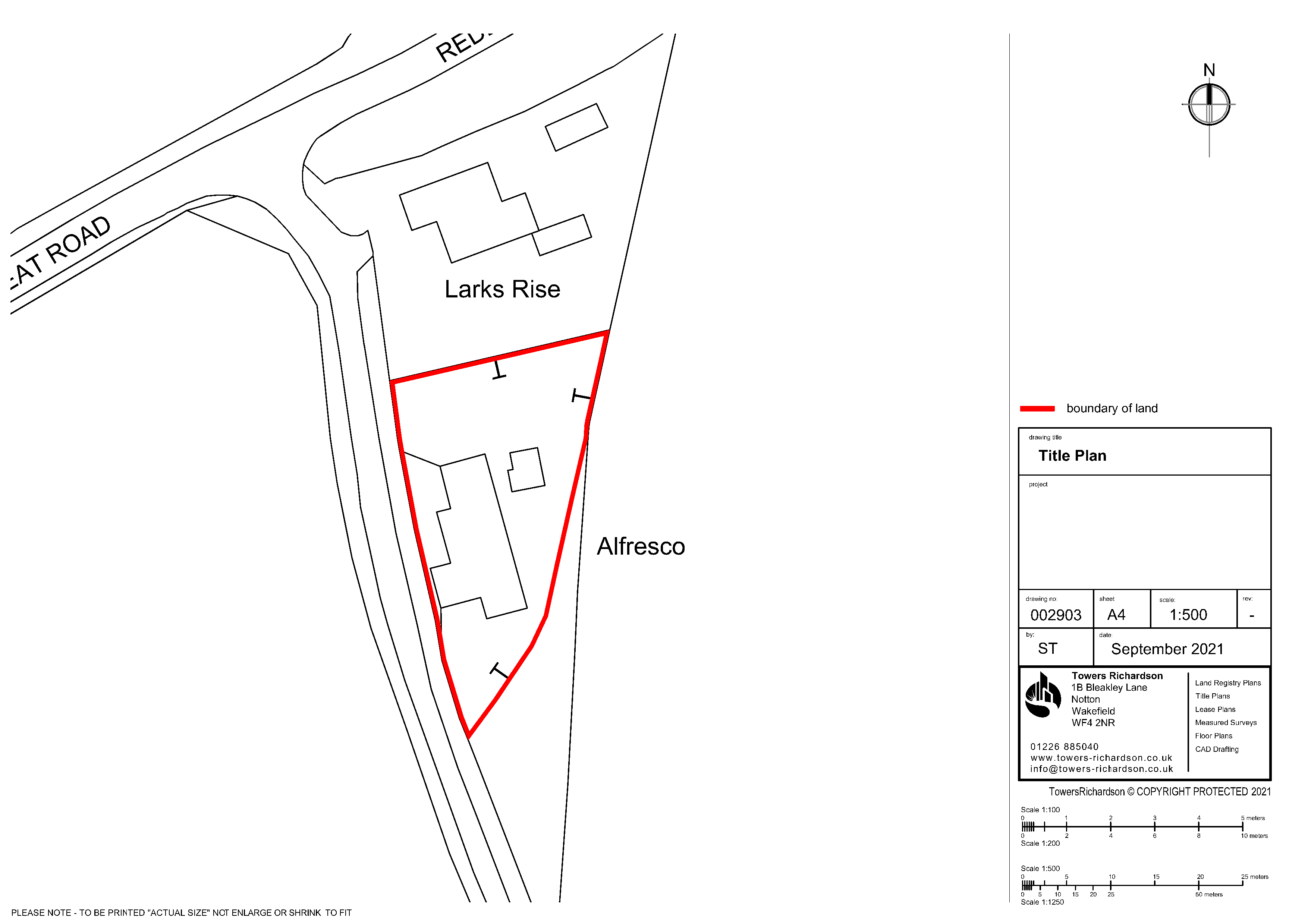
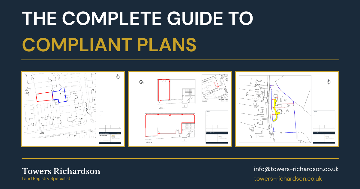
    Title Plan

    Shows the extent of a freehold property. Used for first registrations, sales of whole or part, and boundary corrections. Typically edged red on an OS base map.
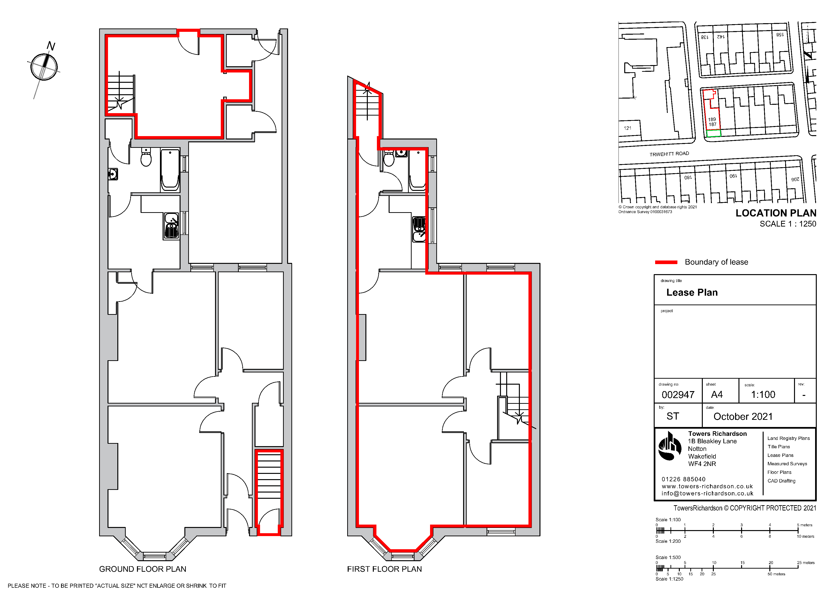
    Learn more about title plans →

    Lease Plan

    Required for leases of 7 years or more. Includes a location plan and detailed floor plans showing the demised area, communal areas, and access routes.

    Learn more about lease plans →

    Transfer Plan

    Accompanies a TP1 transfer deed when part of a registered title is being sold or transferred. Must clearly distinguish the land being transferred from the retained land.

    Learn more about transfer plans →

    Developer & Infrastructure Plans

    Large-scale plans for housing estates, utility routes, and commercial developments. Often require multiple plot plans prepared to a consistent standard.

    Learn more about developer plans →

    Land Registry Plan Requirements — Practice Guide 40

    All plans submitted to HMLR must comply with the requirements set out in Practice Guide 40, Supplement 2. This is the official guidance document that sets the standard for plan preparation, and it is the benchmark against which every submission is assessed.

    The key requirements are as follows:

    1. Based on the Ordnance Survey Map

    Every Land Registry plan must show sufficient Ordnance Survey (OS) detail — roads, buildings, field boundaries and other surrounding features — to allow HMLR to accurately locate the property on their own OS-based mapping. A plan drawn in isolation, without recognisable surrounding context, will not be accepted.

    2. Drawn to a Stated, Metric Scale

    Plans must be drawn to an appropriate metric scale. The scale used must be stated on the plan and must be accurate — meaning the measurements on the plan must correspond correctly to the stated scale. A scale bar should also be included.

    3. Include a North Point

    Every plan must include a north point to confirm its orientation. This allows HMLR to correctly position the plan in relation to the OS map.

    4. Clear Boundary Edging

    The property boundary must be shown by a continuous line of coloured edging. There must be no gaps in the boundary — it must form a complete, enclosed area. The edging must follow the inner edge of any boundary feature shown on the OS map.

    5. Show Sufficient Surrounding Detail

    The plan must include enough surrounding roads, buildings and landmarks outside the property boundary for HMLR to pinpoint the location. An isolated boundary with no context is one of the most common reasons for requisition.

    6. Date of Preparation

    The plan should include the date it was created, providing a record of when the mapping data was current.

    7. No Prohibited Phrases

    Certain wording must not appear on any plan submitted to HMLR. We cover these in detail below.

    Practice Guide 40 Tip: HMLR’s full guidance runs to many pages and covers specialist situations including airspace, subsoil, and strata title registrations. For standard residential transactions, the requirements above cover the essentials — but for complex or unusual applications, it is worth reviewing the full guide or instructing a specialist.

    Accepted Scales & Ordnance Survey Data

    Choosing the correct scale is critical. The plan must be detailed enough for HMLR to identify the property clearly, but at a scale that is practical for the size of the land involved.

    ScaleBest Used ForCoverage
    1:200 or 1:500Individual flats, small commercial units, lease plansHigh detail — individual rooms visible
    1:1250Urban and suburban residential propertiesStandard for most house sales and transfers
    1:2500Rural land, farms, larger sitesWider area — suitable for fields and estates
    1:10000 or smallerVery large rural areas, infrastructure routesLocation context for extensive land holdings

    All plans must be based on current Ordnance Survey mapping data. OS data provides the authoritative base map that HMLR uses to verify property locations. Using outdated mapping — or hand-drawn sketches without an OS base — is a common cause of rejection.

    At Towers Richardson, we hold a full Ordnance Survey licence and work directly with current OS MasterMap data in our CAD systems, ensuring every plan is plotted against the most up-to-date mapping available.

    Colouring Conventions & Boundary Edging

    While HMLR does not mandate specific colours, there are well-established conventions used across the profession that solicitors and Land Registry caseworkers expect to see:

    • Red edging — shows the extent of the property being registered, transferred or leased
    • Blue edging — identifies any retained land (the part being kept by the seller)
    • Brown colouring — indicates a right of way or easement that benefits the property
    • Green colouring — indicates common areas
    • Additional colours — used to distinguish multiple parcels or different floor levels in lease plans

    An important practical point: colours must remain clearly distinguishable when printed. Colours that look distinct on screen — such as orange and brown, or red and pink — can become difficult to differentiate on paper. This is a surprisingly common issue that we regularly see when reviewing plans prepared by others.

    Need a Land Registry Plan?

    Get a compliant plan prepared by specialists with a 100% HMLR acceptance rate. Most plans delivered within 24–48 hours.

    Get a Free Quote

    Common Reasons Land Registry Plans Get Rejected

    After 30 years of preparing plans, we have seen — and been asked to correct — virtually every type of plan rejection. These are the issues that cause the most problems:

    • Insufficient surrounding detail — the plan only shows the property boundary with no roads, buildings or other features nearby, making it impossible for HMLR to locate the land on the OS map
    • Not drawn to a stated scale — the plan has no scale bar, no scale statement, or the stated scale does not match the actual measurements
    • Gaps in the boundary edging — the coloured boundary line does not form a complete, continuous enclosure
    • Using an outdated or inaccurate base map — hand-drawn sketches, old estate agent plans, or plans based on superseded OS data
    • Prohibited phrases on the plan — see the next section
    • Colours that are indistinguishable when printed — particularly when multiple colours are used in close proximity
    • No north point — a basic requirement that is sometimes overlooked
    • Plan not consistent with the deed description — the verbal description in the deed does not match what is shown on the plan
    • Poor print quality — faded or pixelated plans where boundary lines or OS detail cannot be clearly read

    When a plan is rejected (formally called a “requisition”), HMLR will write to the applicant’s solicitor explaining what needs to be corrected. This creates a delay — typically several weeks at minimum — and may require a replacement plan to be prepared from scratch. Getting the plan right first time is always faster, cheaper and less stressful.

    Prohibited Phrases & Marks

    HMLR will not accept any plan that includes wording which casts doubt on the reliability or accuracy of the plan. The following phrases (and anything similar) must not appear on a plan submitted for registration:

    • “For identification purposes only”
    • “Do not scale from this drawing”
    • “Not to scale”
    • “For illustrative purposes only”
    • “This plan is indicative only”
    • “Subject to survey”
    • “Draft” or “Preliminary”
    • “Approximate boundary” or similar qualifications

    These phrases are commonly found on estate agent plans, architect’s preliminary drawings and informal sketches. Any plan bearing such wording will need to be replaced with a clean, compliant version before HMLR will process the application.

    From our experience: The most frequent issue we see is solicitors submitting estate agent floor plans or marketing brochure extracts that carry “for identification purposes only” or “not to scale” disclaimers. These will always be rejected. A purpose-prepared Land Registry plan is needed instead.

    DIY vs Professional Land Registry Plans

    It is technically possible to prepare your own Land Registry plan, provided it meets all of HMLR’s requirements. In practice, however, the majority of plans submitted by non-specialists contain errors that lead to requisitions.

    The main challenges with a DIY approach are access to current Ordnance Survey data (which requires a commercial licence), the ability to plot accurately to stated scales, and understanding HMLR’s detailed requirements for different application types. For simple, straightforward properties, a competent person with the right data may be able to produce an acceptable plan — but for anything involving lease plans, partial transfers, or complex boundaries, professional preparation is strongly recommended.

    A specialist Land Registry plan provider uses licensed OS data, professional CAD software, and an in-depth understanding of Practice Guide 40 to prepare plans that meet HMLR’s standards consistently. The cost of professional preparation is modest relative to the delays and legal costs that a rejected plan can cause.

    What to Look for in a Plan Provider

    When choosing who to prepare your Land Registry plan, consider the following: Do they specialise in Land Registry plans, or is it a sideline? Do they hold an Ordnance Survey licence? What is their turnaround time? Can they demonstrate a strong acceptance rate? And are they familiar with the specific requirements for your type of application?

    At Towers Richardson, Land Registry plan preparation is all we do. It has been our sole focus since 1994, and that specialist expertise is reflected in our 100% acceptance rate and the trust placed in us by solicitors, developers and property professionals across England and Wales.

    How Much Does a Land Registry Plan Cost?

    The cost of a Land Registry plan depends on the type of plan required, the complexity of the property, and how quickly you need it. As a general guide:

    A straightforward title plan or lease plan for a standard residential property starts from £115. Developer projects and large-scale infrastructure work are priced on a project basis.

    If you do not have existing floor plans or drawings that can be used as a base for a lease plan, a measured survey of the premises will be required at additional cost. We will always confirm this upfront when quoting.

    When comparing costs, remember that the cheapest option is not always the best value. A plan that gets rejected costs you the original fee plus the cost of a replacement, not to mention the delay to your transaction. Getting it right first time with a specialist provider is almost always the most cost-effective approach.

    We provide fixed-price quotes with no hidden fees. Request a quote and we will confirm the cost before any work begins.

    How Long Does It Take?

    At Towers Richardson, we typically deliver completed plans within 24 to 48 hours of receiving your instructions. Urgent same-day turnarounds are available for time-critical transactions.

    The main factors that affect timescales are the complexity of the plan, whether a site visit or measured survey is required, and the completeness of the information provided. For most standard title plans and transfer plans, we can work from the deed description, existing title plans and OS data without needing to visit the property.

    Lease plans involving internal floor layouts may require a measured survey of the premises, which adds a small amount of time — but even with a survey, we aim to have completed plans back within a few working days.

    30+ Years. 100% Acceptance Rate.

    Trusted by solicitors, developers and property professionals across England and Wales since 1994.

    Request Your Free Quote

    Frequently Asked Questions

    What is a Land Registry plan?

    A Land Registry plan is a scaled drawing showing the boundaries and extent of a property or parcel of land. It is submitted to HM Land Registry as part of applications to register, transfer, or lease property. The plan must be based on the Ordnance Survey map and comply with the requirements set out in Practice Guide 40.

    Do I need a Land Registry plan to sell my house?

    If you are selling your entire property and it is already registered with a clear title plan, you may not need a new plan. However, if you are selling part of your land, or if the existing title plan is unclear or inaccurate, a new Land Registry-compliant plan will be required to accompany the transfer deed.

    What scale should a Land Registry plan be?

    The most commonly used scales are 1:1250 for urban and suburban properties and 1:2500 for rural land. Lease plans showing individual floor layouts are often drawn at 1:200 or 1:500. The scale must be stated on the plan and must be metrically accurate.

    Can I draw my own Land Registry plan?

    You can, provided it meets all of HMLR’s requirements — including being based on current OS data, drawn to a stated metric scale, with a north point and sufficient surrounding detail. In practice, most DIY plans contain errors that result in rejection. Using a specialist provider is recommended to avoid delays.

    How much does a Land Registry plan cost?

    Costs vary depending on the type and complexity of the plan. Title plans and lease plans start from £115. If a measured survey is needed for lease plans where no existing drawings are available, there is an additional cost. We provide fixed-price quotes upfront — contact us for a personalised quote.

    How long does it take to get a Land Registry plan?

    We typically deliver plans within 24 to 48 hours. Same-day urgent turnarounds are available when needed. Lease plans requiring a measured survey may take a few working days.

    What is Practice Guide 40?

    Practice Guide 40 (PG40) is HM Land Registry’s official guidance on the preparation of plans for registration applications. It sets out the technical requirements that all submitted plans must meet, including scale, orientation, boundary treatment, and prohibited phrases. Supplement 2 of PG40 contains the detailed specifications.

    What is the difference between a title plan and a lease plan?

    A title plan shows the extent of a freehold property and is used for registrations and transfers. A lease plan is specifically required when registering a lease of 7 years or more, and typically includes both a location plan (showing the property on the OS map) and detailed floor plans showing the extent of the demised premises.

    Why was my Land Registry plan rejected?

    The most common reasons for rejection include insufficient surrounding detail, missing north point or scale, gaps in the boundary edging, use of prohibited phrases such as “not to scale”, and plans based on outdated mapping. If your plan has been rejected, we can prepare a compliant replacement — often within 24 hours.

    Need Help With Your Land Registry Plan?

    Towers Richardson has been preparing Land Registry-compliant plans since 1994. Whether you need a simple title plan for a house sale, a detailed lease plan for a commercial property, or a suite of plans for a major development, we can help.

    Every plan is prepared using licensed Ordnance Survey data, professional CAD software, and checked against Practice Guide 40 requirements before delivery. We work with solicitors, estate agents, property developers, housing associations and homeowners across England and Wales.

    Get in touch today:

    📧 info@towers-richardson.co.uk
    📞 01226 885040
    💬 WhatsApp: 07543 434048

    Or request a free quote online — we respond within 1 hour during business hours.

  • How to Find My Land Boundaries: A Guide to Identifying Your Property Lines

    How to Find My Land Boundaries: A Guide to Identifying Your Property Lines

    Whether you’re buying a property, planning an extension, installing a new fence, or dealing with a neighbour who may have encroached on your land, knowing exactly where your boundaries lie is essential. Getting it wrong can lead to costly disputes, delayed transactions, and even legal proceedings.

    If you’ve ever asked yourself “how do I find my land boundaries?” — you’re not alone. It’s one of the most common property questions in England and Wales, and the answer isn’t always as straightforward as people expect.

    This guide walks through every resource available to help you find your land boundaries accurately, explains what those resources actually tell you (and what they don’t), and covers the common myths that catch property owners out.

    Key Takeaway: No single document will tell you exactly where your legal boundaries are. The Land Registry operates a “general boundary” system, meaning the red line on a title plan shows the approximate — not the precise — position of each boundary. To establish an exact legal boundary, you need a determined boundary application or a professional survey.

    1. Title Deeds & Land Registry Records

    Your title deeds are the natural starting point when trying to find your land boundaries. These legal documents record the history of your property’s ownership and often include descriptions or plans that reference the boundaries of the land being conveyed.

    There are some important distinctions to be aware of:

    Registered Properties

    If your property is registered with HM Land Registry, the original deeds will have been lodged at the time of first registration. The Land Registry then creates a title register (a written record of ownership, rights, and restrictions) and a title plan (a map showing the property’s extent). These two documents together replace the practical need for the original deeds in most cases.

    You can obtain a copy of your title register and title plan from HM Land Registry for £3 each through their online search service. You’ll need either the property address or the title number.

    Unregistered Properties

    Approximately 14% of land in England and Wales remains unregistered. If your property falls into this category, the original deeds are your primary source of boundary information. These may be held by your mortgage lender, your solicitor, or in your own possession. Unregistered deeds can contain detailed boundary descriptions, measurements, and plans that are often more specific than what the Land Registry provides for registered land.

    Worth Knowing: When unregistered land is sold, it triggers compulsory first registration with HM Land Registry. At that point, the Land Registry will create a new title plan based on the deed plan — but they won’t necessarily carry across every boundary detail from the original deeds.

    2. Land Registry Title Plans

    The title plan is the most commonly used document for identifying land boundaries. It’s an official document produced by HM Land Registry that shows the approximate extent of a registered property, plotted on Ordnance Survey mapping.

    The property is typically outlined with a red edging, and additional colours may be used to identify specific areas referenced in the title register — for example, land subject to rights of way or restrictive covenants.

    However, understanding what a title plan does and doesn’t tell you is crucial:

    • The red edging shows the general boundary of your property — not the precise legal boundary
    • Title plans are based on Ordnance Survey mapping, which shows physical features (walls, fences, hedges) at the time of survey — these may have changed since
    • The thickness of the red line on a title plan can represent several feet on the ground, so it should never be used to measure exact boundary positions
    • Title plans do not show who owns individual boundary features such as fences, walls, or hedges
    • Title plans do not define precise legal boundaries unless a determined boundary has been registered
    • The Ordnance Survey mapping on a title plan is topographic, not legal — it shows what’s physically on the ground, not where property rights begin and end

    Despite these limitations, the title plan remains an essential starting point. It gives you a clear visual indication of your property’s extent and is accepted as evidence in property transactions across England and Wales.

    If you need a new plan prepared for a property transaction — for example, when transferring part of your land or registering a new title — the plan must comply with Practice Guide 40, HM Land Registry’s technical requirements for plans.

    3. Deed Plans & Boundary Agreements

    For a more detailed picture of your land boundaries, historical deed plans are often invaluable. These are the plans attached to the original conveyance or transfer deeds when the property was first sold. Unlike title plans, deed plans may include:

    • Specific measurements along boundary lines
    • References to physical boundary markers (posts, walls, ditches)
    • T marks indicating boundary ownership or maintenance responsibility
    • Coloured areas identifying gardens, driveways, or shared spaces

    If you can locate the original deed plan for your property, compare it carefully against the current physical features on the ground and the Land Registry title plan. Discrepancies between the three are more common than you might expect — fences get moved, hedges grow, and boundary features are replaced in slightly different positions over time.

    Boundary Agreements

    Where there’s genuine uncertainty about the position of a boundary, neighbouring property owners can enter into a boundary agreement. This is a formal written agreement that records where both parties accept the boundary to be, and it can be noted on the title register at HM Land Registry.

    A boundary agreement is a practical solution that avoids the cost and complexity of a formal dispute. It’s particularly useful where physical features have shifted over the years and both neighbours are willing to agree a sensible line.

    4. Determined Boundary Applications

    If you need to establish the exact legal position of a boundary — rather than relying on the general boundary shown on the title plan — you can apply to HM Land Registry for a determined boundary.

    This is a formal process under Section 60 of the Land Registration Act 2002 and requires:

    • A detailed plan prepared by a qualified surveyor, showing the exact boundary line
    • Supporting evidence such as historical deed plans, conveyance descriptions, and surveyor’s reports
    • Payment of the Land Registry application fee

    Once the application is submitted, HM Land Registry will notify the adjoining landowner, who has 20 working days to object. If no objection is received, the boundary is formally determined and recorded on both title plans.

    Determined boundary applications are relatively uncommon — most property owners manage with the general boundary system. But where a boundary dispute has escalated, or where you need absolute certainty for a development or planning application, it can be the right course of action.

    Professional Tip: A determined boundary application requires a plan that meets very specific Land Registry standards. If you’re considering this route, speak to a Land Registry plan specialist and a chartered surveyor before submitting.

    5. Professional Land Surveyors

    If you need precise measurements of your boundary positions — rather than the approximate indication provided by the title plan — a chartered land surveyor (RICS-accredited) is the most reliable option.

    A professional surveyor will:

    • Use specialist equipment (total stations, GPS, and laser measuring devices) to plot exact boundary positions
    • Compare current physical features with historical deed plans and Ordnance Survey data
    • Prepare a boundary survey report that can be used as evidence in legal proceedings
    • Identify any encroachments — where a neighbour’s structure or fence crosses the boundary line

    A land surveyor’s report carries significant weight in boundary disputes and property tribunal hearings. While Land Registry documents provide general guidance, a surveyor can tell you exactly where the boundary falls on the ground — which is what matters when a dispute reaches a legal conclusion.

    It’s worth noting that a surveyor measures physical positions and interprets legal documents. They don’t make legal decisions about where the boundary should be — that’s ultimately a matter for the courts if the parties can’t agree.

    6. Local Authority Records

    For properties that border public roads, footpaths, bridleways, or common land, your local council may hold additional records that help clarify boundary positions.

    The highways department can confirm:

    • The extent of the adopted highway — the land maintained at public expense, which often extends beyond the visible road surface
    • Whether a wall, fence, or hedge sits on highway land
    • Any highway boundary agreements or stopping-up orders that affect the property

    The planning department may also hold site plans and boundary information from previous planning applications on your property or neighbouring properties. These can be useful reference points, particularly for developments where detailed boundary surveys were submitted as part of the application.

    Local authority searches carried out during the conveyancing process can also flag boundary-related issues — for example, if part of your garden falls within a registered common or village green.

    7. Understanding Boundary Features

    One of the most common misunderstandings about land boundaries is that physical features define the boundary. In reality, physical features such as fences, walls, hedges, and ditches are evidence of where the boundary might be — but they are not the boundary itself.

    The legal boundary is an invisible line. Physical features may sit on the boundary, on one side of it, or even straddle it. Over time, features get replaced, repositioned, or removed entirely. A fence erected in a slightly different position after storm damage doesn’t move the legal boundary — it just means the fence no longer sits exactly where the boundary is.

    The Hedge and Ditch Rule

    There is a long-standing presumption in English law that where a hedge sits on a bank alongside a ditch, the boundary runs along the far edge of the ditch (the side furthest from the hedge). This is based on the historical practice of digging a ditch on the edge of your land and throwing the soil onto your own side to form a bank, on which you would then plant a hedge.

    This presumption can be rebutted by evidence to the contrary, but it remains relevant in rural boundary disputes where the original boundary features have been in place for generations.

    8. Common Boundary Myths

    Several persistent myths about property boundaries catch people out. Understanding what’s legally accurate — and what isn’t — can save you time, money, and unnecessary arguments with neighbours.

    • “You’re responsible for the left-hand boundary” — There is no legal basis for this. Some deeds do specify boundary maintenance responsibilities, but the idea that every owner is responsible for the left (or right) boundary when facing the property from the road is simply a myth.
    • “The fence posts face the owner’s side” — Again, no legal foundation. While it’s conventional practice to erect a fence with the posts and rails on the owner’s side and the flat boards facing outward, this is a preference — not a legal rule. You cannot determine ownership from how a fence is constructed.
    • “T marks always show who owns the boundary” — T marks on a deed plan indicate boundary ownership or maintenance responsibility only if they are specifically referenced in the text of the deed. If the deed doesn’t mention them, they have no legal weight. For more on this, see our guide to T and H marks on title plans.
    • “The Land Registry will tell me my exact boundary” — Under the general boundary rule (Section 60, Land Registration Act 2002), the Land Registry does not guarantee exact boundary positions. The red edging on a title plan is deliberately approximate.

    Remember: If no clear ownership is defined for a boundary feature, it’s generally considered a party boundary — shared between both properties. Any changes, repairs, or replacements to a party boundary should be agreed between both owners.

    9. What To Do Next

    If you need to find your land boundaries, here’s a practical step-by-step approach:

    1. Obtain your title plan and title register from HM Land Registry (£3 each via the online search service). This gives you the general extent of your property and any boundary-related entries on the register.
    2. Locate the original deed plans if possible. Check with your solicitor, mortgage lender, or personal records. These often contain more boundary detail than the title plan.
    3. Walk the physical boundary and compare it against the title plan and deed plan. Note any discrepancies — fences in different positions, missing boundary markers, or structures that appear to cross the boundary line.
    4. Check for T marks or boundary covenants in your title register and deeds. These may clarify ownership or maintenance responsibilities for specific boundaries.
    5. Instruct a professional if the boundaries are unclear or disputed. A chartered surveyor can measure exact positions, and a Land Registry plan specialist can prepare compliant plans for any applications or transactions.

    Need Help With Your Land Boundaries?

    At Towers Richardson, we’ve been preparing Land Registry-compliant plans since 1994 with a 100% acceptance rate. Whether you need a plan for a property transaction, a boundary clarification, or a Land Registry application, we can help.

    Our services include:

    Every plan is prepared using licensed Ordnance Survey data and checked against Practice Guide 40 requirements before delivery. We offer 24-hour turnaround as standard and work with solicitors, estate agents, developers, and homeowners across England and Wales.

    Get in touch today:

    📧 info@towers-richardson.co.uk
    📞 01226 885040
    💬 WhatsApp: 07543 434048

    Or request a free quote online — we respond within 1 hour during business hours.

    Frequently Asked Questions

    How do I find my land boundaries for free?

    You can get a general indication of your boundaries by purchasing a title plan from HM Land Registry for £3 through their online search service. While not free, it’s the cheapest official source. You can also check your original title deeds if you have them, or view historical Ordnance Survey maps through local archives.

    Does the red line on a title plan show the exact boundary?

    No. The red edging on a title plan shows the general boundary of your property, not the precise legal boundary. The line is plotted on Ordnance Survey mapping and its thickness alone can represent several feet on the ground. For an exact boundary, you would need a determined boundary application.

    What is the general boundary rule?

    Under Section 60 of the Land Registration Act 2002, the boundary shown on a Land Registry title plan is a “general boundary” — it shows the approximate position of the boundary but does not determine the exact line. This is the default for all registered properties in England and Wales unless a determined boundary has been specifically applied for and registered.

    Who is responsible for maintaining boundary fences?

    There is no automatic legal obligation to maintain a boundary fence unless your title deeds contain a specific covenant requiring you to do so. If T marks appear on your deed plan and are referenced in the deeds, they indicate boundary maintenance responsibility. Otherwise, there is no general duty to fence your property, and shared boundaries are considered party boundaries requiring agreement from both owners for any changes.

    Can I find out who owns a boundary fence or wall?

    Ownership of a boundary feature is determined by the title deeds, not by the physical appearance of the feature. Check the deed plan for T marks (referenced in the deed text) and the title register for any boundary covenants. If neither document addresses it, the feature is likely a party boundary with no defined single owner.

    What should I do if my neighbour has built on my land?

    First, gather your evidence — title plan, deed plans, and ideally a surveyor’s report confirming the boundary position. Try to resolve the matter directly with your neighbour. If that fails, mediation is a cost-effective option before pursuing legal action. In some cases, adverse possession (squatter’s rights) may apply if the encroachment has been in place for a specified period without challenge.

    How much does a boundary survey cost?

    A professional boundary survey from a chartered RICS surveyor typically costs between £500 and £2,000 depending on the size of the property, complexity of the boundaries, and whether historical research is required. If you need a Land Registry-compliant plan rather than a full boundary survey, our plans start from £115.

    What are T marks on a boundary plan?

    T marks are symbols sometimes shown on deed plans where the stem of the T points towards the boundary feature. When specifically referenced in the text of the deed, they indicate which property owner is responsible for maintaining that boundary structure. If they appear on the plan but aren’t mentioned in the deed, they carry no legal weight. For a full explanation, see our guide to T and H marks on title plans.

  • Understanding Section 52 Agreements

    Understanding Section 52 Agreements

    If you are buying, selling or developing land that is subject to a planning obligation made before 1991, there is a good chance you will encounter a Section 52 agreement. Although these agreements were replaced by the Section 106 framework over 30 years ago, many remain active and legally enforceable today — and they can have a direct impact on property transactions.

    In this guide, we explain what a Section 52 agreement is, how it differs from a Section 106 agreement, why accurate plans matter when dealing with one, and how Towers Richardson can help you navigate the process.

    Why trust this guide? Towers Richardson has prepared Land Registry-compliant plans since 1994, working with solicitors, developers and local authorities on properties subject to both Section 52 and Section 106 agreements. We maintain a 100% HM Land Registry acceptance rate on every plan we produce.

    What Is a Section 52 Agreement?

    A Section 52 agreement is a legally binding obligation made under Section 52 of the Town and Country Planning Act 1971. It allowed local planning authorities to enter into formal agreements with landowners and developers, setting out specific conditions that had to be met as part of a planning permission.

    In practice, these agreements gave councils the ability to secure commitments that went beyond the standard conditions attached to a planning consent. For example, a Section 52 agreement might require a developer to build affordable housing, maintain open space, restrict the use of certain land, or make financial contributions towards local infrastructure.

    The Town and Country Planning Act 1971 was eventually replaced by the Planning and Compensation Act 1991, which introduced the Section 106 agreement as the new mechanism for planning obligations. However, the 1991 Act did not automatically cancel existing Section 52 agreements — many of them remain in force today.

    Key point: A Section 52 agreement runs with the land, not with the original parties. This means that if you buy property subject to a Section 52 agreement, you inherit the obligations — even if the agreement was made decades ago.

    What Did a Section 52 Agreement Typically Include?

    Every Section 52 agreement was different, but they commonly covered one or more of the following obligations:

    • Restrictions on land use — limiting how specific areas of a site could be used, such as preventing commercial development on certain parcels
    • Infrastructure contributions — requiring financial payments towards roads, schools, drainage or other local services
    • Provision of public open space — setting aside areas of a development for communal use, with obligations around maintenance and upkeep
    • Landscaping and conservation requirements — specifying tree planting, ecological mitigation or the preservation of particular features
    • Affordable housing obligations — requiring a percentage of new homes to be offered at below-market rates
    • Access and rights of way — securing public footpaths, cycle routes or vehicular access across the development land

    These obligations were typically accompanied by a plan attached to the agreement, showing the areas of land to which each obligation applied. Over time, those original plans may have become faded, unclear or difficult to reconcile with the current state of the land — which is where problems often arise.

    Are Section 52 Agreements Still Active?

    Yes. Many Section 52 agreements remain legally enforceable today. The introduction of Section 106 in 1991 did not automatically revoke or replace existing Section 52 agreements. Unless a Section 52 agreement has been formally discharged, varied or superseded by a new Section 106 agreement, its terms continue to bind the land and any subsequent owners.

    In practice, this means that properties developed in the 1970s and 1980s may still carry obligations that affect how the land can be used, transferred or developed further. Solicitors conducting due diligence on a property transaction should always check whether a Section 52 agreement is registered against the title.

    How to Find Out if a Section 52 Agreement Applies

    A Section 52 agreement will normally appear on the Charges Register of the property’s title at HM Land Registry. Your solicitor can identify it by ordering official copies of the title register and any associated documents. The agreement itself — including any plans attached to it — can usually be obtained from HMLR or from the local planning authority’s records.

    Section 52 vs Section 106 — What Changed?

    The transition from Section 52 to Section 106 was introduced by the Planning and Compensation Act 1991. While both mechanisms serve a similar purpose — securing planning obligations from developers — there are some important differences.

    Under Section 52, agreements could only be made between the local authority and the landowner. Section 106 broadened the scope, allowing developers to enter into unilateral undertakings — obligations that the developer could offer voluntarily without needing the council to be a party to the agreement.

    Section 106 also introduced clearer provisions for modifying or discharging planning obligations after a specified period, typically five years. Under Section 52, there was no equivalent statutory mechanism, which is one reason why some older agreements have persisted for decades without being updated.

    For anyone dealing with a pre-1991 development, it is important to understand that a Section 52 agreement is not simply an outdated version of a Section 106. It is a separate legal instrument with its own terms, and it requires careful handling — particularly when plans and documentation are involved.

    Dealing With a Section 52 Agreement?

    We prepare compliant plans for properties subject to planning obligations. 100% HMLR acceptance rate. Most plans delivered within 24–48 hours.

    Get a Free Quote

    How a Section 52 Agreement Affects Property Transactions

    If you are buying or selling property that is subject to a Section 52 agreement, the agreement will affect the transaction in several ways.

    During the Conveyancing Process

    Your solicitor will need to review the full terms of the agreement to understand what obligations run with the land. This includes identifying any restrictions on use, maintenance obligations, financial contributions that may still be outstanding, and any areas of land that are subject to specific requirements such as public access or open space provision.

    When Transferring Part of the Land

    If you are selling or transferring part of a site that is subject to a Section 52 agreement, the transfer plan must clearly show which areas of land carry which obligations. This is particularly relevant for older development sites where the original agreement covered a large area that has since been divided into multiple parcels.

    When Seeking to Vary or Discharge the Agreement

    In some cases, it may be possible to apply to the local authority to vary or discharge a Section 52 agreement — for example, if circumstances have changed significantly since it was made. Any application to modify the agreement will typically need to be supported by clear, accurate plans showing the land affected.

    When Developing or Redeveloping the Site

    If you are planning further development on land subject to a Section 52 agreement, you need to understand how the existing obligations interact with any new planning permission. In some cases, a new Section 106 agreement may be negotiated to replace or supplement the original Section 52 terms.

    Why Accurate Plans Matter for Section 52 Agreements

    Accurate, compliant plans play a central role whenever a Section 52 agreement is involved in a property transaction. There are several reasons why getting the plans right is essential.

    Identifying the Agreement Land

    The original plan attached to a Section 52 agreement may be decades old. Over time, paper plans can fade, boundaries can become unclear, and the physical landscape may have changed significantly since the agreement was made. A fresh, professionally prepared plan based on current Ordnance Survey data can clearly identify the land affected by the agreement in its present context.

    Supporting Transfer and Registration

    When transferring land that is subject to a Section 52 agreement, the plan accompanying the transfer deed must comply with HM Land Registry’s requirements under Practice Guide 40. This means it must be based on the OS map, drawn to a stated metric scale, include a north point, and show clear boundary edging with sufficient surrounding detail.

    Resolving Boundary Disputes

    Section 52 agreements on older developments can sometimes lead to disputes about exactly which areas of land are subject to which obligations. A precise, up-to-date plan helps resolve these disputes by providing clarity that the original documentation may lack.

    Supporting Applications to Vary or Discharge

    If you are applying to modify or discharge a Section 52 agreement, you will need to provide plans that clearly show the land in question. Both the local authority and HM Land Registry will expect these plans to meet current professional standards.

    Common Issues When Dealing With Section 52 Agreements

    After decades of working with properties subject to planning obligations, we regularly see the following issues arise:

    • Faded or illegible original plans — plans attached to Section 52 agreements from the 1970s and 1980s are often barely readable, making it difficult to determine the exact boundaries
    • Plans that do not match the current state of the land — the development may have changed significantly since the agreement was made, with new buildings, roads or boundaries that are not reflected on the original plan
    • Ambiguous boundary descriptions — the agreement may describe areas of land in vague terms that are open to interpretation without a clear plan
    • Obligations that overlap with newer agreements — where a Section 106 agreement has been made on the same land, it can be unclear which obligations still apply under the original Section 52
    • Missing or incomplete documentation — local authority records from the 1970s and 1980s are not always complete, and obtaining copies of original agreements and plans can take time
    • Transfer plans that fail to reflect the agreement boundaries — when selling part of a site, the transfer plan must align with both the title boundaries and the areas identified in the Section 52 agreement

    In each of these situations, a professionally prepared plan based on current OS data helps bring clarity to what can otherwise become a complicated and time-consuming process.

    How Towers Richardson Can Help

    At Towers Richardson, we work with solicitors, developers, local authorities and landowners to prepare Land Registry-compliant plans for properties subject to Section 52 agreements. Our experience covers everything from straightforward title plans to complex multi-parcel development sites with overlapping planning obligations.

    Here is what we offer:

    • Title plans — clearly showing ownership boundaries and any areas subject to the Section 52 agreement, prepared to HMLR standards
    • Transfer plans — for selling or transferring parts of a site, with clear distinction between the land being transferred and the retained land
    • Site plans for applications — supporting applications to vary, discharge or replace a Section 52 agreement
    • 100% HMLR acceptance rate — every plan we produce is checked against Practice Guide 40 before delivery
    • Licensed Ordnance Survey data — we work with current OS MasterMap data to ensure accuracy
    • Fast turnaround — most plans delivered within 24 to 48 hours, with same-day options available
    • Nationwide coverage — we serve clients across England and Wales from our base in South Yorkshire

    Whether you need a single plan for a conveyancing transaction or a suite of plans for a complex development site, we have the expertise to deliver.

    30+ Years. 100% Acceptance Rate.

    Trusted by solicitors, developers and property professionals across England and Wales since 1994.

    Request Your Free Quote

    Frequently Asked Questions

    What is a Section 52 agreement?

    A Section 52 agreement is a legally binding planning obligation made under Section 52 of the Town and Country Planning Act 1971. It allowed local authorities to secure commitments from developers and landowners as a condition of planning permission, covering matters such as land use restrictions, infrastructure contributions and open space provision.

    Are Section 52 agreements still enforceable?

    Yes. Unless a Section 52 agreement has been formally discharged, varied or replaced by a Section 106 agreement, its terms remain legally binding. The introduction of Section 106 in 1991 did not automatically cancel existing Section 52 agreements.

    What is the difference between Section 52 and Section 106?

    Both are mechanisms for securing planning obligations, but Section 52 was introduced under the 1971 Act and Section 106 replaced it under the 1991 Act. Section 106 broadened the scope to allow unilateral undertakings and introduced clearer provisions for modifying or discharging obligations.

    How do I find out if my property has a Section 52 agreement?

    A Section 52 agreement will normally appear on the Charges Register of the property’s title at HM Land Registry. Your solicitor can check this by ordering official copies of the title. The agreement and any attached plans can usually be obtained from HMLR or from the local planning authority.

    Can a Section 52 agreement be removed or changed?

    In some cases, yes. You can apply to the local planning authority to vary or discharge a Section 52 agreement if circumstances have changed. Alternatively, a new Section 106 agreement may be negotiated to replace the original terms. Legal advice is recommended before pursuing either route.

    Do I need a plan for a property with a Section 52 agreement?

    If you are buying, selling or transferring land that is subject to a Section 52 agreement, you will need a Land Registry-compliant plan that meets the requirements of Practice Guide 40. This is essential for registering the transaction with HMLR.

    How much does a plan cost for a Section 52 property?

    Plans start from £115 for standard title plans and transfer plans. Complex sites with multiple parcels are priced on a project basis. We provide fixed-price quotes upfront — contact us for a personalised quote.

    Need Help With a Section 52 Agreement Property?

    Towers Richardson has been preparing Land Registry-compliant plans since 1994. Whether you need a title plan for a conveyancing transaction, a transfer plan for a partial sale, or supporting plans for an application to vary a planning obligation, we can help you get it right first time.

    Every plan is prepared using licensed Ordnance Survey data, professional CAD software, and checked against Practice Guide 40 requirements before delivery. We work with solicitors, developers, local authorities and landowners across England and Wales.

    For more information about the original legislation, see Section 52 of the Town and Country Planning Act 1971 on the legislation website.

    Get in touch today:

    📧 info@towers-richardson.co.uk
    📞 01226 885040
    💬 WhatsApp: 07543 434048

    Or request a free quote online — we respond within 1 hour during business hours.

  • Land Registry Plans for Resolving Search of the Index Map Issues

    Land Registry Plans for Resolving Search of the Index Map Issues

    If you are dealing with unregistered land or investigating the ownership of a piece of land, you will almost certainly need to carry out a Search of the Index Map. This search tells you whether the land in question is already registered at HM Land Registry — and, if so, which titles affect it.

    In this guide, we explain what a Search of the Index Map is, how it works, what the results mean, and how a professionally prepared Land Registry plan can help when the results reveal issues that need resolving. We draw on over 30 years of specialist experience to help you understand the process.

    Why trust this guide? Towers Richardson has prepared Land Registry-compliant plans since 1994, regularly supporting solicitors and conveyancers with applications involving unregistered land and Index Map searches. We maintain a 100% HM Land Registry acceptance rate on every plan we produce.

    What Is a Search of the Index Map?

    A Search of the Index Map is an official search carried out by HM Land Registry against their Index Map — the master map that shows the extent of every registered title in England and Wales. The search reveals whether a specific piece of land falls within, or is affected by, any existing registered title.

    The formal name for the result is the Official Certificate of the Result of Search of the Index Map. Solicitors and conveyancers commonly refer to it as a SIM search or an Index Map search.

    Why Does the Index Map Exist?

    HM Land Registry maintains the Index Map as a visual record of all registered titles. Every registered property in England and Wales has a boundary shown on this map, linked to its title number. When you apply for a Search of the Index Map, HMLR checks the land you have identified against this map and tells you what it finds.

    This is particularly important for unregistered land. Not all land in England and Wales is registered — some parcels, particularly in rural areas or where land has not changed hands since compulsory registration was introduced, remain unregistered. A Search of the Index Map helps establish the registration status of any piece of land.

    When Do You Need a Search of the Index Map?

    A Search of the Index Map is typically carried out in the following situations:

    • First registration of unregistered land — before applying to register land for the first time, you need to confirm whether any part of it is already registered under an existing title
    • Buying or selling unregistered land — to verify the registration status of the land and identify any titles that may affect it
    • Investigating ownership — when the ownership of a piece of land is unclear, a Search of the Index Map reveals which registered titles, if any, cover the area
    • Resolving boundary disputes — the search can show whether neighbouring titles overlap with the land in question
    • Identifying cautions and other entries — the search reveals cautions against first registration, pending applications, and other entries that affect the land
    • Development projects on unregistered land — developers need to confirm the registration status of every parcel before proceeding with site assembly

    Your solicitor or conveyancer will advise whether a Search of the Index Map is needed for your specific transaction. In most cases involving unregistered land, it is a standard part of the due diligence process.

    How to Apply for a Search of the Index Map

    You apply for a Search of the Index Map by submitting Form SIM to HM Land Registry. The form requires you to identify the land you want searched — and this is where the quality of your plan becomes critical.

    What You Need to Submit

    Form SIM asks for a description of the land and, importantly, a plan showing the land in question. The plan must show the land clearly against sufficient surrounding detail — roads, buildings and other features — for HMLR to locate it accurately on the Index Map. Without a clear plan, HMLR may not be able to carry out the search or may return incomplete results.

    How to Submit

    You can submit a Search of the Index Map through the HM Land Registry portal (for account holders), by post using the paper Form SIM, or through the Business Gateway used by many conveyancing firms. The current fee for a Search of the Index Map is set by HMLR and is payable at the time of application.

    Turnaround Times

    Electronic applications through the portal or Business Gateway are typically processed within a few hours to a few working days. Postal applications take longer. The turnaround depends on HMLR’s current workload and the complexity of the search area.

    Important: The quality of the plan you submit with Form SIM directly affects the quality of the results you receive. If your plan is vague, hand-drawn, or does not include enough surrounding detail, HMLR may struggle to identify the correct area — leading to incomplete or misleading results.

    What Do the Results Show?

    When HMLR completes your Search of the Index Map, they return an Official Certificate that tells you whether the land you identified is affected by any registered titles. The results will typically show one or more of the following:

    • Registered title(s) affecting the land — the certificate will list the title number(s) of any registered properties that cover or touch the search area
    • Cautions against first registration — these are entries made by someone claiming an interest in unregistered land, warning that they want to be notified if anyone applies to register it
    • Pending applications — if someone has already submitted an application affecting the search area, this will be flagged
    • No registered titles found — confirming that the land appears to be unregistered, which is the expected result when preparing for a first registration

    The certificate is a snapshot in time. It tells you the position at the date and time of the search. If you are relying on the results for a transaction, your solicitor will advise on how long the results remain valid and whether a fresh search is needed before completion.

    Need a Plan for an Index Map Search?

    We prepare compliant plans for SIM applications and first registrations. 100% HMLR acceptance rate. Most plans delivered within 24–48 hours.

    Get a Free Quote

    Common Issues Revealed by Index Map Searches

    While a Search of the Index Map is a straightforward process, the results can sometimes reveal issues that need careful attention. After 30 years of supporting solicitors with these applications, we regularly see the following problems arise:

    • Boundary overlaps with existing titles — the search reveals that part of the land you thought was unregistered actually falls within a neighbouring registered title, creating an overlap that must be resolved before any application can proceed
    • Gaps between registered titles — narrow strips of unregistered land between two registered titles, often caused by historical mapping inaccuracies
    • Unexpected cautions against first registration — a third party has lodged a caution claiming an interest in the land, which must be addressed before registration
    • Unrecorded rights of way or easements — while the Index Map search itself does not reveal these directly, the title registers it identifies may contain entries for rights that affect the search land
    • Plans that do not match the current state of the land — the boundaries shown on existing title plans may reflect an earlier layout that no longer matches what is on the ground
    • Multiple titles affecting the same area — in complex situations, several registered titles may partially overlap with the search area, requiring careful analysis to untangle

    Each of these issues requires accurate plans to resolve. Whether you are correcting a boundary, applying for first registration of a gap site, or dealing with a caution, the plan you submit to HMLR must be clear, compliant and precise.

    How Land Registry Plans Help Resolve Index Map Issues

    When a Search of the Index Map reveals a problem, the next step almost always involves preparing a compliant Land Registry plan. Here is how professional plans help in the most common scenarios.

    First Registration of Unregistered Land

    If your Search of the Index Map confirms that the land is unregistered, you can proceed with a first registration application. This requires a title plan that meets all of HMLR’s requirements under Practice Guide 40 — based on current Ordnance Survey data, drawn to a stated metric scale, with a north point, clear boundary edging and sufficient surrounding detail.

    Resolving Boundary Overlaps

    When the search reveals that the land overlaps with an existing registered title, an accurate plan is essential for identifying exactly where the overlap occurs. This allows solicitors to engage with the neighbouring title holder and HMLR to resolve the discrepancy. The plan must show both the search land and the boundaries of the affected registered title clearly.

    Registering Gap Sites

    Strips of unregistered land between registered titles — known as gap sites — are a common finding from Index Map searches. Registering these gaps requires a precise plan that shows the exact extent of the unregistered strip in relation to the surrounding registered boundaries.

    Supporting Caution Proceedings

    If a caution against first registration has been lodged, any application to proceed with registration (or to cancel the caution) will need to be supported by a clear plan showing the land affected. The plan helps HMLR and all parties understand exactly which area is in dispute.

    Providing the Plan for the SIM Application Itself

    The quality of the plan you submit with your Form SIM directly affects the usefulness of the results. A professionally prepared plan based on OS data ensures that HMLR can accurately identify the search area, giving you reliable results to work from.

    Plan Requirements for Index Map Applications

    Whether you are submitting a plan with your Form SIM or preparing a plan for a subsequent application based on the search results, the plan must meet HMLR’s standards. The key requirements are:

    • Based on the Ordnance Survey map — showing sufficient OS detail for HMLR to locate the land accurately
    • Drawn to a stated metric scale — typically 1:1250 for urban areas or 1:2500 for rural land, with a scale bar
    • A north point — confirming the orientation of the plan
    • Clear boundary identification — the search area must be clearly outlined, typically edged in red
    • Sufficient surrounding detail — roads, buildings and neighbouring features must be visible to provide context
    • No prohibited phrases — wording such as “not to scale” or “for identification purposes only” must not appear
    • Date of preparation — confirming when the plan was produced

    For first registration applications that follow a Search of the Index Map, the title plan must also comply with any additional requirements specific to the type of registration. Your solicitor will advise on the exact documentation needed.

    How Much Does It Cost?

    There are two costs to consider: the HMLR fee for the Search of the Index Map itself, and the cost of the professional plan.

    HMLR Search Fee

    HM Land Registry charges a fee for processing a Search of the Index Map. The current fee is published on the GOV.UK website and varies depending on whether you apply electronically or by post.

    Plan Preparation Cost

    At Towers Richardson, plans for Index Map search applications start from £115. The final cost depends on the complexity of the site and whether additional plans are needed for subsequent applications such as first registration. We provide fixed-price quotes with no hidden fees — contact us for a personalised quote.

    Turnaround Time

    We typically deliver completed plans within 24 to 48 hours. Urgent same-day turnarounds are available when you need them. For solicitors managing time-sensitive transactions, our fast turnaround helps keep things on track.

    How Towers Richardson Can Help

    At Towers Richardson, we regularly prepare plans for solicitors and conveyancers dealing with Search of the Index Map applications and the issues that arise from them. Whether you need a plan to accompany your Form SIM, a title plan for a first registration, or a boundary plan to resolve an overlap, we have the experience and expertise to deliver.

    Here is what we offer:

    • 100% HMLR acceptance rate — every plan is checked against Practice Guide 40 before delivery
    • Licensed Ordnance Survey data — we work directly with current OS MasterMap data in our CAD systems
    • 30+ years of specialist experience — we have supported solicitors with Index Map applications since 1994
    • Fast turnaround — most plans delivered within 24 to 48 hours, with same-day options available
    • Nationwide coverage — we serve clients across England and Wales from our base in South Yorkshire
    • Fixed-price quotes — no hidden fees, with costs confirmed before any work starts

    30+ Years. 100% Acceptance Rate.

    Trusted by solicitors, developers and property professionals across England and Wales since 1994.

    Request Your Free Quote

    Frequently Asked Questions

    What is a Search of the Index Map?

    A Search of the Index Map is an official search carried out by HM Land Registry that reveals whether a specific piece of land is affected by any registered titles. It is applied for using Form SIM and returns an Official Certificate showing the registration status of the land.

    When do I need a Search of the Index Map?

    You typically need one when dealing with unregistered land — for example, before applying for first registration, when investigating ownership of a parcel, or when checking whether neighbouring titles affect the land in question.

    What form do I use for a Search of the Index Map?

    You use Form SIM, which is submitted to HM Land Registry along with a plan showing the area of land you want searched. The form can be submitted electronically through the HMLR portal or by post.

    Do I need a professional plan for a Search of the Index Map?

    While it is possible to submit your own plan with Form SIM, using a professionally prepared plan based on current Ordnance Survey data ensures that HMLR can accurately identify the search area. A vague or inaccurate plan can lead to incomplete or misleading results.

    How long does a Search of the Index Map take?

    Electronic applications are typically processed within a few hours to a few working days. Postal applications take longer. The turnaround depends on HMLR’s current workload.

    What does a Search of the Index Map cost?

    HM Land Registry charges a fee for the search, which varies depending on the submission method. A professional plan to accompany the application starts from £115. Contact us for a personalised quote.

    What happens if the search reveals a problem?

    Common issues include boundary overlaps with existing titles, unexpected cautions against first registration, and gaps between registered titles. Each of these requires an accurate, HMLR-compliant plan to resolve. We regularly help solicitors prepare plans for exactly these situations.

    What is a caution against first registration?

    A caution against first registration is an entry made by someone claiming an interest in unregistered land. It alerts them if anyone applies to register the land for the first time, giving the cautioner the opportunity to object to the application.

    Need Help With a Search of the Index Map?

    Towers Richardson has been preparing Land Registry-compliant plans since 1994. Whether you need a plan to accompany your Form SIM application, a title plan for a first registration, or a boundary plan to resolve an issue identified by an Index Map search, we can help you get it right first time.

    Every plan is prepared using licensed Ordnance Survey data, professional CAD software, and checked against Practice Guide 40 requirements before delivery. We work with solicitors, conveyancers and property professionals across England and Wales.

    Get in touch today:

    📧 info@towers-richardson.co.uk
    📞 01226 885040
    💬 WhatsApp: 07543 434048

    Or request a free quote online — we respond within 1 hour during business hours.

  • HM Land Registry Public Guidance

    HM Land Registry Public Guidance

    HM Land Registry publishes a wide range of HM Land Registry guidance to help property professionals, landowners and the general public understand the registration process. From official practice guides to video tutorials, these resources explain how applications should be prepared, what forms to use, and what standards HMLR expects.

    In this guide, we summarise the key HM Land Registry guidance resources available, explain what each one covers, and highlight the guidance that is most relevant if you need to submit plans as part of a property transaction. We also explain how Towers Richardson can help when guidance alone is not enough and you need a professionally prepared, compliant plan.

    Why trust this guide? Towers Richardson has worked to HM Land Registry guidance and standards since 1994. We prepare every plan in accordance with Practice Guide 40 and maintain a 100% HMLR acceptance rate across all plan types.

    What Is HM Land Registry Guidance?

    HM Land Registry guidance is the collective term for the official documents, practice guides, forms, videos and online resources that HMLR publishes to explain how the land registration system works. This guidance covers everything from how to complete application forms to the technical standards that plans must meet.

    The guidance is freely available on the GOV.UK website and through HMLR’s YouTube channel. It is aimed at solicitors, conveyancers, surveyors, developers and members of the public who need to interact with the Land Registry.

    Why Does HMLR Guidance Matter?

    Every application submitted to HM Land Registry is assessed against the standards set out in their guidance. If your application — or the plan accompanying it — does not meet these standards, HMLR will raise a requisition. This means they will write to the applicant’s solicitor asking for corrections, which causes delays and additional costs.

    Understanding the relevant HM Land Registry guidance before you submit an application significantly reduces the risk of requisitions. For plans in particular, the guidance is very specific about what HMLR expects, and non-compliance is one of the most common reasons for applications being held up.

    Practice Guides — The Official Standards

    HMLR’s practice guides are the most detailed and authoritative source of HM Land Registry guidance. There are over 80 practice guides covering every aspect of land registration, from first registrations to leases, transfers, charges and more.

    For property professionals, the most frequently referenced practice guides include:

    Practice GuideWhat It Covers
    PG1First registrations — how to apply to register unregistered land for the first time
    PG2General boundaries — the legal position on boundary ownership and the general boundary rule
    PG40Plans for Land Registry applications — the technical requirements for all plans submitted to HMLR
    PG40S2Supplement 2 to PG40 — detailed specifications for plan preparation
    PG25Leases — how to register new leases and what plans are required
    PG31Transfers of part — requirements when selling or transferring part of a registered title

    All practice guides are available free of charge on the GOV.UK practice guides page. They are updated periodically by HMLR, so it is always worth checking you are working from the latest version.

    Tip: Practice guides are written in formal language and can be lengthy. If you are a solicitor or conveyancer, the practice guides are essential reading. If you are a property owner dealing with a one-off transaction, the key points are often easier to understand through HMLR’s video guides or by consulting a specialist.

    Practice Guide 40 — Plans for Land Registry Applications

    Of all the HM Land Registry guidance available, Practice Guide 40 is the most relevant for anyone submitting a plan with a Land Registry application. This is the document that sets out exactly what HMLR expects from every plan, and it is the standard against which every submission is assessed.

    What Practice Guide 40 Requires

    Practice Guide 40 and its Supplement 2 set out the following core requirements for plans:

    • Based on the Ordnance Survey map — every plan must show sufficient OS detail for HMLR to locate the property accurately
    • Drawn to a stated metric scale — the scale must be clearly stated on the plan and must be accurate, with a scale bar included
    • A north point — confirming the orientation of the plan
    • Clear boundary edging — the property boundary must form a complete, continuous enclosure with no gaps
    • Sufficient surrounding detail — roads, buildings and neighbouring features must provide context
    • No prohibited phrases — wording such as “not to scale” or “for identification purposes only” must not appear
    • Date of preparation — a record of when the plan was produced

    Practice Guide 40 also covers specialist situations including airspace plans, subsoil plans, and plans for properties in multi-storey buildings. For standard residential transactions, the requirements listed above cover the essentials.

    You can read the full guidance on the GOV.UK Practice Guide 40 page.

    HMLR Public Guidance Videos

    In addition to written practice guides, HM Land Registry maintains a Public Guidance playlist on YouTube. These videos offer step-by-step walkthroughs of common processes, making the HM Land Registry guidance more accessible for people who prefer a visual format.

    Topics Covered in the Video Playlist

    The HMLR Public Guidance playlist covers a range of practical topics, including:

    • How to find information about your property boundaries — explains how to access and interpret boundary data held by HMLR
    • Lodging an application with HM Land Registry — a step-by-step guide to submitting applications correctly
    • How to update your address for service — explains how to keep your contact details current on the register
    • How to complete Form AP1 — the application form used for most changes to the register
    • How to complete Form TR1 — the standard transfer form used when ownership of a property changes hands
    • How to complete Form AS1 — used when transferring the whole of a registered title
    • How to complete Form ID1 — the identity verification form required for certain applications
    • What is happening with my application — explains how to check the progress of a pending application

    You can access the full playlist on the HM Land Registry YouTube channel. The videos are short, clear and free to watch.

    Worth noting: The HMLR video guides are useful for understanding forms and application processes. However, they do not cover the technical detail of plan preparation in depth. For plans, Practice Guide 40 remains the definitive source of HM Land Registry guidance.

    Need a Compliant Land Registry Plan?

    We prepare every plan to Practice Guide 40 standards. 100% HMLR acceptance rate. Most plans delivered within 24–48 hours.

    Get a Free Quote

    Key Land Registry Forms Explained

    HM Land Registry guidance covers dozens of forms used for different types of application. Here are the ones you are most likely to encounter in property transactions that require plans:

    FormPurposePlan Required?
    AP1Application to change the register (most common application form)Usually — depends on the change
    FR1Application for first registration of unregistered landYes — a title plan is required
    TR1Transfer of whole of registered titleNot usually for whole transfers
    TP1Transfer of part of registered titleYes — a transfer plan is required
    AS1Assent of whole of registered titleNot usually for whole assents
    Form SIMSearch of the Index MapYes — a plan identifying the search area
    ID1Identity verification for private individualsNo

    For any application that requires a plan, that plan must comply with Practice Guide 40. Submitting a non-compliant plan — even if the rest of the application is perfect — will result in a requisition.

    Common Mistakes When Following HMLR Guidance

    The HM Land Registry guidance is comprehensive, but it does not prevent mistakes. After 30 years of working alongside solicitors and conveyancers, we regularly see the following issues:

    • Using estate agent plans instead of compliant Land Registry plans — marketing brochure plans almost always carry prohibited phrases like “for identification purposes only” and are not based on OS data
    • Submitting architect’s drawings with “not to scale” disclaimers — preliminary drawings are not suitable for Land Registry applications, regardless of how detailed they appear
    • Not checking the latest version of the practice guide — HMLR updates their guidance periodically, and requirements can change
    • Assuming a plan from a previous transaction can be reused — if the boundaries have changed, the OS mapping has been updated, or the plan does not match the current deed description, a new plan may be needed
    • Overlooking the plan requirements for lease applications — lease plans have additional requirements beyond standard title plans, including detailed floor plans showing the demised area
    • Using outdated Ordnance Survey data — plans must be based on current OS mapping, not data from years ago that may not reflect new buildings, roads or boundary changes

    Each of these mistakes leads to a requisition, which delays the transaction and creates additional work for everyone involved. Following the HM Land Registry guidance carefully — and using a specialist plan provider — avoids these problems.

    When You Need Professional Help

    HM Land Registry guidance gives you the rules. However, understanding the rules and producing a plan that meets them are two different things. Here are the situations where professional plan preparation is strongly recommended:

    • Any application requiring a plan — title plans, transfer plans and lease plans all need to comply with Practice Guide 40 and be based on licensed OS data
    • First registrations — the title plan must show the property’s boundaries precisely against the OS map, which requires professional CAD software and an OS data licence
    • Transfers of part — the plan must clearly distinguish the land being transferred from the retained land, with correct colouring and boundary treatment
    • Lease plans — these require both a location plan and detailed floor plans, often at different scales
    • Complex or unusual boundaries — irregular shapes, multiple parcels, airspace and subsoil all require specialist expertise
    • Replacing a rejected plan — if HMLR has raised a requisition on your plan, a professional replacement is the fastest way to resolve it

    The HM Land Registry guidance itself recommends that applicants use plans prepared by qualified professionals where the property or transaction is complex. For straightforward applications, a competent person with the right tools may be able to produce an acceptable plan — but for anything beyond the basics, professional preparation is the safer option.

    How Towers Richardson Can Help

    At Towers Richardson, we prepare every plan in strict accordance with HM Land Registry guidance, particularly Practice Guide 40 and its supplements. We have done so since 1994, and our 100% HMLR acceptance rate reflects that commitment.

    Here is what we offer:

    • 100% HMLR acceptance rate — every plan is checked against Practice Guide 40 before delivery
    • Licensed Ordnance Survey data — we work directly with current OS MasterMap data in our CAD systems
    • 30+ years of specialist experience — we have been preparing Land Registry plans since 1994
    • All plan types — title plans, lease plans, transfer plans and developer plans
    • Fast turnaround — most plans delivered within 24 to 48 hours, with same-day options available
    • Nationwide coverage — we serve clients across England and Wales from our base in South Yorkshire
    • Fixed-price quotes — no hidden fees, with costs confirmed before work begins

    Whether you need a single title plan for a house sale or a full suite of plans for a development project, we can deliver compliant plans that meet HM Land Registry guidance first time, every time.

    30+ Years. 100% Acceptance Rate.

    Trusted by solicitors, developers and property professionals across England and Wales since 1994.

    Request Your Free Quote

    Frequently Asked Questions

    Where can I find HM Land Registry guidance?

    All official HM Land Registry guidance is published free of charge on the GOV.UK website. This includes practice guides, forms and detailed instructions. HMLR also maintains a Public Guidance video playlist on YouTube covering common application processes.

    What is Practice Guide 40?

    Practice Guide 40 is HM Land Registry’s official guidance on preparing plans for registration applications. It sets out the technical requirements that all plans must meet, including scale, orientation, boundary treatment and prohibited phrases. Supplement 2 contains the detailed specifications.

    Do I need a professional plan for a Land Registry application?

    For any application that requires a plan — including first registrations, transfers of part and lease registrations — the plan must comply with Practice Guide 40. While it is possible to prepare your own plan, most non-specialist plans contain errors that lead to requisitions. Professional preparation is recommended.

    What forms require a plan?

    The most common forms that require an accompanying plan are FR1 (first registration), TP1 (transfer of part), lease applications, and Form SIM (Search of the Index Map). The plan must comply with Practice Guide 40 in each case.

    Does HMLR have video guidance?

    Yes. HM Land Registry maintains a Public Guidance playlist on YouTube covering topics such as lodging applications, completing key forms, finding boundary information and updating your address for service. The videos are free to watch.

    Why was my Land Registry plan rejected?

    The most common reasons for plan rejection include insufficient surrounding detail, missing north point or scale, gaps in boundary edging, prohibited phrases such as “not to scale”, and plans based on outdated mapping. All of these are covered in Practice Guide 40.

    How much does a Land Registry plan cost?

    Plans start from £115 for standard title plans and transfer plans. Lease plans and complex projects are priced on a project basis. We provide fixed-price quotes upfront — contact us for a personalised quote.

    Need a Plan That Meets HMLR Standards?

    Towers Richardson has been preparing Land Registry-compliant plans since 1994. Whether you need a title plan, transfer plan, lease plan or a plan to accompany a Form SIM application, we prepare every plan in accordance with HM Land Registry guidance and check it against Practice Guide 40 before delivery.

    We work with solicitors, conveyancers, developers and property professionals across England and Wales.

    Get in touch today:

    📧 info@towers-richardson.co.uk
    📞 01226 885040
    💬 WhatsApp: 07543 434048

    Or request a free quote online — we respond within 1 hour during business hours.

  • What is a Title Register

    What is a Title Register

    When a property is registered with HM Land Registry, it’s assigned a unique title number and two key documents are created: the title register and the title plan. Together, these form the official record of ownership for that property.

    The title register is the written record. It contains the names of the legal owners, describes the property, records the class of title, and details any mortgages, restrictions, rights of way, or covenants that affect the land. If you’re buying, selling, remortgaging, or simply trying to understand what’s registered against your property, the title register is where you’ll find the answers.

    This guide explains what a title register contains, how it’s structured, and how to read each section — so you can make sense of your own register or understand what you’re looking at during a property transaction.

    Key Takeaway: The title register is divided into three sections — A (Property Register), B (Proprietorship Register), and C (Charges Register). Not every register has a Section C. Together with the title plan, these documents provide the complete official record of a registered property in England and Wales.

    1. What Is a Title Register?

    A title register — formally known as the “Official Copy of Register of Title” — is the legal record of a registered property held by HM Land Registry. It’s an electronic document that records:

    • A description of the property (usually the postal address)
    • Whether the property is freehold or leasehold
    • The names and addresses of the legal owners (proprietors)
    • The class of title granted by the Land Registry
    • The price paid for the property (if recorded)
    • Any rights that benefit the property, such as rights of way
    • Any burdens on the property — mortgages, restrictive covenants, easements, and other third-party interests
    • Any restrictions on the owner’s ability to deal with the property

    Every registered property in England and Wales has a title register. Approximately 87% of land in England and Wales is now registered with HM Land Registry. For the remaining unregistered properties, the original title deeds serve as the record of ownership instead.

    The title register is a public document — anyone can request a copy for any registered property, not just the owner. This is one of the fundamental principles of the land registration system: transparency of ownership.

    2. Title Register vs Title Plan

    People often confuse the title register and the title plan, but they serve different purposes:

    Title RegisterTitle Plan
    Written record of ownership, rights, and restrictionsMap showing the property’s extent and boundaries
    Contains names, addresses, mortgages, covenantsShows the property edged in red on Ordnance Survey mapping
    Records the class of title and any restrictionsMay show coloured areas referenced in the register
    Text documentVisual/map document
    £7 electronic / £11 postal£7 electronic / £11 postal

    While it’s useful to read them separately, the title register and title plan are designed to work together. Entries in the register often refer to areas shown on the title plan — for example, “the land edged blue on the title plan” or “the area shaded green”. To fully understand your property’s legal position, you need both documents.

    For more on title plans and what the boundary lines actually mean, see our guide on how to find your land boundaries.

    3. How a Title Register Is Structured

    Every title register follows the same format. At the top, you’ll find the header information:

    • Title Number — the unique reference for this registered property (e.g., WYK123456)
    • Edition Date — the date the register was last updated. Any change to the register — a sale, new mortgage, restriction, or notice — generates a new edition

    Below the header, the register is divided into three sections, universally referred to as A, B, and C:

    • Section A — Property Register: Describes the property and any rights it benefits from
    • Section B — Proprietorship Register: Names the owners and records any restrictions on their power to deal with the property
    • Section C — Charges Register: Records mortgages, covenants, easements, and other burdens affecting the property

    Not every register has a Section C. If there are no mortgages, charges, or third-party interests registered against the property, Section C simply won’t appear.

    Each entry within the register is dated — the date in brackets indicates when that particular entry was added. The order of entries matters, particularly in Section C, because earlier entries take priority over later ones.

    4. Section A — The Property Register

    The Property Register describes the land included in the title. The first entry will always contain:

    • Whether the property is freehold or leasehold
    • The postal address (where one exists)
    • A reference to the title plan — usually worded as “the land shown edged with red on the plan of the above title”
    • The date of first registration

    If the property benefits from any rights — such as a right of way over a neighbour’s land, a right to run drainage pipes through adjoining property, or a shared access — these will be recorded here as additional entries.

    Leasehold Properties

    For leasehold properties, Section A will also contain the short particulars of the lease — the date of the lease, the parties involved, the term (length), and any ground rent payable. This is essential information for anyone buying a leasehold property, as the remaining term and ground rent can significantly affect the property’s value and mortgageability.

    Section A may also note where land has been removed from the title — for example, where part of the original property has been sold off and registered under a new title number.

    5. Section B — The Proprietorship Register

    The Proprietorship Register records who owns the property and any limitations on their ability to deal with it. This is the section most people turn to first.

    It contains:

    • Class of title — the level of guarantee HM Land Registry provides (see Classes of Title below)
    • Names and addresses of the proprietors — the legal owners. Up to four individuals can be registered as joint proprietors
    • Date of registration — when the current owners were registered (usually a few weeks after completion)
    • Price paid — recorded for most properties purchased after April 2000

    Restrictions

    Section B is also where you’ll find any restrictions registered against the title. A restriction limits the owner’s ability to deal with the property unless certain conditions are met. Common examples include:

    • Joint proprietor restrictions — preventing one owner from selling without the other’s involvement. This is standard on jointly owned properties.
    • Mortgage lender restrictions — requiring the lender’s consent before certain transactions can be completed
    • Indemnity covenant restrictions — requiring a new owner to enter into a covenant to observe existing obligations on the land
    • Court order restrictions — preventing dealings with the property as directed by a court, for example during divorce proceedings or bankruptcy

    Restrictions are important to understand early in any property transaction. If a restriction exists, the conditions it specifies must be satisfied before HM Land Registry will register a new transfer, lease, or charge.

    6. Section C — The Charges Register

    The Charges Register records interests that burden the property — things that affect how the land can be used or that give third parties rights over it. Not every title register has a Section C; it only appears when there are relevant entries to record.

    Common entries in Section C include:

    • Mortgages (legal charges) — recorded when a lender has a secured interest in the property. The register won’t show the amount borrowed, only the lender’s name and the date the charge was registered. The order of charges matters — earlier charges have priority over later ones.
    • Restrictive covenants — obligations that limit what the owner can do with the land. For example, a covenant not to build above a certain height, not to use the property for business purposes, or not to erect fences above a specified level.
    • Positive covenants — obligations requiring the owner to do something, such as maintain a shared boundary wall or contribute to the upkeep of a private road.
    • Easements (as burdens) — rights that others hold over the property. For example, a neighbour’s right of way across your garden, or a utility company’s right to access and maintain pipes running under your land.
    • Notices — protecting various interests, including home rights notices (giving a spouse or civil partner occupation rights), contracts for sale, or charging orders imposed by courts.
    • Leases — where the property is subject to a lease granted to a tenant, details will appear here or in a schedule of leases.

    When entries in the Charges Register refer to specific documents — such as the original conveyance containing the covenants — you can request a copy of that filed document from HM Land Registry (£7 electronic, £11 postal) using form OC2.

    7. Classes of Title

    When HM Land Registry first registers a property, it grants a class of title based on the strength of the evidence of ownership provided. The class of title is recorded in Section B and determines the level of guarantee the state provides.

    There are six classes of title — three for freehold and three for leasehold:

    Freehold

    • Absolute — the strongest class. The owner’s title is guaranteed by the state, subject only to entries on the register and overriding interests. This is the most common class for freehold properties.
    • Qualified — rare. Granted where there’s a specific defect in the title that the Land Registry has identified. The guarantee is subject to that defect.
    • Possessory — granted where the applicant’s claim is based on possession (adverse possession) or where original deeds have been lost. The guarantee doesn’t cover issues arising before the date of registration.

    Leasehold

    • Absolute — the strongest class for leasehold. Guarantees both the lease and the landlord’s right to grant it.
    • Good Leasehold — guarantees the lease itself but not the landlord’s right to have granted it. Common where the freehold title hasn’t been examined.
    • Qualified / Possessory — as with freehold, granted where there are specific defects or the claim is based on possession.

    Worth Knowing: The vast majority of residential properties have absolute title. If you see “qualified” or “possessory” on a register, it’s worth taking legal advice — some mortgage lenders won’t lend against anything less than absolute title.

    8. How to Get a Copy of Your Title Register

    Anyone can obtain a copy of the title register for any registered property in England and Wales. You don’t need to be the owner.

    There are two ways to access it:

    Online — GOV.UK (Recommended)

    Visit the Search for Land and Property Information service on GOV.UK. You can search by property address or title number. An electronic copy of the title register costs £7. The title plan is a separate £7 if you want both.

    By Post

    Complete form OC1 and send it to HM Land Registry with a fee of £11 per document. Postal copies take longer to arrive and cost more — the electronic route is faster and cheaper.

    Avoid Third-Party Resellers: Many websites repackage official Land Registry data at inflated prices — sometimes charging £20 or more for a document that costs £7 from GOV.UK. Always check that the URL ends in .gov.uk before paying. See our guide on the recent HM Land Registry fee increase for more detail on current costs.

    9. Why the Title Register Matters

    The title register is the single most important document in any property transaction. It serves different purposes for different people:

    For Buyers

    The register confirms who you’re buying from, whether they have the right to sell, and what restrictions, covenants, or charges come with the property. Your solicitor will examine the register as part of the conveyancing process and raise enquiries on anything that could affect your use or enjoyment of the property.

    For Sellers

    An up-to-date register is essential for a smooth transaction. If details are outdated — for example, a former owner’s name still appears, or a discharged mortgage hasn’t been removed — it can cause delays. It’s worth checking your register before putting your property on the market.

    For Solicitors & Conveyancers

    The register is the foundation of due diligence. It reveals mortgages that need to be discharged, restrictions that must be satisfied, covenants that need to be disclosed, and rights that need to be protected. Where the register references filed documents, these will need to be examined too.

    For Mortgage Lenders

    Lenders use the register to assess risk. They need to confirm clear title, check for prior charges that would take priority over their mortgage, and ensure there are no restrictions that could prevent repossession and sale if the borrower defaults.

    Where entries on the register reference specific areas on the title plan — for example, land subject to a right of way or an area excluded from the title — a Land Registry-compliant plan may be needed to clarify the position for the transaction.

    Need a Land Registry Plan?

    At Towers Richardson, we’ve been preparing Land Registry-compliant plans since 1994 with a 100% acceptance rate. If your property transaction requires a new plan — whether it’s a title plan, lease plan, transfer plan, or developer plan — we can help.

    Plans from £115 with 24-hour turnaround as standard.

    📧 info@towers-richardson.co.uk
    📞 01226 885040
    💬 WhatsApp: 07543 434048

    Or request a free quote online — we respond within 1 hour during business hours.

    Frequently Asked Questions

    What is a title register?

    A title register is the official written record of a registered property held by HM Land Registry. It records who owns the property, describes the land, and details any mortgages, restrictions, rights of way, or covenants that affect it. It is divided into three sections: A (Property Register), B (Proprietorship Register), and C (Charges Register).

    How much does a title register cost?

    An official copy of a title register costs £7 when ordered electronically through the GOV.UK search service, or £11 by post. The title plan is a separate document at the same price. These fees were updated on 9 December 2024.

    What is the difference between a title register and title deeds?

    Title deeds are the original paper documents (conveyances, transfers, leases) that recorded property transactions before electronic registration. When a property is registered with HM Land Registry, the information from the deeds is recorded on the title register and title plan, which become the official record. For registered properties, the title register has replaced the need to rely on the original deeds for most purposes — though the deeds can still contain useful detail, particularly about boundaries.

    Can anyone access a title register?

    Yes. Title registers are public documents. Anyone can request a copy of the register for any registered property in England and Wales — you don’t need to be the owner or have any connection to the property. This is a fundamental principle of the land registration system.

    What are the three sections of a title register?

    Section A (Property Register) describes the property and any rights it benefits from. Section B (Proprietorship Register) names the owners, records the class of title, and lists any restrictions on their power to deal with the property. Section C (Charges Register) records mortgages, covenants, easements, and other burdens — it only appears if there are relevant entries.

    What does “absolute title” mean on a title register?

    Absolute title is the highest class of title granted by HM Land Registry. It means the state guarantees the owner’s title, subject only to entries on the register and any overriding interests. It’s the most common class for both freehold and leasehold properties and is the class that mortgage lenders typically require.

    What does it mean if there is no Section C on my title register?

    If your title register has no Section C (Charges Register), it means there are no registered mortgages, charges, covenants, or other third-party interests recorded against your property. This is a positive sign — it typically means the property is mortgage-free with no registered burdens.

    How do I update my title register?

    Changes to the title register are made by submitting an application to HM Land Registry — usually through a solicitor or conveyancer. Common updates include recording a change of name, removing a discharged mortgage, adding or removing a proprietor, or noting a new restriction. Each application has a separate fee, and some changes require supporting documentation.

  • What are T & H marks on Title Plans

    What are T & H marks on Title Plans

    Key Takeaway

    T marks indicate which party is responsible for maintaining a boundary feature (such as a fence or wall). The ‘T’ points towards the property whose owner has the maintenance responsibility.

    Where T marks are shown they indicate boundary structure ownership or responsibility, the side of the T indicating the responsible side of the boundary. H marks or 2 T marks back-to-back, indicate shared boundary structure ownership or responsibility.

    What Do T Marks Actually Mean?

    Conveyancing plans frequently show T marks. It is relatively well known that if T marks are within your land that you are usually responsible for the repair of those boundaries. However, does it also mean (or at least indicate) that you therefore own that boundary feature as well?

    Some would be forgiven for thinking that it might, but the Court of Appeal have recently confirmed in the case of Lanfear v Chandler [2013], that it does not.

    Ownership and/or maintenance of boundaries

    There are various notions that the way a wall or fence is constructed indicates ownership, for example that the posts and arris rails of a fence are on the owner’s side. There is, however, no legal foundation for such beliefs.

    Deeds may contain covenants to maintain a wall or fence but on their own, such covenants do not confer ownership. Where the ownership or responsibility for maintenance of a boundary cannot be determined, that boundary feature is generally best regarded as a party boundary.

    Any alterations or replacement of the boundary should only be done with the agreement of the adjoining owners.

    The register will only show information concerning the ownership and/or maintenance of boundary features when this information is specifically referred to in the deeds lodged for registration. The most common marking on deed plans that relates to boundaries are ‘T’ marks.

    When T Marks Are Not on the Title Plan

    An entry referring to a ‘T’ mark is normally a statement concerning the ownership of a boundary structure or the liability to maintain and repair it.

    Important Note

    ‘T’ marks on deed plans which are not referred to in the text of a deed have no special force or meaning in law and unless an applicant specifically requests that the T marks be shown on the title plan, it will normally be ignored.

  • Ownership and/or maintenance of boundaries

    Ownership and/or maintenance of boundaries

    Boundary ownership is one of the most misunderstood topics in property law. Many people believe there are firm rules about who owns which fence or wall — for example, the widespread belief that fence posts and arris rails always face the owner’s side. In reality, there is no legal foundation for most of these assumptions.

    In this guide, we explain how boundary ownership actually works, what the Land Registry title plan does and does not tell you, how T marks on deeds and title plans indicate maintenance responsibility, and what to do when boundary ownership is unclear. We also cover the common myths that cause confusion and the practical steps you can take to clarify your position.

    Important: HM Land Registry does not guarantee the exact position of property boundaries. The title plan shows the general boundary only. If you need to establish precise boundary ownership or resolve a dispute, specialist advice is recommended. Towers Richardson prepares accurate plans that support boundary documentation — contact us if you need help.

    How Boundary Ownership Works

    Boundary ownership refers to which property owner is responsible for a boundary feature — a fence, wall, hedge or other structure that marks the dividing line between two properties. In England and Wales, there is no automatic legal rule that determines who owns a particular boundary. Instead, ownership depends on what the deeds say.

    When a property is first developed and the land is divided into individual plots, the developer’s transfer deeds typically contain clauses and plan markings that allocate boundary responsibility. These provisions are then carried forward each time the property changes hands. If the original deeds are clear, the position should be straightforward. The problem is that many properties — particularly older ones — have no clear provision about boundary ownership at all.

    The Land Registry register will only record information about boundary ownership when it is specifically referred to in the deeds lodged for registration. If the deeds are silent on the matter, the register will be too.

    Common Myths About Boundary Ownership

    There are several widely held beliefs about boundary ownership that have no basis in law. These myths cause more confusion and neighbour disputes than almost any other property issue.

    • “The fence posts face the owner’s side” — this is the most common myth. There is no legal rule that says the posts and arris rails of a fence indicate ownership. While some developers do follow this convention when erecting fences on new estates, it is not a legal requirement and cannot be relied upon
    • “You always own the left-hand boundary” — another persistent myth with no legal foundation. There is no standard rule that allocates the left or right boundary to either property when viewed from the road
    • “The boundary is always in the middle of the fence” — this is sometimes true but cannot be assumed. The boundary may run along one side of the fence, through the middle, or even some distance from it
    • “If I maintain a fence, I own it” — maintaining a boundary feature does not automatically confer ownership. Many people voluntarily maintain fences for appearance or security without being legally responsible for them
    • “A covenant to maintain means I own the boundary” — a deed may contain a covenant requiring you to maintain a wall or fence, but this is a maintenance obligation, not proof of ownership. The boundary structure may still be jointly owned

    The reality: Boundary ownership can only be determined by looking at the deeds, the title plan, and any T marks or covenants that have been recorded. Physical features like fence posts and hedge growth do not provide reliable evidence of ownership in law.

    What Are T Marks?

    T marks are one of the most important boundary ownership indicators you will find on property deeds and title plans. A T mark is a small letter “T” drawn on the plan alongside a boundary line. The stem of the T points towards the property whose owner is responsible for that boundary feature.

    For example, if a T mark on the boundary between your property and your neighbour’s is drawn with the stem pointing into your land, this typically means that you are responsible for maintaining the wall, fence or other boundary structure on that side.

    When T marks appear on both sides of a boundary — forming an “H” shape — this indicates that both property owners share responsibility for the boundary feature. This is sometimes referred to as a “double T” or “H mark.”

    What T Marks Mean in Practice

    • Single T mark pointing into your land — you are responsible for maintaining that boundary fence, wall or hedge
    • Single T mark pointing into your neighbour’s land — your neighbour is responsible for that boundary
    • Double T marks (H mark) — both owners share responsibility for the boundary feature
    • No T marks — the deeds do not specify who is responsible, and ownership cannot be determined from the title plan alone

    It is worth noting that T marks on a deed plan primarily indicate maintenance responsibility rather than outright ownership. The distinction matters — a covenant to maintain a fence does not necessarily mean you own the land on which it stands. However, in practice, T marks are the closest indicator most property owners have to determining boundary responsibility.

    How T Marks Work on Title Plans

    HM Land Registry will reproduce T marks on the title plan when certain conditions are met. Understanding how this process works helps explain why some title plans show T marks and others do not.

    When deeds are lodged for registration, HMLR examines the plans and the text of the deed. If the T marks on the deed plan are expressly referred to in the wording of the deed, HMLR will either reproduce them on the title plan with a corresponding register entry, describe the affected boundaries verbally in the register, or make a note that a copy of the deed plan showing the T marks is on file.

    The register entry might read something like: “The T mark referred to in clause 4 affects the north-western boundary of the land in this title.” This tells you which boundary the T mark relates to, even if the mark itself is difficult to read on the title plan.

    Need Help With a Boundary Plan?

    We prepare accurate title plans and transfer plans that clearly show boundary features, T marks and ownership responsibilities. 100% HMLR acceptance rate.

    Get a Free Quote

    When T Marks Are Shown on the Title Plan

    T marks are not automatically shown on every title plan. HMLR will only include them when they are both present on the deed plan and referred to in the text of the deed. Here is how the different scenarios play out.

    T Marks Are Shown

    If the T marks on the deed plan are expressly mentioned in the deed wording — for example, “the transferee shall maintain and keep in repair the boundary fence on the southern side of the property indicated by the T mark on the plan” — then HMLR will reproduce the T marks on the title plan and record the obligation in the register.

    T Marks Are Not Shown

    If the deed plan contains T marks but the text of the deed does not refer to them, the T marks have no special legal force. In this situation, unless the applicant specifically requests that the T marks be shown, HMLR will normally ignore them. This means many title plans do not show T marks even though the original deed plan included them.

    T Marks Requested by the Applicant

    An applicant can specifically request that HMLR reproduce T marks on the title plan, even if they are not referred to in the deed text. However, HMLR will only do this if the marks are clearly shown on the deed plan and the applicant makes the request at the time of registration.

    What If There Are No T Marks?

    Many properties — particularly older ones — have no T marks on their deeds or title plans at all. This does not necessarily mean that boundary ownership is unknown. It may simply mean that the original developer or conveyancer did not include them when the land was first sold.

    When there are no T marks and the deeds do not specify boundary ownership, you may need to look at other evidence to determine who is responsible. This can include the physical characteristics of the boundary (though these are not conclusive), any informal agreements between neighbours, historical maintenance patterns, and the layout of surrounding properties from the same development.

    In the absence of clear evidence, the boundary feature is generally best treated as a party boundary — shared between both adjoining owners.

    Boundary Maintenance Responsibilities

    Boundary ownership and maintenance responsibility are related but not identical concepts. Even where boundary ownership is established, the rules around maintenance can be surprising.

    Is There a Legal Obligation to Maintain a Boundary?

    In general, there is no automatic legal obligation to maintain a boundary fence or wall in England and Wales. Unless there is a specific covenant in the deeds requiring you to maintain the boundary, you are not legally compelled to keep it in repair — even if you own it.

    However, there are important exceptions. If the deeds contain a covenant to maintain a boundary (indicated by T marks or stated in the text), that obligation is binding. In some cases, local planning conditions or conservation area rules may also require boundary features to be maintained. Where a boundary wall is a retaining wall that supports the neighbouring land, there may be an obligation to keep it in a safe condition.

    What If Your Neighbour’s Boundary Fence Falls Down?

    If your neighbour is responsible for a boundary fence and it falls into disrepair, you generally cannot compel them to fix it unless there is a covenant in their deeds requiring maintenance. You can, however, erect your own fence on your side of the boundary. Any alterations or replacement of a shared boundary feature should only be done with the agreement of both adjoining owners.

    Party Boundaries

    When boundary ownership cannot be determined from the deeds or title plan, the boundary feature is generally treated as a party boundary. This means it is considered to be shared between both adjoining property owners.

    Party boundaries are common on older properties where the original conveyancing documentation did not address boundary responsibility. In practice, a party boundary means that neither owner has an exclusive right to alter, remove or replace the boundary feature without the agreement of the other.

    If you want to make changes to a party boundary — for example, replacing a fence or lowering a wall — you should discuss this with your neighbour and agree the works in advance. Unilateral changes to a shared boundary can lead to disputes that are difficult and expensive to resolve.

    How to Check Boundary Ownership

    If you want to establish who owns a particular boundary, here are the steps to follow.

    • Check your title plan — order a copy from HM Land Registry (available from GOV.UK for a small fee) and look for T marks along the boundaries
    • Read the register entries — the property register and charges register may contain verbal references to boundary obligations that are not shown as T marks on the plan
    • Review the original deeds — the transfer deed or conveyance that first created the boundary may contain clauses and plan markings about boundary responsibility. Your solicitor or mortgage lender may hold copies
    • Check the neighbour’s title — sometimes the boundary obligation is recorded on the neighbouring title rather than your own. You can order their title documents from HMLR
    • Look at the filed deed plan — HMLR sometimes holds a copy of the original deed plan on file, which may show T marks that were not reproduced on the title plan. You can request this from HMLR

    If none of these sources provide a clear answer, the boundary is likely a party boundary and should be treated as shared.

    What to Do About Boundary Disputes

    Boundary disputes are among the most common — and most costly — property disagreements. If you are in a dispute about boundary ownership with a neighbour, the following steps are generally advisable.

    • Start with the evidence — gather your title plan, register entries, original deeds and any historical photographs or documents that show the boundary position over time
    • Talk to your neighbour — many boundary disputes can be resolved through direct, reasonable conversation before legal costs are incurred
    • Seek professional advice — a solicitor specialising in property disputes can advise on your legal position based on the documentary evidence
    • Consider mediation — boundary mediation is often faster and cheaper than going to court, and many disputes are successfully resolved this way
    • Get an accurate plan — if the dispute centres on the position of the boundary, a professionally prepared plan showing the title boundary against the physical features on the ground can help clarify the situation
    • Determined boundary application — in serious cases, you can apply to HMLR under Section 60 of the Land Registration Act 2002 to have the exact boundary determined and recorded. This requires a detailed plan prepared to specific standards

    Practical advice: Boundary disputes can be disproportionately expensive relative to the value of the land in question. Before escalating, always check whether the documentary evidence (deeds, title plans, T marks) provides a clear answer. Many disputes arise from misunderstanding rather than genuine conflict about the legal position.

    How Towers Richardson Can Help

    At Towers Richardson, we prepare accurate Land Registry plans that help clarify boundary ownership and support property transactions. While we are not solicitors and do not provide legal advice on boundary disputes, we produce the plans that solicitors and property owners need to document boundary positions, T marks and maintenance responsibilities.

    • Title plans — showing the registered boundaries of your property based on licensed OS data
    • Transfer plans — for sales of part, with clear boundary edging and T marks where required
    • Plans for determined boundary applications — prepared to the specific standards required by HMLR for Section 60 applications
    • 100% HMLR acceptance rate — every plan is checked against Practice Guide 40 before delivery
    • 30+ years of specialist experience — preparing Land Registry plans since 1994
    • Fast turnaround — most plans delivered within 24 to 48 hours, with same-day options available
    • Nationwide coverage — we serve clients across England and Wales
    • Fixed-price quotes from £115 — no hidden fees, costs confirmed before work starts

    30+ Years. 100% Acceptance Rate.

    Trusted by solicitors, developers and property professionals across England and Wales since 1994.

    Request Your Free Quote

    Frequently Asked Questions

    How do I find out who owns a boundary fence?

    Check your title plan and register entries for T marks or verbal references to boundary responsibility. You can also review the original transfer deed, check the neighbour’s title, or request the filed deed plan from HM Land Registry. If none of these provide a clear answer, the boundary is likely shared between both properties.

    What are T marks on a title plan?

    T marks are small letter “T” symbols drawn alongside a boundary line on a deed plan or title plan. The stem of the T points towards the property whose owner is responsible for maintaining that boundary feature. Double T marks (forming an H) indicate shared responsibility between both adjoining owners.

    Do fence posts always face the owner’s side?

    No. This is a common myth with no legal foundation. While some developers follow this convention, it is not a legal rule and cannot be relied upon to determine boundary ownership. Only the deeds and title plan can provide reliable evidence of who is responsible for a boundary.

    Am I legally required to maintain my boundary fence?

    Not automatically. In England and Wales, there is no general legal obligation to maintain a boundary fence or wall unless a specific covenant in the deeds requires it. However, there may be obligations under local planning conditions, conservation area rules, or where a boundary wall serves as a retaining structure.

    What is a party boundary?

    A party boundary is one that is shared between two adjoining property owners. When boundary ownership cannot be determined from the deeds or title plan, the boundary feature is generally treated as a party boundary. Neither owner has an exclusive right to alter or remove it without the other’s agreement.

    Why are there no T marks on my title plan?

    T marks are only shown on the title plan when they appear on the deed plan and are expressly referred to in the deed text. If the original deed did not include T marks, or included them without mentioning them in the wording, they will not appear on the title plan. This does not necessarily mean that boundary ownership is unresolved — the deeds may address it in other ways.

    Can I add T marks to my title plan?

    T marks can only be added to the title plan if they are supported by the deeds. You cannot simply request HMLR to add T marks without documentary evidence. If you and your neighbour agree on boundary responsibility, a solicitor can prepare a deed that records the arrangement and includes T marks, which can then be registered.

    What is a determined boundary?

    A determined boundary is the exact legal boundary of a property, as opposed to the general boundary shown on most title plans. You can apply to HMLR under Section 60 of the Land Registration Act 2002 to have a boundary determined. This requires a detailed plan prepared to specific standards and is typically used to resolve serious boundary disputes.

    Need a Plan for a Boundary Matter?

    Towers Richardson has been preparing Land Registry-compliant plans since 1994. Whether you need a title plan showing your registered boundaries, a transfer plan with T marks for a property sale, or a plan for a determined boundary application, we can help.

    We work with solicitors, homeowners, developers and property professionals across England and Wales.

    Get in touch today:

    📧 info@towers-richardson.co.uk
    📞 01226 885040
    💬 WhatsApp: 07543 434048

    Or request a free quote online — we respond within 1 hour during business hours.

  • Scale and accuracy of Ordnance Survey mapping

    Scale and accuracy of Ordnance Survey mapping

    Ordnance Survey accuracy is a subject that matters to anyone working with Land Registry plans. Every title plan, transfer plan and lease plan submitted to HM Land Registry is based on Ordnance Survey mapping — but that mapping is not a perfect representation of what exists on the ground. There are built-in tolerances at every scale, and understanding them helps explain why boundary positions on title plans are described as “general” rather than exact.

    In this guide, we explain how Ordnance Survey accuracy works, what the different map scales mean, how tolerances vary between urban and rural mapping, what relative and absolute accuracy actually measure, and why this matters when you are dealing with property boundaries and Land Registry plans.

    Why this matters: At Towers Richardson, we work with licensed Ordnance Survey data every day. Understanding the accuracy limitations of OS mapping is fundamental to preparing reliable Land Registry plans — and it is the reason HM Land Registry cannot provide scaled measurements from title plans. This guide explains the technical detail in practical terms.

    Why OS Mapping Is Not Exact

    It is not possible for Ordnance Survey to replicate the exact position of every physical feature on the ground. No matter how sophisticated the surveying equipment, there will always be a degree of variation between the real-life position of a feature and where it appears on the map. This variation is known as the accuracy tolerance.

    The level of Ordnance Survey accuracy depends on two key factors: the scale of the map and the original survey method used to create it. Urban mapping at 1:1250 scale, which has been surveyed using modern methods, is the most accurate. Rural mapping at 1:2500 and mountain or moorland mapping at 1:10000 have progressively wider tolerances.

    This means that if you measure the distance between two features on an Ordnance Survey map and then measure the same distance on the ground, the two figures may not match exactly. The difference will usually be small — especially at larger scales — but it is always present. It is for this reason that HM Land Registry states it is unable to provide scaled measurements from title plans or from Ordnance Survey mapping.

    Key point: Ordnance Survey mapping is highly accurate for the purpose it is designed for — identifying the general position and extent of features. However, it is not a precise measured survey of every boundary, and small discrepancies between the map and the ground should be expected.

    Ordnance Survey Map Scales Explained

    Ordnance Survey produces large-scale mapping at three main scales. Each is used for different types of land and has its own level of accuracy.

    1:1250 Scale

    This is the largest and most detailed OS scale, used for urban areas — towns and cities. At 1:1250, one centimetre on the map represents 12.5 metres on the ground. This is the most common scale for residential and commercial title plans and provides the highest level of Ordnance Survey accuracy.

    1:2500 Scale

    Used for rural and semi-rural areas. At 1:2500, one centimetre on the map represents 25 metres on the ground. This scale covers farmland, villages and the outskirts of towns. It is less detailed than 1:1250 and has wider accuracy tolerances.

    1:10000 Scale

    Used for mountain and moorland areas where there is very little built development. At 1:10000, one centimetre on the map represents 100 metres on the ground. This is the least detailed scale and has the widest accuracy tolerances.

    The scale of mapping available for a particular property depends on its location. If your property is in a town or city, 1:1250 mapping will be available. If it is in a rural area, you may only have 1:2500 mapping. This directly affects the precision of any Land Registry plan based on that data.

    What a Line on the Map Represents

    One of the most practical ways to understand Ordnance Survey accuracy is to consider what a single line on the map represents in real-world terms.

    • At 1:1250 scale — the width of a line on the map represents approximately 0.3 metres on the ground
    • At 1:2500 scale — the width of a line on the map represents approximately 0.6 metres on the ground

    This means that even the boundary line itself — before you consider any surveying tolerance — covers a strip of ground rather than a precise point. At 1:2500 scale, the line on the map could represent a strip of land more than half a metre wide. This is one of the fundamental reasons why HM Land Registry operates a “general boundary” rule, meaning the exact line of the boundary is not determined by the title plan.

    For property professionals, this is an important reality check. If a client asks exactly where their boundary runs based on the title plan, the honest answer is that the plan shows the general position only — not a precise line on the ground.

    The Four Accuracy Categories

    Ordnance Survey’s large-scale mapping has been produced at different times using different surveying methods. This means that even maps at the same scale can have different levels of accuracy depending on how and when they were created. There are four accuracy categories.

    1. 1:1250 Scale (Urban)

    The most accurate category. This mapping covers towns and cities and has been surveyed to the tightest tolerances. Most urban title plans are based on this data.

    2. 1:2500 Scale — Resurvey or Reformed

    Rural mapping that has been resurveyed using modern methods or “reformed” (redrawn from aerial photography and ground checks). This is reasonably accurate but has wider tolerances than 1:1250.

    3. 1:2500 Scale — Overhaul

    This is older rural mapping that was originally compiled from pre-1946 County Series maps and updated (“overhauled”) rather than fully resurveyed. It has noticeably wider accuracy tolerances than resurveyed mapping at the same scale. Many rural title plans in England and Wales are still based on overhaul-category data.

    4. 1:10000 Scale (Mountain and Moorland)

    The least accurate category, covering upland and moorland areas. These maps provide a general picture of the landscape but are not suitable for detailed boundary work.

    Why this matters: Two rural properties mapped at 1:2500 can have significantly different levels of Ordnance Survey accuracy depending on whether the mapping is resurvey or overhaul category. Overhaul mapping — still common in many parts of England and Wales — has tolerances nearly twice as wide as resurveyed data at the same scale.

    Need an Accurate Land Registry Plan?

    We prepare compliant plans using licensed OS MasterMap data. 100% HMLR acceptance rate since 1994.

    Get a Free Quote

    Relative Accuracy

    Ordnance Survey describes accuracy in two ways. The first is relative accuracy — a measure of how accurately the distance between two features on the map reflects the actual distance between those same features on the ground.

    Relative accuracy compares scaled distances measured from the map with distances measured on the ground between the same well-defined points. The following table summarises the published relative accuracy values for each mapping category.

    ScaleRelative Error95% Confidence99% ConfidenceMax Measured Distance
    1:1250 (urban)< ±0.5 m< ±0.9 m< ±1.1 m60.0 m
    1:2500 resurvey/reformed< ±1.0 m< ±1.9 m< ±2.5 m100.0 m
    1:2500 overhaul< ±1.8 m< ±3.6 m< ±4.7 m200.0 m
    1:10000 (moorland)< ±4.0 m< ±7.7 m< ±10.1 m500.0 m

    What This Means in Practice

    At 1:1250 scale, if you measured the distance between two well-defined features that are 60 metres apart on the ground, 95 per cent of those measurements scaled from the map would fall between 59.1 m and 60.9 m. That is a tolerance of less than one metre — highly accurate for mapping purposes, but still not precise enough to determine an exact boundary line.

    At 1:2500 resurvey scale, the same exercise over 100 metres would produce scaled measurements between 98.1 m and 101.9 m at 95 per cent confidence. At the overhaul category, the tolerance widens significantly — to ±3.6 m at 95 per cent confidence over 200 metres.

    Absolute Accuracy

    The second measure is absolute accuracy (also called positional accuracy). This indicates how closely the coordinates of a point on the OS map agree with the true National Grid coordinates of that same point on the ground. Since the “true” position can never be known exactly, absolute accuracy is measured against the best known position determined by precise survey methods.

    ScaleRMSE95% Confidence99% Confidence
    1:1250 (urban)< ±0.5 m< ±0.8 m< ±0.9 m
    1:2500 resurvey/reformed< ±1.1 m< ±1.9 m< ±2.4 m
    1:2500 overhaul< ±2.8 m< ±4.7 m< ±5.8 m
    1:10000 (moorland)< ±4.1 m< ±7.1 m< ±8.8 m

    RMSE stands for Root Mean Squared Error — the standard statistical measure used to quantify the overall accuracy of a dataset. The lower the RMSE value, the more accurate the mapping.

    In practical terms, a point shown on 1:1250 urban mapping is expected to be within 0.8 metres of its true National Grid position at 95 per cent confidence. On 1:2500 overhaul mapping, that tolerance widens to 4.7 metres — a significant difference when you are trying to establish the position of a property boundary.

    Why Enlarging a Map Does Not Improve Accuracy

    A common misunderstanding is that enlarging a map makes it more accurate. It does not. When an Ordnance Survey map is enlarged from its original scale, the degree of accuracy remains the same as the original survey specification.

    For example, a plan originally surveyed at 1:2500 and enlarged to 1:1250 will still have the accuracy tolerances of 1:2500 mapping. The features simply appear larger on the page — they do not become more precisely positioned. The underlying data has not changed.

    It should also be noted that copying, reducing or enlarging a plan — whether digitally or by photocopying — can introduce further distortion that reduces accuracy beyond the original tolerances. This is one of the reasons HM Land Registry requires plans to be prepared using licensed digital OS data rather than scanned or photocopied maps.

    • Enlarging a map does not improve accuracy — the tolerances remain those of the original survey scale, not the enlarged scale
    • Photocopying or scanning can introduce distortion — further degrading the accuracy of the plan
    • Measurements taken from enlarged plans are unreliable — they carry the tolerances of the original scale plus any distortion from the enlargement process

    What This Means for Land Registry Plans

    The accuracy limitations of Ordnance Survey mapping have direct implications for every Land Registry plan.

    The General Boundary Rule

    HM Land Registry operates under the “general boundary” rule. This means that the boundary shown on a title plan indicates the general position of the boundary — not the exact line. The exact boundary between two registered titles is not determined by the title plan unless a specific “determined boundary” application has been made under Section 60 of the Land Registration Act 2002.

    No Scaled Measurements From Title Plans

    Because of the accuracy tolerances inherent in OS mapping, HM Land Registry cannot provide scaled measurements from title plans. If someone measures a distance from a title plan and assumes it is precise, they may be relying on a figure that is subject to a tolerance of up to several metres — depending on the mapping category.

    Why OS-Based Plans Are Still Required

    Despite the accuracy limitations, HM Land Registry requires all plans to be based on Ordnance Survey mapping. This is because OS data provides a consistent, nationally referenced framework that allows HMLR to relate every title plan to the same base map. The alternative — allowing plans based on random survey data with no common reference — would make it impossible to maintain a coherent register of title.

    Professional perspective: At Towers Richardson, we work with licensed OS MasterMap data — the most current and accurate Ordnance Survey dataset available. While we understand the inherent tolerances, we ensure every plan we produce uses the best data available and is drawn to the standards required by Practice Guide 40.

    What This Means for Property Boundaries

    Understanding Ordnance Survey accuracy is particularly important when it comes to property boundaries. The tolerances described above explain why boundary disputes cannot be settled simply by looking at a title plan.

    • Title plan boundaries are general, not precise — the line on the plan shows approximately where the boundary lies, not the exact legal boundary
    • Small discrepancies are normal — a fence or wall that appears to be slightly inside or outside the boundary line on the plan may simply reflect the accuracy tolerance of the mapping, not an encroachment
    • Field measurements should not be compared directly with map measurements — the tolerances mean that a scaled distance from the map and a tape measurement on the ground will rarely match exactly
    • Boundary evidence comes from the deeds, not the map — the title plan supports the deed description but does not override it. Physical features, T marks and deed descriptions all contribute to establishing the boundary position

    For more information on how Ordnance Survey mapping works, visit the Ordnance Survey website.

    How Towers Richardson Can Help

    At Towers Richardson, we prepare Land Registry plans using licensed Ordnance Survey MasterMap data — the most current and detailed OS dataset. We understand the accuracy characteristics of the data we work with and ensure every plan meets HM Land Registry standards under Practice Guide 40.

    • 100% HMLR acceptance rate — every plan is checked before delivery
    • Licensed OS MasterMap data — we work directly with the most current Ordnance Survey dataset
    • 30+ years of specialist experience — preparing Land Registry plans since 1994
    • Title plans, transfer plans and lease plans — all plan types prepared to HMLR-compliant standards
    • Fast turnaround — most plans delivered within 24 to 48 hours, with same-day options available
    • Nationwide coverage — we serve clients across England and Wales
    • Fixed-price quotes from £115 — no hidden fees, costs confirmed before work starts

    30+ Years. 100% Acceptance Rate.

    Trusted by solicitors, developers and property professionals across England and Wales since 1994.

    Request Your Free Quote

    Frequently Asked Questions

    How accurate is Ordnance Survey mapping?

    It depends on the scale and survey method. At 1:1250 (urban), features are positioned to within approximately ±0.5 metres. At 1:2500 resurvey, the tolerance widens to approximately ±1.1 metres. At 1:2500 overhaul (older rural mapping), the tolerance can be ±2.8 metres or more. These are RMSE values — 95 per cent confidence levels are wider.

    Can I take measurements from a title plan?

    HM Land Registry advises that scaled measurements should not be taken from title plans. Because of the accuracy tolerances inherent in Ordnance Survey mapping, any measurement taken from a title plan is subject to a margin of error that varies by scale and mapping category.

    What does the line on a title plan represent?

    At 1:1250 scale, the width of the line itself represents approximately 0.3 metres on the ground. At 1:2500, it represents approximately 0.6 metres. This is before any accuracy tolerance is applied. The title plan shows the general boundary position only.

    Does enlarging a map make it more accurate?

    No. When a map is enlarged, the features appear bigger but the accuracy remains that of the original survey scale. A 1:2500 map enlarged to 1:1250 still carries 1:2500 accuracy tolerances. Photocopying or scanning can also introduce additional distortion.

    What is the difference between relative and absolute accuracy?

    Relative accuracy measures how accurately the distance between two features on the map reflects the actual distance on the ground. Absolute accuracy measures how closely the coordinates of a point on the map match the true National Grid coordinates of that point on the ground.

    Why does HM Land Registry use the general boundary rule?

    Because Ordnance Survey mapping has inherent accuracy tolerances, it is not possible for a title plan to show the exact legal boundary between two properties. The general boundary rule acknowledges this by stating that the title plan shows the approximate position of the boundary only. The exact boundary can only be determined through a formal application under Section 60 of the Land Registration Act 2002.

    What is OS MasterMap?

    OS MasterMap is the most detailed and current Ordnance Survey dataset, providing large-scale topographic mapping of Great Britain. It is continuously updated and is the dataset used by professionals — including Towers Richardson — to prepare Land Registry plans. It replaced the older Landline dataset.

    Need a Land Registry Plan Based on Current OS Data?

    Towers Richardson has been preparing Land Registry-compliant plans using licensed Ordnance Survey data since 1994. Whether you need a title plan, transfer plan or lease plan, every drawing is based on current OS MasterMap data and checked against Practice Guide 40 standards before delivery.

    We work with solicitors, developers, property professionals and homeowners across England and Wales.

    Get in touch today:

    📧 info@towers-richardson.co.uk
    📞 01226 885040
    💬 WhatsApp: 07543 434048

    Or request a free quote online — we respond within 1 hour during business hours.

  • What Makes a plan Land Registry Compliant?

    What Makes a plan Land Registry Compliant?

    A Land Registry compliant plan is one that meets all of HM Land Registry’s requirements for registration. If a plan does not comply, HMLR will reject the application — raising a requisition that delays the transaction and often requires the plan to be prepared again from scratch.

    In this guide, we set out exactly what makes a plan Land Registry compliant, covering the core requirements that apply to all plans, the additional rules for lease plans and complex properties, the common mistakes that lead to rejections, and how you can ensure your plan passes first time. Everything is based on Practice Guide 40 — the official HMLR guidance that governs plan preparation.

    Our track record: Every plan Towers Richardson produces is checked against Practice Guide 40 before delivery. We have maintained a 100% HMLR acceptance rate since 1994 — across thousands of title plans, transfer plans, lease plans and developer plans.

    What Is a Land Registry Compliant Plan?

    A Land Registry compliant plan is a drawing that meets all of the technical and content requirements set by HM Land Registry for property registration. When a plan is compliant, HMLR can use it to identify the land or property being registered, transferred or leased — and the application can proceed without delay.

    Compliance is not optional. HMLR will raise a requisition — a formal request for corrections — if a plan fails to meet the required standards. This pauses the application until a corrected or replacement plan is submitted, adding weeks to the transaction and generating additional costs for all parties involved.

    The requirements for a Land Registry compliant plan are set out in Practice Guide 40 (and its supplements), which is published by HMLR and updated periodically. Whether you are preparing a title plan for first registration, a transfer plan for a sale of part, or a lease plan for a new lease, the same fundamental standards apply.

    Practice Guide 40 — The Standard

    Practice Guide 40 is the definitive reference for preparing a Land Registry compliant plan. It is published by HMLR and covers the standards, specifications and requirements that every plan must meet.

    The main guide covers the general requirements that apply to all plan types. Supplement 2 provides additional guidance specifically for lease plans, including the requirements for showing demised premises, floor levels and internal layouts.

    The key areas covered by Practice Guide 40 include:

    • Plan basis — what the plan must be based on (Ordnance Survey mapping)
    • Scale — the appropriate scales for different property types
    • Orientation — the requirement for a north point
    • Content — what must be shown on the plan
    • Colouring and marking — how boundaries and areas should be edged, coloured or hatched
    • Prohibited content — phrases and features that must not appear on the plan
    • Lease plan specifics — additional requirements for plans accompanying leases

    You can read the full guide on GOV.UK: Practice Guide 40 and Supplement 2 (Lease Plans).

    Core Requirements for All Plans

    Every Land Registry compliant plan — regardless of type — must meet the following core requirements.

    Based on the Ordnance Survey Map

    The plan must be based on current Ordnance Survey mapping and show sufficient OS detail for HMLR to identify the land on the national map. This means surrounding roads, buildings and other features must be visible to provide context. Plans that are not based on OS data — for example, hand-drawn sketches, architect’s drawings or estate agent site plans — will not be accepted.

    Drawn to a Stated Metric Scale

    The plan must be drawn to a specific metric scale, and that scale must be clearly stated on the plan. The scale must be accurate — if the plan states 1:1250 but the drawing has been resized, HMLR will identify the discrepancy. A scale bar should also be included to allow verification.

    Showing Orientation

    A north arrow must appear on the plan to confirm its orientation. This is a basic requirement but one that is occasionally overlooked on hastily prepared plans.

    Showing Sufficient Detail

    The plan must show the whole of the property being registered, transferred or leased, including any associated land such as garden ground, garages, parking spaces, bin stores and access routes. Buildings must be shown in their correct or intended position.

    Clear Boundary Marking

    The land or property must be clearly identified on the plan. This is typically done by edging the boundary in a continuous colour (usually red for the land being registered or transferred) that forms a complete enclosure with no gaps. Where different areas need to be distinguished — for example, transferred and retained land on a transfer plan — different colours must be used.

    Scale Requirements

    The scale of a Land Registry compliant plan must be appropriate to the property type and size. Practice Guide 40 specifies the following.

    Property TypeRecommended Scale
    Individual flats, apartments and small units1:200 or 1:500
    Urban residential properties1:1250
    Larger urban sites and developments1:1250 or 1:2500
    Rural properties and farmland1:2500
    Very large rural areas1:10000 or smaller

    Lease plans for individual flats or units within a building are typically prepared at 1:200 or 1:500 to show the internal layout at a readable size. Title plans and transfer plans for standard residential properties are most commonly prepared at 1:1250 in urban areas and 1:2500 in rural areas.

    The scale must be accurate when printed. If a plan is printed at a different size from the original — for example, if an A3 plan is printed on A4 paper — the scale will be wrong and the plan will not be compliant.

    Need a Compliant Plan?

    Every plan we produce is checked against Practice Guide 40 before delivery. 100% HMLR acceptance rate since 1994.

    Get a Free Quote

    Colouring and Marking

    A Land Registry compliant plan must use colour and marking to clearly identify the land or property. The conventions vary depending on the plan type, but the general principles are consistent.

    Title Plans and First Registration

    The boundary of the property is edged in red, forming a complete enclosure. The edging must be clearly visible and must not obscure the detail beneath it.

    Transfer Plans (TP1/TP2)

    The land being transferred is edged in red. The retained land is edged in blue. Any rights of way or easements are shown in a different colour — typically brown for access routes and green for communal areas.

    Lease Plans

    The demised premises (the area being leased) are typically edged in red or shown with a coloured wash. Communal areas are shown in a different colour, and any rights over other parts of the building (such as access routes or shared facilities) are identified using additional colours or hatching.

    In all cases, the colours must be clearly distinguishable from each other and from the base OS detail when printed. Colours that merge or become ambiguous on paper will result in a requisition from HMLR.

    Additional Requirements for Lease Plans

    Lease plans have additional requirements beyond the core standards. These are set out in Practice Guide 40 Supplement 2 and reflect the fact that leases often cover complex three-dimensional spaces within buildings rather than simple parcels of land.

    A Land Registry compliant plan for a lease must meet all of the core requirements and the following additional standards.

    • Relationship to the building footprint — the plan must show where the demised premises sit in relation to the external footprint of the building and the surrounding detail on the Ordnance Survey map
    • Floor-level plans — if the lease covers property on more than one floor, or if the extent of the demise varies by floor, separate plans must be provided for each level
    • Subsoil and airspace — if the lease includes land below or above ground level (for example, a basement or an upper-floor flat), the plan must show the relevant levels, ideally referenced to Ordnance Survey Datum
    • Intricate boundaries — internal divisions within a building, such as party walls between flats, must be shown clearly so that the exact extent of the demise can be identified
    • Communal areas — shared spaces such as hallways, stairwells, lifts and bin stores must be shown and distinguished from the demised premises
    • Access routes — the routes by which the tenant accesses the demised premises from the building entrance should be identifiable on the plan

    Why lease plans are more complex: A title plan shows a boundary on the ground. A lease plan must show a three-dimensional space within a building — including which floors, walls, ceilings and shared areas are included. This is why lease plans require detailed floor plans at larger scales (1:200 or 1:500) in addition to the location plan showing the building on the OS map.

    Prohibited Phrases and Common Errors

    Certain phrases and features will cause a plan to fail compliance, regardless of how well it is drawn. These are the most common errors that result in HMLR rejections.

    Prohibited Phrases

    The following phrases must never appear on a Land Registry compliant plan:

    • “Not to scale” — if the plan is not to scale, it cannot be used for Land Registry purposes
    • “For identification purposes only” — this implies the plan is approximate, which undermines its value for registration
    • “For illustrative purposes only” — same principle as above
    • “Do not scale from this drawing” — contradicts the requirement for a stated, accurate scale
    • “Subject to survey” — suggests the plan may change, which is not acceptable for a definitive registration document
    • “Approximate boundary” — all boundaries on a registration plan must be shown as definitively as the OS data allows

    Other Common Errors

    • Boundary edging with gaps — the red (or other) edging must form a complete enclosure with no breaks
    • No north arrow — a basic omission that still causes rejections
    • Missing scale bar — the scale must be stated and verifiable
    • Insufficient surrounding detail — the plan must show enough context (roads, buildings, features) for HMLR to locate it on the OS map
    • Inconsistency with the deed — the plan must match the verbal description in the transfer, lease or other document it accompanies
    • Plan not based on OS data — architect’s drawings, estate agent plans and builder’s site plans are not acceptable without an OS base
    • Scale distorted by printing — if an A3 plan is printed at A4 size, the scale changes and the plan is no longer compliant

    Requirements by Plan Type

    While the core requirements are the same, each plan type has specific considerations that affect compliance.

    Plan TypeKey Compliance Points
    Title planProperty edged red on OS base, full extent of ownership shown, sufficient surrounding detail, no prohibited phrases
    Transfer planTransferred land edged red, retained land edged blue, rights of way shown in separate colour, matches TP1/TP2 deed description
    Lease planFloor plans at 1:200 or 1:500, location plan on OS base, demised area clearly marked, communal areas shown, PG40 Supplement 2 compliance
    Developer planIndividual plot boundaries clearly defined, consistent numbering, rights and infrastructure shown, works across full site layout

    Compliance Checklist

    Before submitting any plan to HM Land Registry, check it against this compliance checklist. Every item must be satisfied for the plan to be accepted.

    • Based on current Ordnance Survey mapping — licensed OS data, not a sketch or architect’s drawing
    • Drawn to a stated metric scale — clearly printed on the plan with a scale bar
    • Scale is accurate when printed — check by measuring the scale bar with a ruler
    • North arrow present — confirming the orientation of the plan
    • Sufficient surrounding detail — roads, buildings and features visible for context
    • The whole property is shown — including gardens, garages, parking, access routes
    • Buildings in correct position — matching the OS mapping or shown in intended position for new builds
    • Boundaries form a complete enclosure — no gaps in the red (or other colour) edging
    • Colours are clear and distinguishable — will remain readable when printed
    • No prohibited phrases appear — no “not to scale,” “for identification only” or similar
    • Plan matches the deed description — the visual and verbal descriptions are consistent
    • Lease plan specifics met — floor plans, building footprint relationship, communal areas (if applicable)
    • Date of preparation included — a record of when the plan was produced

    Our process: At Towers Richardson, every plan goes through a compliance check against this list before it leaves our office. It is this systematic approach that has allowed us to maintain a 100% HMLR acceptance rate across thousands of plans since 1994.

    How Towers Richardson Can Help

    Preparing a Land Registry compliant plan requires specialist knowledge of Practice Guide 40, access to licensed Ordnance Survey data, and professional CAD software. At Towers Richardson, we bring all three together — along with over 30 years of experience producing plans that HMLR accepts first time.

    • 100% HMLR acceptance rate — every plan checked against Practice Guide 40
    • Licensed Ordnance Survey data — we work directly with current OS MasterMap
    • Title plans, transfer plans, lease plans and developer plans — all plan types prepared to the same compliant standard
    • 30+ years of specialist experience — preparing Land Registry plans since 1994
    • Fast turnaround — most plans delivered within 24 to 48 hours, with same-day options available
    • Nationwide coverage — we serve clients across England and Wales
    • Fixed-price quotes from £115 — no hidden fees, costs confirmed before work starts

    If you have had a plan rejected and need a compliant replacement, we can typically deliver within 24 hours. Contact us with the details and we will provide a fixed-price quote.

    30+ Years. 100% Acceptance Rate.

    Trusted by solicitors, developers and property professionals across England and Wales since 1994.

    Request Your Free Quote

    Frequently Asked Questions

    What makes a plan Land Registry compliant?

    A Land Registry compliant plan must be based on Ordnance Survey mapping, drawn to a stated metric scale with a scale bar and north arrow, show the whole of the property with clear boundary edging, include sufficient surrounding detail, contain no prohibited phrases, and match the description in the accompanying deed. Lease plans have additional requirements set out in Practice Guide 40 Supplement 2.

    What is Practice Guide 40?

    Practice Guide 40 is HM Land Registry’s official guidance for preparing plans for registration applications. It sets out the standards for all plan types including title plans, transfer plans and lease plans. Supplement 2 covers the additional requirements for lease plans. Compliance with PG40 is essential for any plan submitted to HMLR.

    What phrases are prohibited on a Land Registry plan?

    You must not include phrases such as “not to scale,” “for identification purposes only,” “for illustrative purposes only,” “do not scale from this drawing,” “subject to survey” or “approximate boundary.” These phrases undermine the accuracy and definitiveness of the plan and will result in rejection.

    What scale should a Land Registry plan be?

    Urban residential properties typically require 1:1250. Rural properties use 1:2500. Lease plan floor plans are typically 1:200 or 1:500 to show internal detail. Very large rural areas may use 1:10000. The scale must be stated on the plan and must be accurate when printed.

    Can I use an architect’s drawing as a Land Registry plan?

    Not on its own. Architect’s drawings are not based on Ordnance Survey mapping and typically carry prohibited phrases like “do not scale.” However, an architect’s floor plan can be used as a reference when preparing a compliant lease plan, provided it is redrawn onto an OS base and meets all Practice Guide 40 requirements.

    What happens if my plan is rejected?

    HMLR will raise a requisition — a formal request for corrections. The application is paused until a compliant plan is submitted. This typically delays the transaction by several weeks. If your plan has been rejected, Towers Richardson can prepare a compliant replacement, often within 24 hours.

    How much does a Land Registry compliant plan cost?

    Plans start from £115 for standard title plans and transfer plans. Lease plans and more complex drawings are priced on a project basis. We provide fixed-price quotes upfront — contact us for a personalised quote.

    Need a Compliant Plan?

    Towers Richardson has been preparing Land Registry compliant plans since 1994. Whether you need a title plan, transfer plan, lease plan or developer plan, every drawing is prepared to Practice Guide 40 standards and checked before delivery.

    We work with solicitors, developers, estate agents and property professionals across England and Wales.

    Get in touch today:

    📧 info@towers-richardson.co.uk
    📞 01226 885040
    💬 WhatsApp: 07543 434048

    Or request a free quote online — we respond within 1 hour during business hours.