Blog

  • Laser Measurement Devices

    Laser Measurement Devices

    A laser measure is one of the most important tools in property surveying. Whether you are measuring internal room dimensions for a lease plan, checking the extent of a building for a title plan, or surveying a commercial property for a floor layout, a reliable laser measure delivers the speed and accuracy that professional plan preparation demands.

    In this guide, we look at the different types of laser measure available, explain how they are used in property surveying, highlight the features that matter most for producing Land Registry-compliant plans, and share what we have learned from using these tools on site for over 30 years.

    From our experience: At Towers Richardson, we use professional-grade laser measure devices on every measured survey we carry out. The accuracy of the laser measure directly affects the accuracy of the finished plan — which is why choosing the right tool and knowing how to use it properly matters so much.

    What Is a Laser Measure?

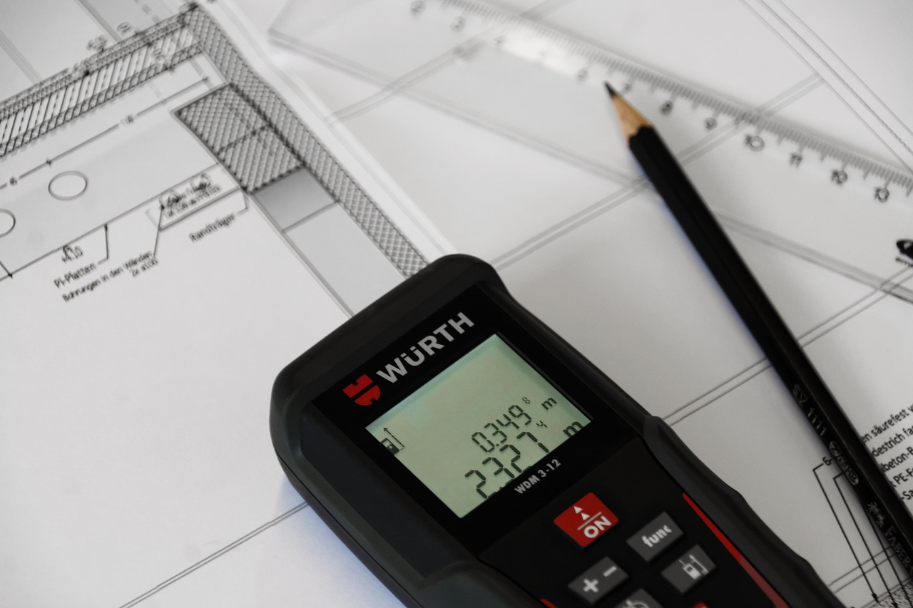
    A laser measure — also known as a laser distance meter or laser rangefinder — is a handheld device that calculates distance by emitting a laser beam at a target and measuring the time it takes for the beam to return. The result is displayed instantly on a digital screen, giving you an accurate measurement in seconds.

    Modern laser measure devices can record distances from around 0.05 metres up to 200 metres or more, depending on the model. Most professional units are accurate to within 1 to 2 millimetres, which is more than sufficient for the vast majority of property surveying tasks.

    For property professionals, the laser measure has largely replaced the traditional tape measure for internal surveys. It is faster, more accurate over longer distances, and can be operated by a single person — making it an essential tool for anyone carrying out measured surveys for lease plans, floor plans and building layouts.

    How Laser Measures Are Used in Property Surveying

    In the context of property surveying and plan preparation, a laser measure is used for several key tasks.

    Measured Surveys for Lease Plans

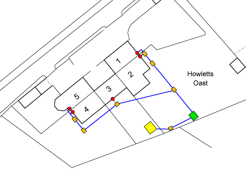
    When preparing a lease plan for HM Land Registry, detailed floor plans showing the internal layout of the property are required. A laser measure allows the surveyor to quickly and accurately record room dimensions, wall thicknesses, corridor widths and the positions of doors and windows. These measurements are then used to produce scaled floor plans in CAD software.

    Checking Building Dimensions for Title Plans

    While title plans are primarily based on Ordnance Survey mapping data, there are situations where a surveyor needs to verify building dimensions on the ground — for example, where a new extension does not yet appear on the OS map. A laser measure provides a fast way to check these measurements on site.

    Commercial Property Surveys

    Commercial properties — offices, retail units, warehouses and industrial premises — often require detailed measured surveys for lease plans, floor area calculations and property management purposes. A laser measure is the primary tool used for capturing these measurements efficiently.

    Development Site Surveys

    On development sites, a laser measure can be used to check plot dimensions, building setbacks and the positions of key features. While larger-scale site surveys typically use GPS and total station equipment, a laser measure is invaluable for quick on-site checks and internal measurements.

    Types of Laser Measure

    There are several categories of laser measure on the market. The right choice depends on what you are using it for and the level of precision you need.

    Point-and-Shoot Laser Measures

    These are the most common type. You point the device at the target surface, press a button, and the distance appears on the screen. Most models in this category have a range of 20 to 60 metres, which is sufficient for measuring rooms and internal spaces. They are compact, affordable and easy to use, making them a good starting point for basic property measurement tasks.

    Professional Laser Distance Meters

    Designed for surveyors, construction professionals and architects, these devices offer longer ranges (typically 100 to 200 metres), higher accuracy (often ±1.0 mm) and additional functions such as area calculation, volume calculation, indirect height measurement and Pythagoras functions. Professional models from manufacturers such as Leica, Bosch and Stabila are widely used in property surveying.

    Bluetooth-Enabled Laser Measures

    Many modern laser measure devices include Bluetooth connectivity, allowing you to send measurements directly to a smartphone, tablet or laptop. This is particularly useful when working with survey apps or CAD software on site, as it reduces the risk of transcription errors and speeds up the data capture process.

    Laser Measures With Camera Viewfinders

    For outdoor use or long-range measurements where the laser dot becomes difficult to see, some models include a built-in camera with a digital viewfinder. This allows you to see exactly where the laser is pointing on screen, even at distances of 100 metres or more. These are useful for surveying large buildings, facades and open sites.

    Laser Levels With Distance Measurement

    Some devices combine laser measuring with laser levelling functions in a single unit. While these are more commonly used in construction for setting out levels and alignments, they can be useful for surveyors who need both measuring and levelling capability on the same site visit.

    Practical tip: For property surveying and lease plan preparation, a professional laser distance meter with Bluetooth is the best all-round choice. The Bluetooth function saves significant time when you are recording dozens of measurements in a single survey, and the professional accuracy ensures your finished plans are reliable.

    Key Features to Look For

    If you are choosing a laser measure for property surveying work, the following features are worth prioritising:

    • Accuracy of ±1.5 mm or better — professional surveying demands precision, and this level of accuracy ensures your measurements translate reliably into scaled plans
    • Range of at least 60 metres — sufficient for most internal and external property measurements, though 100+ metres is better for commercial and outdoor work
    • Bluetooth connectivity — allows direct transfer of measurements to your phone, tablet or laptop, reducing manual errors
    • Area and volume calculation — built-in functions that save time when surveying rooms and calculating floor areas
    • Indirect measurement (Pythagoras function) — useful for measuring heights and distances that cannot be reached directly
    • Robust build quality — a rubberised casing and IP54 dust and water protection are essential for site use
    • Clear digital display — a backlit screen with large, readable digits makes a difference when working in dim or bright conditions
    • Measurement from back edge — the ability to measure from the back of the device (rather than the front) is important when measuring into corners

    Need a Measured Survey or Lease Plan?

    We carry out professional measured surveys using calibrated laser measure equipment. 100% HMLR acceptance rate on every plan.

    Get a Free Quote

    Laser Measure vs Traditional Tape Measure

    The traditional tape measure is still a useful tool, but for professional property surveying it has largely been replaced by the laser measure. Here is how they compare:

    Feature Laser Measure Tape Measure
    Accuracy ±1.0 to ±1.5 mm (professional models) ±1 to ±3 mm (depends on technique)
    Range Up to 200+ metres Typically 5 to 8 metres
    One-person operation Yes — point and shoot Often requires two people for longer distances
    Speed Instant readings Slower, especially over longer distances
    Data transfer Bluetooth to phone, tablet or CAD Manual recording only
    Curved surfaces Not suitable Better for curved or irregular surfaces
    Cost £50 to £500+ depending on model £5 to £30

    In practice, most surveyors carry both. A laser measure handles the vast majority of measurements, while a short tape measure is useful for small details, curved surfaces and situations where a flat surface to reflect the laser is not available.

    How Accurate Is a Laser Measure?

    The accuracy of a laser measure depends on the model, the conditions and how it is used. Professional-grade devices are typically accurate to within ±1.0 to ±1.5 mm over their full range. Entry-level consumer models may be accurate to within ±2.0 to ±3.0 mm.

    Factors That Affect Accuracy

    Several factors can influence the accuracy of a laser measure reading:

    • Target surface — the laser works best against flat, solid surfaces. Rough, dark or highly reflective surfaces can affect the reading
    • Bright sunlight — strong ambient light can make the laser dot difficult to see and may reduce accuracy at longer distances
    • Temperature extremes — very hot or cold conditions can affect the internal electronics of the device
    • Obstructions — dust, rain or obstacles in the laser path will give incorrect readings
    • Reference point — you need to know whether the device is measuring from its front edge or back edge, and set it accordingly for the situation

    For property surveying, the accuracy of a good-quality laser measure is more than sufficient. The tolerances involved in producing lease plans and floor plans are well within the capabilities of professional devices, provided they are used correctly and maintained properly.

    Common Mistakes When Using a Laser Measure

    Even with a reliable laser measure, errors can creep in if the device is not used carefully. Here are the most common mistakes we see:

    • Measuring to the wrong surface — if the laser hits a door frame, skirting board or piece of furniture instead of the wall, the reading will be wrong
    • Not checking the reference point setting — most devices can measure from the front or back edge, and selecting the wrong one adds or subtracts the length of the device itself
    • Forgetting to account for wall thickness — when measuring between rooms, you need to add the wall thickness to get the overall building dimension
    • Taking readings at an angle — the laser must be perpendicular to the target surface for an accurate distance reading, as measuring at an angle gives a longer result
    • Not recording measurements systematically — on a complex survey with dozens of readings, it is easy to lose track of which measurement relates to which room or dimension
    • Relying on a single measurement — good practice is to take at least two readings for each dimension and check they agree before recording the measurement

    These are basic errors, but they can lead to inaccurate floor plans and, in the worst case, plans that do not reflect the true layout of the property. On a lease plan submitted to HM Land Registry, accuracy matters — an incorrect plan can lead to disputes about the extent of the demised premises.

    What We Use at Towers Richardson

    At Towers Richardson, we use professional-grade laser measure devices on every measured survey. Our equipment is calibrated regularly and maintained to ensure consistent accuracy across all of our work.

    We combine laser measure data with professional CAD software and licensed Ordnance Survey mapping to produce plans that meet HM Land Registry standards under Practice Guide 40. The accuracy of our laser measure equipment is a critical part of that process.

    Here is what we offer:

    • Professional measured surveys — using calibrated laser measure equipment for accurate room dimensions and building layouts
    • Lease plans — detailed floor plans showing the demised area, communal spaces and access routes, prepared for HMLR registration
    • Title plans and transfer plans — based on licensed OS data and verified with on-site measurements where needed
    • 100% HMLR acceptance rate — every plan is checked against Practice Guide 40 before delivery
    • Fast turnaround — most plans delivered within 24 to 48 hours, with same-day options available
    • Nationwide coverage — we carry out measured surveys and prepare plans across England and Wales

    30+ Years. 100% Acceptance Rate.

    Trusted by solicitors, developers and property professionals across England and Wales since 1994.

    Request Your Free Quote

    Frequently Asked Questions

    What is a laser measure?

    A laser measure is a handheld device that calculates distance by emitting a laser beam at a target surface and measuring the time it takes for the beam to return. It displays the result instantly on a digital screen, providing fast and accurate distance measurements.

    How accurate is a laser measure?

    Professional-grade laser measure devices are typically accurate to within ±1.0 to ±1.5 mm. Entry-level consumer models may have an accuracy of ±2.0 to ±3.0 mm. For property surveying and plan preparation, professional models provide more than sufficient precision.

    Can I use a laser measure for a lease plan survey?

    Yes. A laser measure is the primary tool used for carrying out measured surveys for lease plans. It allows the surveyor to record room dimensions, wall positions and building layouts quickly and accurately. The measurements are then used to produce scaled floor plans in CAD software.

    Which laser measure is best for property surveying?

    For professional property surveying, look for a laser measure with an accuracy of ±1.5 mm or better, a range of at least 60 metres, Bluetooth connectivity and a robust build. Professional models from Leica, Bosch and Stabila are widely used in the industry.

    Do I need a laser measure to prepare a Land Registry plan?

    Not always. Title plans and transfer plans are primarily based on Ordnance Survey data and do not require a site visit in most cases. However, lease plans that include internal floor layouts require a measured survey, and a laser measure is the standard tool for capturing those measurements.

    Is a laser measure better than a tape measure?

    For most property surveying tasks, yes. A laser measure is faster, more accurate over longer distances and can be operated by one person. However, a traditional tape measure is still useful for small details, curved surfaces and situations where a flat target surface is not available. Most surveyors carry both.

    How much does a measured survey cost?

    The cost of a measured survey depends on the size and complexity of the property. We provide fixed-price quotes with no hidden fees — contact us with details of your property and we will confirm the cost before any work begins.

    Need a Measured Survey or Compliant Plan?

    Towers Richardson has been carrying out measured surveys and preparing Land Registry-compliant plans since 1994. We use professional-grade laser measure equipment on every survey and produce plans that meet Practice Guide 40 standards. Whether you need a lease plan, title plan or transfer plan, we can help.

    We work with solicitors, estate agents, developers and property professionals across England and Wales.

    Get in touch today:

    📧 info@towers-richardson.co.uk
    📞 01226 885040
    💬 WhatsApp: 07543 434048

    Or request a free quote online — we respond within 1 hour during business hours.

  • Land Registry TP1 & TP2 Transfer Plans

    Land Registry TP1 & TP2 Transfer Plans

    If you are selling part of your property, splitting a title, or transferring land to a new owner, you will almost certainly need a transfer plan. This plan accompanies the transfer deed — typically a Form TP1 or TP2 — and shows HM Land Registry exactly which land is being transferred and which is being retained.

    In this guide, we explain what a transfer plan is, when you need one, the difference between TP1 and TP2 transfers, what the plan must include, and the common mistakes that lead to rejections. We draw on over 30 years of preparing transfer plans for solicitors, developers and property professionals across England and Wales.

    Why trust this guide? Towers Richardson has prepared thousands of transfer plans since 1994. Every plan we produce is drafted to the standards set out in Practice Guide 40 and we maintain a 100% HM Land Registry acceptance rate.

    What Is a Transfer Plan?

    A transfer plan is a scaled drawing that identifies the land being transferred from one registered title to another. It forms part of the transfer deed submitted to HM Land Registry and must show clearly which part of the existing title is being moved to a new owner — and which part the seller is keeping.

    Every registered property has a title plan held by HMLR. When the whole of a title changes hands, a new transfer plan is not usually required — the existing title plan serves the purpose. However, when only part of a title is being transferred, a transfer plan is essential. Without it, HMLR cannot determine which area of land the transfer relates to.

    The transfer plan accompanies either a Form TP1 (transfer of part of a registered title) or a Form TP2 (transfer of part where a new charge is created). In both cases, the plan must meet HMLR’s requirements under Practice Guide 40.

    When Do You Need a Transfer Plan?

    A transfer plan is required whenever part of a registered title is being separated and transferred to a new owner. The most common situations include:

    • Selling part of your garden or land — for example, selling a building plot at the side of your house while keeping the rest of the property
    • Splitting a title between two or more buyers — when a property is divided into separate parcels, each needs its own transfer plan
    • Transferring land to a family member — gifting part of your land requires the same documentation as a sale
    • Developer plot sales — each individual plot sold on a development site requires a transfer plan showing the plot boundaries
    • Transferring public open space or communal areas — developers transferring POS or estate roads to local authorities or management companies
    • Adding land to an existing title — transferring a parcel from one title to be merged with an adjacent registered title
    • Boundary adjustments between neighbours — where two landowners agree to realign their boundary, both titles need updating

    If you are selling or transferring the whole of your registered title, a new transfer plan is not usually needed — the existing HMLR title plan is sufficient. Your solicitor will advise whether a new plan is required for your particular transaction.

    Key distinction: A transfer plan is only needed for a transfer of part. If the entire title is changing hands, the standard transfer form (TR1) is used and the existing title plan remains unchanged.

    TP1 vs TP2 — What Is the Difference?

    When transferring part of a registered title, you will use either Form TP1 or Form TP2. Both forms require a transfer plan, but they serve different purposes.

    Form TP1 — Transfer of Part

    Form TP1 is the standard transfer deed used when part of a registered title is being transferred to a new owner. It is the most commonly used form for partial transfers and covers the vast majority of situations — garden land sales, building plot transfers, boundary adjustments and developer plot disposals.

    The transfer plan attached to a TP1 must clearly identify the land being transferred, typically edged in red, along with the retained land, typically edged in blue. Any rights of way, easements or other interests affecting the land should also be shown on the plan.

    Form TP2 — Transfer of Part With a New Charge

    Form TP2 is used in the same circumstances as a TP1, but with an additional element: it includes a new mortgage or charge over the transferred land. In practical terms, this means the buyer is purchasing part of the seller’s title with the help of a mortgage, and the lender’s charge needs to be registered at the same time as the transfer.

    The transfer plan requirements for a TP2 are identical to those for a TP1. The only difference is in the deed itself, which includes additional clauses relating to the new charge.

    Feature Form TP1 Form TP2
    Purpose Transfer of part of a registered title Transfer of part with a new mortgage/charge
    Transfer plan required? Yes Yes
    Plan requirements Practice Guide 40 compliant Identical to TP1
    When to use Most partial transfers When buyer has a mortgage on the transferred land

    Transfer Plan Requirements

    Every transfer plan submitted to HMLR must comply with Practice Guide 40. The key requirements are:

    • Based on the Ordnance Survey map — the transfer plan must show sufficient OS detail for HMLR to locate the land accurately and identify it against the existing title plan
    • Drawn to a stated metric scale — the scale must be clearly stated on the plan and must be accurate, with a scale bar included
    • A north point — confirming the orientation of the plan
    • Clear boundary edging — the land being transferred must be edged in a continuous colour with no gaps, forming a complete enclosure
    • Distinction between transferred and retained land — different colours must clearly show which land is being transferred and which is being kept
    • Sufficient surrounding detail — roads, buildings and neighbouring features must be visible to provide context for HMLR
    • No prohibited phrases — wording such as “not to scale,” “for identification purposes only” or “subject to survey” must not appear
    • Date of preparation — a record of when the plan was produced
    • Consistency with the deed description — the plan must match the verbal description of the land in the TP1 or TP2 transfer deed

    The transfer plan must also be consistent with the existing title plan. HMLR will compare the two, and any significant discrepancy between the boundaries shown on the transfer plan and those on the existing title will raise a requisition.

    Need a Transfer Plan?

    We prepare compliant transfer plans for TP1 and TP2 applications. 100% HMLR acceptance rate. Most plans delivered within 24–48 hours.

    Get a Free Quote

    Colouring Conventions for Transfer Plans

    Colour is essential on a transfer plan. It tells HMLR — and the parties to the transaction — exactly which land is being transferred and which is being retained. While HMLR does not mandate specific colours, the following conventions are standard practice:

    • Red edging — shows the land being transferred to the new owner
    • Blue edging — shows the retained land (the part being kept by the seller)
    • Brown colouring — indicates a right of way or easement benefiting the transferred or retained land
    • Green colouring — indicates communal areas or shared access routes

    The colours must remain clearly distinguishable when printed. This is especially important when the transferred and retained areas share a common boundary — if the red and blue edging merge or become difficult to tell apart, HMLR will raise a requisition.

    Practical tip: If the transfer involves rights of way or easements (for example, a right of access over the retained land to reach the transferred land), these must be clearly shown on the transfer plan using a different colour from the boundary edging. Your solicitor will confirm which rights need to be shown.

    Recommended Scales

    The scale of a transfer plan depends on the size of the land involved. The plan must be detailed enough for HMLR to identify the boundaries clearly, but at a scale that fits the area practically on the page.

    Scale Best Used For
    1:200 or 1:500 Small areas — individual flats, garden plots, car parking spaces
    1:1250 Urban and suburban properties — the most common scale for residential transfer plans
    1:2500 Rural land, farms and larger sites
    1:10000 or smaller Very large rural areas or infrastructure routes

    For most residential transfers — selling a garden plot, splitting a title between two houses, or transferring a building plot — 1:1250 is the standard scale. The scale must be stated on the plan and must be metrically accurate.

    Common Reasons Transfer Plans Get Rejected

    Transfer plans are one of the most common types of plan we are asked to prepare — and one of the most common to be rejected when prepared by non-specialists. After 30 years of experience, these are the issues we see most often:

    • The boundary does not form a complete enclosure — gaps in the red edging mean HMLR cannot determine the full extent of the transferred land
    • Insufficient surrounding detail — the plan only shows the transfer boundary with no roads, buildings or other features to help HMLR locate it
    • Not based on the Ordnance Survey map — hand-drawn sketches, estate agent plans or architect’s drawings without an OS base are rejected
    • Prohibited phrases on the plan — “not to scale,” “for identification purposes only,” “approximate boundary” and similar wording will cause automatic rejection
    • Plan does not match the deed description — the verbal description in the TP1 refers to land that does not correspond with what is shown on the plan
    • Transfer boundary conflicts with the existing title plan — the new boundary does not align with the boundaries already recorded on the seller’s title
    • Colours not distinguishable when printed — similar colours used for transferred and retained land that merge on paper
    • Missing north point or scale — basic requirements that are sometimes overlooked
    • Rights of way not shown — if the deed grants or reserves rights over the land, these should be identifiable on the plan

    When HMLR rejects a transfer plan, they raise a requisition — a formal request for corrections. This delays the transaction, typically by several weeks at minimum, and may require a replacement plan to be prepared from scratch. Getting the transfer plan right first time avoids all of this.

    How the Transfer Process Works

    Understanding where the transfer plan fits into the wider process helps explain why accuracy matters. Here is how a typical transfer of part works.

    1. The Solicitor Prepares the Transfer Deed

    The seller’s solicitor drafts the TP1 or TP2 transfer deed, setting out the terms of the transfer — the land being transferred, the purchase price, any new rights or reservations, and any covenants. The transfer plan is attached to this deed as a visual reference for the land described.

    2. The Transfer Plan Is Prepared

    A compliant transfer plan is prepared showing the land being transferred (edged red) and the retained land (edged blue). The plan must match the deed description and be based on current OS data. At Towers Richardson, we work directly with the solicitor to ensure the plan and deed are consistent.

    3. The Deed Is Completed and Submitted

    Once the transaction completes, the buyer’s solicitor submits the transfer deed, the transfer plan and an application form (AP1) to HM Land Registry for registration.

    4. HMLR Reviews the Application

    HMLR examines the transfer deed, the plan and the application form. They compare the transfer plan against the existing title plan to verify the boundaries. If everything is in order, they register the transfer and create a new title for the transferred land.

    5. New Title Created

    Once HMLR is satisfied, they update the register. The transferred land receives its own title number with a new title plan, and the seller’s existing title plan is updated to remove the transferred area.

    How Much Does a Transfer Plan Cost?

    The cost of a transfer plan depends on the complexity of the site and the amount of detail required. As a general guide, a straightforward transfer plan for a residential property starts from £115.

    More complex transfer plans — for example, those involving multiple parcels, rights of way, shared access arrangements or large development sites — are priced on a project basis. We always confirm the cost upfront before any work begins.

    We provide fixed-price quotes with no hidden fees. Request a quote and we will respond within 1 hour during business hours.

    Value tip: The cost of a rejected transfer plan is not just the fee for a replacement — it is the delay to your transaction, the additional solicitor time, and the frustration for all parties. Getting the transfer plan right first time with a specialist is almost always the most cost-effective approach.

    How Long Does It Take?

    At Towers Richardson, we typically deliver completed transfer plans within 24 to 48 hours of receiving your instructions. Urgent same-day turnarounds are available for time-critical transactions.

    For most standard transfer plans, we can work from the existing title plan, the deed description and OS data without needing to visit the property. If a site visit is required — for example, where new features are not yet shown on the OS map — we will confirm this at the quoting stage.

    How Towers Richardson Can Help

    At Towers Richardson, transfer plans are one of our core services. We prepare them every day for solicitors, developers and property professionals dealing with transfers of part across England and Wales.

    Here is what we offer:

    • 100% HMLR acceptance rate — every transfer plan is checked against Practice Guide 40 before delivery
    • Licensed Ordnance Survey data — we work directly with current OS MasterMap data in our CAD systems
    • 30+ years of specialist experience — we have been preparing transfer plans since 1994
    • TP1 and TP2 expertise — we understand the specific requirements for both types of transfer
    • Fast turnaround — most transfer plans delivered within 24 to 48 hours, with same-day options available
    • Nationwide coverage — we serve clients across England and Wales from our base in South Yorkshire
    • Fixed-price quotes — no hidden fees, with costs confirmed before any work starts

    Whether you need a single transfer plan for a garden land sale or a full suite of plans for a multi-plot development, we have the experience to deliver.

    30+ Years. 100% Acceptance Rate.

    Trusted by solicitors, developers and property professionals across England and Wales since 1994.

    Request Your Free Quote

    Frequently Asked Questions

    What is a transfer plan?

    A transfer plan is a scaled drawing that identifies the land being transferred from one registered title to another. It accompanies the transfer deed (Form TP1 or TP2) and must show the transferred land and the retained land clearly, based on the Ordnance Survey map and compliant with Practice Guide 40.

    When do I need a transfer plan?

    You need a transfer plan whenever you are transferring part of a registered title — for example, selling part of your garden, splitting a title, or transferring individual plots on a development site. If you are transferring the whole of a title, a new plan is not usually required.

    What is the difference between TP1 and TP2?

    Form TP1 is the standard transfer of part deed. Form TP2 is used when the transfer of part also involves a new mortgage or charge over the transferred land. The transfer plan requirements are identical for both forms.

    What colours should a transfer plan use?

    By convention, the land being transferred is edged in red and the retained land is edged in blue. Rights of way are typically shown in brown, and communal areas in green. The colours must remain clearly distinguishable when printed.

    How much does a transfer plan cost?

    Transfer plans start from £115 for standard residential properties. More complex plans are priced on a project basis. We provide fixed-price quotes upfront — contact us for a personalised quote.

    How long does a transfer plan take?

    We typically deliver transfer plans within 24 to 48 hours. Same-day urgent turnarounds are available when needed.

    Why was my transfer plan rejected?

    The most common reasons include gaps in the boundary edging, insufficient surrounding detail, prohibited phrases on the plan, the plan not matching the deed description, and the transfer boundary conflicting with the existing title plan. If your plan has been rejected, we can prepare a compliant replacement — often within 24 hours.

    Can I draw my own transfer plan?

    You can attempt to, provided the plan meets all of HMLR’s requirements under Practice Guide 40 — including being based on current OS data, drawn to a stated metric scale, with a north point and clear boundary edging. In practice, most DIY transfer plans contain errors that lead to rejection. Professional preparation is recommended.

    Need a Transfer Plan?

    Towers Richardson has been preparing Land Registry-compliant transfer plans since 1994. Whether you need a transfer plan for a garden land sale, a boundary adjustment, or a multi-plot development site, we can help you get it right first time.

    Every plan is prepared using licensed Ordnance Survey data, professional CAD software, and checked against Practice Guide 40 requirements before delivery. We work with solicitors, developers, estate agents and property professionals across England and Wales.

    Get in touch today:

    📧 info@towers-richardson.co.uk
    📞 01226 885040
    💬 WhatsApp: 07543 434048

    Or request a free quote online — we respond within 1 hour during business hours.

  • Land For Sale Near Me

    Land For Sale Near Me

    Whether you are looking for a building plot, a rural smallholding or a development opportunity, finding land for sale in the right location is the first step. However, once you find a plot, there is a legal process to navigate — and accurate Land Registry plans play a crucial part in making sure your purchase goes through smoothly.

    In this guide, we cover the best websites for searching for land for sale across the UK, explain what to check before buying, and set out the Land Registry plans you will need when your transaction reaches the conveyancing stage.

    Why we wrote this guide: Towers Richardson has prepared Land Registry plans for land purchases since 1994. We regularly work with buyers, solicitors and developers who need compliant title plans and transfer plans for land transactions. This guide brings together the search resources and the practical plan advice in one place.

    The best place to start looking for land for sale is online. There are several property portals and specialist websites that list land, building plots and development sites across England, Wales, Scotland and Northern Ireland.

    We have grouped the most useful search resources into categories below. Some focus on residential building plots, others specialise in rural land, woodland or commercial development opportunities. Using a combination of these sites gives you the broadest view of what is available in your target area.

    Main Property Portals

    The major property portals all include land listings alongside residential and commercial property. These are the best starting points for finding land for sale in any part of the UK.

    Website What It Covers
    Rightmove The UK’s largest property portal — search for land and building plots by location, price and size
    OnTheMarket A growing portal with a dedicated land section, including development sites
    Your Move National estate agency chain listing land and plots alongside residential property
    PropertyPal The leading property portal for Northern Ireland, including land and sites

    These portals aggregate listings from local and national estate agents, giving you a wide range of land for sale from a single search. You can filter results by location, price range, plot size and land type.

    Specialist Land Search Websites

    If you are specifically looking for building plots or development land, these specialist websites focus exclusively on land for sale rather than general property.

    Website What It Covers
    PlotFinder Specialist portal for self-build plots and building land across the UK
    AddLand Land marketplace with detailed mapping tools showing ownership boundaries, planning history and environmental data
    Woods4Sale Specialist in woodland and forest plots, with land for sale across England, Scotland and Wales
    Tustins Land and property auctioneers, often listing development sites and plots at auction

    Search tip: AddLand is particularly useful for due diligence. It overlays Land Registry title boundaries, planning application data and environmental information on a map, giving you a detailed picture of any plot before you even visit it.

    Rural Land, Farms and Woodland

    If you are looking for agricultural land, farmland, estates or woodland for sale, these specialist agents and portals focus on the rural property market.

    Website What It Covers
    UK Land and Farms Specialist portal for farms, rural estates and agricultural land
    Knight Frank Leading estate agent for country houses, farms and rural estates
    Strutt & Parker Rural property specialists with farm, estate and land listings across England, Scotland and Wales
    Fox & Sons Regional estate agent covering the South of England, with rural land and property listings
    Woodlands.co.uk Small woodland plots for sale across England, Scotland and Wales — ideal for conservation, recreation or investment
    Forests.co.uk Larger forest and woodland properties, including commercial forestry and estate plantations
    Savills Major national agent with a strong rural and estates division covering farms, development land and rural commercial property

    Rural land purchases often involve larger areas, complex boundaries and unregistered land — all of which can require specialist Land Registry plans to complete the transaction.

    Found Land for Sale? Need a Plan?

    We prepare compliant title plans and transfer plans for land purchases. 100% HMLR acceptance rate. Most plans delivered within 24–48 hours.

    Get a Free Quote

    Estate Agents and Land Agents

    Not all land for sale appears on the major online portals. Local estate agents and specialist land agents often have plots available that are not widely advertised — particularly smaller parcels, infill plots and off-market opportunities.

    If you are searching in a specific area, it is worth contacting local agents directly and asking to be added to their mailing list for land and plots. Many agents will notify you of new listings before they appear online, giving you an early opportunity to view and make an offer.

    For development land and larger sites, specialist land agents and commercial property firms such as Savills, Knight Frank and Strutt & Parker often handle sales that are marketed exclusively through their own networks.

    What to Check Before Buying Land

    Finding land for sale is the exciting part. However, before committing to a purchase, there are several important checks that you or your solicitor should carry out.

    • Title and ownership — is the land registered at HM Land Registry? Who owns it? Are there any charges, restrictions or covenants on the title?
    • Planning status — does the land have planning permission for your intended use? If not, what are the prospects of obtaining it?
    • Access — does the land have legal access from a public highway? If access is across third-party land, is there a formal right of way?
    • Boundaries — are the boundaries clear and agreed? Do they match what is shown on the title plan?
    • Services — is the land connected to mains water, electricity, gas and drainage? If not, what are the costs of connection?
    • Environmental considerations — is the land in a flood zone, conservation area, or subject to tree preservation orders or ecological designations?
    • Local authority searches — these reveal planned developments, road schemes and other matters that could affect the value or use of the land
    • Unregistered land — if the land is not registered at HMLR, additional investigations are needed to establish ownership and any existing rights over the land

    Your solicitor or conveyancer will carry out the detailed legal checks as part of the conveyancing process. However, understanding these issues early helps you avoid costly surprises later.

    Planning tip: Land with full planning permission is almost always more expensive than land without. However, buying land without planning permission carries the risk that consent may not be granted. If you are buying land for sale with the intention of building on it, check the planning status carefully before exchanging contracts.

    What Land Registry Plans Do You Need?

    When you buy land, the conveyancing process will require one or more Land Registry-compliant plans depending on the nature of the transaction. Here are the most common scenarios.

    Buying the Whole of a Registered Title

    If you are buying land that is already registered and you are purchasing the entire title, a new plan is not usually required. The existing title plan held by HMLR will remain in place, and ownership simply transfers to you.

    Buying Part of a Registered Title

    If you are buying part of someone else’s land — for example, a building plot carved out of a larger title — a transfer plan is required. This accompanies the TP1 transfer deed and shows HMLR exactly which part of the title is being transferred to you and which part the seller is keeping.

    First Registration of Unregistered Land

    If the land you are buying is unregistered (it does not currently have a title number at HMLR), your solicitor will need to apply for first registration after completion. This requires a title plan showing the boundaries of the land you are registering.

    Land With Complex Boundaries or Multiple Parcels

    For larger purchases involving multiple fields, parcels or access routes, several plans may be needed — potentially at different scales — to clearly show all of the land being acquired and any rights being granted or reserved.

    In every case, the plan must comply with HM Land Registry’s requirements under Practice Guide 40. Plans that do not meet these standards will be rejected, causing delays to your transaction.

    Common Issues With Land Purchases

    Land transactions can be more complex than standard house purchases. After 30 years of preparing plans for land buyers and their solicitors, we regularly see the following issues arise:

    • Boundaries on the ground do not match the title plan — fences, hedges and walls may not align with the registered boundary, creating uncertainty about exactly what you are buying
    • The land is unregistered — with no HMLR title, establishing ownership requires a chain of deeds and may involve a Search of the Index Map to check for any existing registrations
    • Access is unclear — the land may not have a formal right of way, or the access route may cross land owned by a third party
    • Existing plans are non-compliant — estate agent sales particulars and marketing plans often carry prohibited phrases like “not to scale” and cannot be used for Land Registry purposes
    • Overlapping titles — in some cases, parts of the land may already be included in a neighbouring registered title, creating a conflict that needs resolving
    • Planning restrictions or covenants — restrictions on the title may limit what you can do with the land, even if it appears to have development potential

    Each of these issues requires careful handling — and in most cases, accurate Land Registry plans are part of the solution. Whether it is a fresh title plan for a first registration or a transfer plan to resolve a boundary issue, getting the plan right is essential for completing the transaction.

    How Towers Richardson Can Help

    At Towers Richardson, we prepare Land Registry-compliant plans for land purchases across England and Wales. Whether you are buying a small building plot, a large rural parcel or a multi-plot development site, we have the experience to deliver the plans your solicitor needs.

    Here is what we offer:

    • Title plans — for first registrations of unregistered land
    • Transfer plans — for purchases of part of a registered title (TP1 transfers)
    • 100% HMLR acceptance rate — every plan is checked against Practice Guide 40 before delivery
    • Licensed Ordnance Survey data — we work directly with current OS MasterMap data in our CAD systems
    • 30+ years of specialist experience — we have been preparing plans for land transactions since 1994
    • Fast turnaround — most plans delivered within 24 to 48 hours, with same-day options available
    • Nationwide coverage — we serve clients across England and Wales from our base in South Yorkshire
    • Fixed-price quotes — no hidden fees, with costs confirmed before any work starts

    Plans start from £115. Request a quote and we will respond within 1 hour during business hours.

    30+ Years. 100% Acceptance Rate.

    Trusted by solicitors, developers and property professionals across England and Wales since 1994.

    Request Your Free Quote

    Frequently Asked Questions

    Where can I find land for sale near me?

    The best starting points are the major property portals — Rightmove and OnTheMarket — which both have dedicated land sections. For specialist searches, PlotFinder focuses on self-build plots, AddLand offers detailed mapping and ownership data, and rural agents like Knight Frank and Strutt & Parker list farms, estates and woodland.

    Do I need a Land Registry plan when buying land?

    It depends on the transaction. If you are buying the whole of an already-registered title, a new plan is not usually needed. If you are buying part of a title or the land is unregistered, you will need a compliant plan — either a transfer plan or a title plan for first registration.

    What checks should I do before buying land?

    Key checks include confirming ownership and title status, planning permission, legal access, boundary accuracy, service connections, flood risk and any restrictions or covenants on the land. Your solicitor will carry out these checks as part of the conveyancing process.

    What is unregistered land?

    Unregistered land is land that does not currently have a title registered at HM Land Registry. When you buy unregistered land, your solicitor must apply for first registration, which requires a compliant title plan showing the boundaries of the land being registered.

    How much does a Land Registry plan cost for a land purchase?

    Plans start from £115 for standard title plans and transfer plans. More complex sites involving multiple parcels or large areas are priced on a project basis. We provide fixed-price quotes upfront — contact us for a personalised quote.

    Can I use the estate agent’s plan for Land Registry purposes?

    No. Estate agent plans are typically marked “for identification purposes only” or “not to scale,” which are prohibited phrases under HMLR’s requirements. A purpose-prepared Land Registry plan based on Ordnance Survey data is needed for registration.

    How long does a Land Registry plan take?

    We typically deliver plans within 24 to 48 hours. Same-day urgent turnarounds are available when needed.

    Buying Land? We Can Help With the Plans.

    Towers Richardson has been preparing Land Registry-compliant plans since 1994. Whether you have found land for sale and need a title plan for first registration or a transfer plan for a partial purchase, we prepare every plan to Practice Guide 40 standards and deliver with a 100% HMLR acceptance rate.

    We work with solicitors, buyers, developers and property professionals across England and Wales.

    Get in touch today:

    📧 info@towers-richardson.co.uk
    📞 01226 885040
    💬 WhatsApp: 07543 434048

    Or request a free quote online — we respond within 1 hour during business hours.

  • How to find my house plans

    How to find my house plans

    If you want to find your house plans, the quickest and easiest way is through your Local Planning Authority’s website. Most councils now have their planning records available online, meaning you can search for and download drawings of your property from home — completely free of charge.

    In this guide, we walk you through the process step by step with screenshots, explain where to look if your property was built before online records were available, and cover the difference between planning drawings and the Land Registry plans you may need for a property transaction.

    Important distinction: The house plans you can find through your local council are planning application drawings — floor plans, elevations and site plans submitted by the architect or builder when the property was built or altered. These are not the same as Land Registry plans (title plans), which show the legal boundaries of your property. If you need a Land Registry plan, contact us and we can help.

    Where to Find Your House Plans

    The best place to find your house plans is your Local Planning Authority (LPA). Every council in England and Wales keeps records of planning applications, and most now make these accessible through an online search portal.

    When a property is built, extended or altered, the builder or homeowner submits planning drawings to the council as part of the planning application. These drawings typically include floor plans, elevations, site plans and sometimes structural details. Once the application is determined, these documents remain on file as a public record.

    How Far Back Do Online Records Go?

    Most councils have digitised their planning records going back approximately 20 years. If your house was built or altered within this period, there is a good chance you can find the plans online. For older properties, you may need to contact the council directly or visit your local library — we cover this in more detail below.

    To find your Local Planning Authority, you can use the GOV.UK search tool: Find your local council on GOV.UK.

    Step-by-Step: How to Find My House Plans Online

    Every council’s website is slightly different, but the process for finding your house plans follows the same general pattern. Here is a step-by-step walkthrough.

    Step 1 Find Your Local Planning Authority Website

    Start by searching for your Local Planning Authority’s website. You can use the GOV.UK council finder to identify which council covers your area. Once you are on their website, look for a section called “Planning” or “Planning applications.”

    Step 2 Find the Online Planning Search

    On the council’s planning page, look for a link or button that says something like “View or comment on planning applications online,” “Search planning applications” or “Public Access.” This will take you to their online planning portal.

    Screenshot showing the view or comment on planning applications link on a council website

    Step 3 Access the Public Search Portal

    Many councils use a system called “Public Access” for their planning records. You may see a link labelled “View Public Access” or similar. Click through to reach the search screen.

    Screenshot showing the View Public Access link on a planning portal

    Step 4 Search for Your Property

    You should now see a simple search screen. Type in your address — the postcode usually works best — and click “Search.” The system will return a list of planning applications associated with your property.

    Screenshot showing the planning application search screen with address field

    Step 5 Find the Right Application

    The search results may show several planning applications for the same property — original construction, extensions, conversions and other alterations. Check the description and date of each one to find the application you are interested in. The listing will tell you how many documents are associated with each application.

    Screenshot showing planning application search results with multiple applications listed

    Step 6 View and Download the Plans

    Open the application and navigate to the “Documents” tab. You will see a list of all the documents submitted with the application. Drawings are typically indicated by an icon showing two rulers in an L-shape. Click the “View” link (usually shown as a document icon with a magnifying glass) to open the PDF of the drawing. From here you can view, download and print your house plans.

    Screenshot showing the documents tab with drawing files available to view and download

    Tip: If you cannot find your house plans using the online search, try different search terms — your house name, the street name without a number, or just the postcode. Some older records may be indexed differently from how you expect.

    What If My House Was Built Before Online Records?

    If your property was built more than 20 years ago, the planning records may not be available online. In that case, you have several options to find your house plans.

    • Contact your council directly — phone or email the planning department and ask for copies of the original planning application drawings. There may be a small fee for retrieving archived records
    • Visit your local library — many libraries hold copies of historical planning records and building control archives, particularly for significant local buildings
    • Check with the original builder or architect — if you know who designed or built the property, they may still hold copies of the original drawings
    • Ask previous owners — the seller or their solicitor may have retained copies of plans from when the property was purchased or altered
    • Building control records — your council’s building control department holds separate records from planning, and these sometimes include floor plans and structural drawings
    • Commission a measured survey — if no original plans exist, a surveyor can carry out a measured survey of the property and produce accurate floor plans from scratch

    Other Places to Find House Plans

    Beyond the Local Planning Authority, there are several other sources where you may be able to find drawings of your property.

    HM Land Registry Title Plans

    Every registered property in England and Wales has a title plan held by HM Land Registry. This is not a detailed house plan — it is a boundary plan showing the extent of your property on the Ordnance Survey map. You can order a copy of your title plan from the HM Land Registry website for a small fee.

    Your Mortgage Lender or Solicitor

    When you purchased your property, your solicitor will have obtained copies of the title documents — including the title plan. Your mortgage lender may also hold copies on file. It is worth contacting them if you need a copy of the boundary plan.

    The Deeds

    If your property is older and was purchased before compulsory registration, the original paper deeds may include plans. These deeds are sometimes held by your solicitor, your mortgage lender, or by you personally if the property is owned outright.

    Need a Land Registry Plan?

    Planning drawings are not the same as Land Registry plans. If you need a compliant title plan, lease plan or transfer plan, we can help.

    Get a Free Quote

    Planning Drawings vs Land Registry Plans

    This is an important distinction that many people overlook. The house plans you find through your Local Planning Authority are planning application drawings. They are not the same as Land Registry plans, and they serve different purposes.

    Feature Planning Drawings Land Registry Plans
    Purpose Show what is being built or altered Show the legal boundaries and extent of ownership
    Contents Floor plans, elevations, site layout, sections Boundary plan on OS base map
    Who produces them Architect or building designer Land Registry plan specialist or surveyor
    Used for Planning permission, building control Property registration, sales, transfers, leases
    Can it be used at Land Registry? No — usually carries prohibited phrases Yes — prepared to Practice Guide 40 standards

    Planning drawings often carry disclaimers such as “not to scale” or “for planning purposes only.” These phrases mean the plans cannot be submitted to HM Land Registry. If you need a plan for a property transaction — selling, transferring or leasing your home — you need a purpose-prepared Land Registry plan.

    When You Need a Land Registry Plan Instead

    While finding your house plans through the council is useful for understanding the layout and design of your property, there are situations where you need a different type of plan entirely. You will need a Land Registry-compliant plan when:

    • Selling part of your land or garden — a transfer plan is required to accompany the TP1 transfer deed
    • Granting a lease of 7 years or more — a lease plan with detailed floor plans is mandatory for HMLR registration
    • First registration of unregistered land — a title plan must accompany the application
    • Correcting or updating your title plan — where the existing boundary plan held by HMLR is inaccurate
    • Boundary disputes — an accurate plan based on OS data can help clarify the position

    In each of these cases, the plan must comply with HM Land Registry’s requirements under Practice Guide 40. Planning drawings from the council will not be accepted.

    How Towers Richardson Can Help

    At Towers Richardson, we specialise in Land Registry-compliant plans — the plans you need for property transactions, not the planning drawings held by your council. If you need a title plan, transfer plan or lease plan, we can prepare it to HMLR standards and deliver within 24 to 48 hours.

    Here is what we offer:

    • 100% HMLR acceptance rate — every plan is checked against Practice Guide 40 before delivery
    • Licensed Ordnance Survey data — we work directly with current OS MasterMap data
    • 30+ years of specialist experience — preparing Land Registry plans since 1994
    • Fast turnaround — most plans delivered within 24 to 48 hours, with same-day options available
    • Nationwide coverage — we serve clients across England and Wales
    • Fixed-price quotes from £115 — no hidden fees, costs confirmed before work starts

    30+ Years. 100% Acceptance Rate.

    Trusted by solicitors, developers and property professionals across England and Wales since 1994.

    Request Your Free Quote

    Frequently Asked Questions

    How can I find my house plans?

    The easiest way to find your house plans is through your Local Planning Authority’s website. Most councils have an online planning portal where you can search by address and view or download the drawings submitted with planning applications for your property.

    Are house plans available online for free?

    Yes. Planning application documents, including house plans, are public records and can be viewed and downloaded free of charge through most council planning portals. Records are typically available online for properties built or altered within the last 20 years.

    What if my house was built more than 20 years ago?

    For older properties, online records may not be available. You can contact your council’s planning department directly to request archived records, visit your local library, check with the original builder or architect, or ask your solicitor if they hold copies from a previous purchase.

    Can I use planning drawings for a Land Registry application?

    No. Planning drawings typically carry phrases like “not to scale” which are prohibited by HM Land Registry. For property registrations, sales, transfers and leases, you need a purpose-prepared Land Registry plan that complies with Practice Guide 40.

    What is the difference between house plans and a title plan?

    House plans (planning drawings) show the design and layout of a building — floor plans, elevations and site layout. A title plan is a Land Registry document that shows the legal boundaries and extent of your property on the Ordnance Survey map. They serve completely different purposes.

    How do I find my Local Planning Authority?

    You can find your Local Planning Authority using the GOV.UK council finder at gov.uk/find-local-council. Enter your postcode and it will tell you which council handles planning for your area.

    What if no plans exist for my property?

    If no planning drawings exist — for example, for very old properties that pre-date the planning system — you can commission a measured survey. A surveyor will visit the property, take measurements using laser equipment, and produce accurate floor plans and elevations from scratch.

    Need a Land Registry Plan for Your Property?

    If you need a Land Registry plan rather than planning drawings, Towers Richardson can help. We have been preparing compliant title plans, lease plans and transfer plans since 1994, and we maintain a 100% HMLR acceptance rate on every plan we produce.

    We work with homeowners, solicitors, developers and property professionals across England and Wales.

    Get in touch today:

    📧 info@towers-richardson.co.uk
    📞 01226 885040
    💬 WhatsApp: 07543 434048

    Or request a free quote online — we respond within 1 hour during business hours.

  • Land Registry Drainage Plans

    Land Registry Drainage Plans

    A drainage plan is a scaled drawing that shows the route of drainage systems through or across a property. When drainage infrastructure crosses property boundaries — which it very often does — an accurate plan is essential for documenting easements, establishing maintenance responsibilities, and supporting property transactions at HM Land Registry.

    In this guide, we explain what a drainage plan is, why you might need one, how it differs from other utility plans, what information it must include, and how we prepare them at Towers Richardson. We also cover the related plan types — sewer location plans, water pipe route plans and cable route plans — that are often needed alongside drainage plans.

    Why trust this guide? Towers Richardson has been preparing Land Registry-compliant drainage plans and utility route plans since 1994. Every plan we produce is drawn to HMLR standards and we maintain a 100% acceptance rate.

    What Is a Drainage Plan?

    A drainage plan is a detailed, scaled drawing that identifies the route of drainage and sewerage infrastructure in relation to one or more properties. It shows where drains run, where they cross property boundaries, where they connect to the wider sewerage network, and the positions of key features such as manholes, inspection chambers and outfall points.

    In the context of Land Registry work, a drainage plan is typically prepared to support a deed or transfer that grants or reserves drainage rights over neighbouring land. When a drain runs beneath a property that is being sold, transferred or leased, the plan provides the visual record of exactly where that drain is located and which properties are affected.

    These plans are sometimes referred to as drainage route plans, drainage easement plans or sewer route plans, depending on the specific purpose. Whatever the terminology, the principle is the same: the plan must accurately show the drainage route on an Ordnance Survey base map at a suitable scale, compliant with HM Land Registry requirements.

    When Do You Need a Drainage Plan?

    A drainage plan is required in several common property scenarios. If any of the following apply, your solicitor is likely to need an accurate drainage plan as part of the transaction.

    • Granting a drainage easement — when a property owner grants a right for a neighbouring property’s drainage to run through their land, the easement deed must be accompanied by a plan showing the exact route
    • Reserving drainage rights on a transfer — when selling part of your land, you may need to reserve the right for your drainage to continue running through the land being sold, which requires a plan showing the route
    • New build developments — developers often need drainage plans to show how each plot connects to the site drainage network and where shared drains cross plot boundaries
    • Adopting drainage infrastructure — when a water company agrees to adopt private drains (typically under a Section 104 agreement), plans showing the drainage layout are needed
    • Resolving drainage disputes — where neighbours disagree about drainage responsibilities or access for maintenance, an accurate plan helps establish the position
    • Property sales with shared drainage — if the property being sold has drainage that serves other properties, or relies on drainage running through neighbouring land, the solicitor will need a plan to document the arrangement
    • Lease plans with drainage references — some leases include drainage easements or refer to drainage infrastructure that must be shown on the plan

    Key point: A drainage plan is not the same as a standard title plan. A title plan shows the boundaries of your property. A drainage plan shows the route of drainage infrastructure in relation to those boundaries. You may need both — particularly on a transfer or lease where drainage rights are being granted or reserved.

    What Does a Drainage Plan Show?

    A well-prepared drainage plan should include all of the information needed to identify the drainage route clearly and accurately. The specific content depends on the purpose of the plan, but typically includes:

    • The drainage route — shown as a clearly marked line (usually in a distinct colour) indicating the path of the drain through or across the property
    • Property boundaries — the registered boundaries of all properties affected by the drainage route
    • Manholes and inspection chambers — marked at their correct positions along the route
    • Connection points — where the private drainage connects to the public sewer network
    • Easement corridor — if a drainage easement is being granted, the plan may show a defined strip (for example, 3 metres either side of the drain centre line) within which the easement applies
    • Ordnance Survey base data — the plan must be based on current OS mapping so that HMLR can relate it to the title plan
    • Scale and north point — a stated metric scale with a scale bar, and a north arrow for orientation
    • Key or legend — explaining the colours and symbols used on the plan

    The level of detail required depends on the legal document the plan supports. A simple drainage route plan for a transfer deed may only need to show the drain line and boundaries. A more detailed plan for a Section 104 adoption or a complex development may need to include pipe sizes, gradients and additional infrastructure.

    Drainage Plan Examples

    Below are examples of drainage plans we have prepared at Towers Richardson. Each one shows the drainage route clearly marked in relation to the property boundaries, drawn on an Ordnance Survey base at an appropriate scale.

    Every drainage plan we produce is prepared using licensed Ordnance Survey data and professional CAD software, ensuring it meets HM Land Registry standards under Practice Guide 40.

    Need a Drainage Plan?

    We prepare compliant drainage plans, sewer route plans and utility plans for Land Registry applications. 100% HMLR acceptance rate.

    Get a Free Quote

    Drainage Easements and Why They Matter

    A drainage easement is a legal right that allows drainage infrastructure belonging to one property to run through land owned by another. These easements are extremely common — in most residential areas, drains regularly cross neighbouring properties on their way to the public sewer.

    When a drainage easement is created — either as part of a property sale, a new development, or a standalone deed — the easement must be clearly documented. This includes both a written description in the deed and a drainage plan showing the route on a scaled drawing.

    What a Drainage Easement Typically Includes

    • The right to drain — the right for water and waste to flow through the drain across the neighbouring property
    • Access for maintenance — the right to enter the neighbouring property to inspect, repair or replace the drainage infrastructure
    • An easement corridor — a defined strip of land either side of the drain (commonly 1 to 3 metres each side) within which the easement rights apply
    • Restrictions on the servient land — typically, the landowner through whose property the drain runs cannot build over or obstruct the drain or the easement corridor

    Without an accurate drainage plan, the easement cannot be properly registered at HM Land Registry. If the plan is unclear or the drainage route is not shown precisely, HMLR may raise a requisition — delaying the registration and the underlying transaction.

    Drainage plans are the most commonly requested utility route plan, but they are not the only type. At Towers Richardson, we also prepare the following related plans, all to Land Registry standards.

    Plan Type What It Shows When It Is Needed
    Sewer location plan The route of public and private sewers across or near the property Property sales, build-over agreements, development applications
    Water pipe route plan The route of water supply pipes through or across the property Easement deeds for water supply, development infrastructure
    Cable route plan The route of electricity cables, telecoms or fibre running through the property Wayleave agreements, utility easements, development sites
    Gas pipe route plan The route of gas mains or service pipes across the property Easement deeds, development infrastructure, HSE compliance

    In many transactions — particularly new developments — multiple utility route plans are needed alongside the standard title or transfer plan. We can prepare all of these as a coordinated set, ensuring consistency across every drawing.

    How We Prepare a Drainage Plan

    At Towers Richardson, we follow a clear process to ensure every drainage plan is accurate and compliant.

    1. Understanding the Requirement

    We start by discussing the requirement with you or your solicitor. This includes understanding the purpose of the plan (easement, transfer, lease or other), identifying which properties are affected, and confirming what drainage information is available.

    2. Gathering Drainage Data

    The drainage route information typically comes from one or more of the following sources: existing drainage surveys or CCTV reports, water company sewer records, site plans from the developer or builder, or information provided by the property owner or their solicitor. In some cases, a drainage survey may need to be carried out on site before the plan can be prepared.

    3. Preparing the Plan

    We plot the drainage route onto current licensed Ordnance Survey mapping using professional CAD software. The drain line, manholes, connection points and any easement corridor are clearly marked. The plan is drawn to an appropriate scale with a north point, scale bar and legend.

    4. Checking and Delivery

    Every drainage plan is reviewed against Practice Guide 40 requirements before delivery. We supply the plan as a high-resolution PDF, ready for attachment to the deed or application. Most plans are delivered within 24 to 48 hours.

    Common Issues With Drainage Plans

    After decades of preparing drainage plans, we regularly encounter the following issues — understanding them in advance helps avoid delays.

    • The drainage route is unknown — the property owner or solicitor does not know exactly where the drain runs, making a drainage survey necessary before the plan can be prepared
    • Water company records are inaccurate — sewer record plans from water companies are indicative only and may not reflect the actual position of the drainage on the ground
    • The drain route is not shown precisely enough — vague descriptions like “the drain running under the garden” are not sufficient for HMLR; the route must be plotted to a specific position on the plan
    • The plan does not match the deed description — if the easement deed describes the drain as running “from manhole A to manhole B” but the plan shows a different route, HMLR will raise a requisition
    • The easement corridor is not defined — some deeds grant an easement over a strip of land either side of the drain, and if this corridor is not clearly shown on the plan, it cannot be properly registered
    • Shared drainage is not properly documented — on older properties, shared drainage arrangements often exist informally with no easement in place, which becomes a problem when the property is sold

    How Much Does a Drainage Plan Cost?

    The cost of a drainage plan depends on the complexity of the drainage route and the number of properties involved. As a general guide, a straightforward drainage plan starts from £115.

    More complex plans — for example, those involving multiple drainage routes across several properties, development sites with extensive infrastructure, or plans that require coordination with water company records — are priced on a project basis. We always confirm the cost upfront before any work begins.

    We provide fixed-price quotes with no hidden fees. Request a quote and we will respond within 1 hour during business hours.

    How Towers Richardson Can Help

    At Towers Richardson, we prepare drainage plans and utility route plans every week for solicitors, developers and property professionals across England and Wales. Whether you need a single drainage plan for an easement deed or a full set of utility plans for a development site, we have the experience to deliver.

    • 100% HMLR acceptance rate — every drainage plan is checked against Practice Guide 40 before delivery
    • Licensed Ordnance Survey data — we work directly with current OS MasterMap data in our CAD systems
    • 30+ years of specialist experience — preparing drainage plans and utility route plans since 1994
    • Drainage, sewer, water pipe, cable and gas route plans — all plan types prepared to the same HMLR-compliant standard
    • Fast turnaround — most plans delivered within 24 to 48 hours, with same-day options available
    • Nationwide coverage — we serve clients across England and Wales from our base in South Yorkshire
    • Fixed-price quotes from £115 — no hidden fees, costs confirmed before work starts

    30+ Years. 100% Acceptance Rate.

    Trusted by solicitors, developers and property professionals across England and Wales since 1994.

    Request Your Free Quote

    Frequently Asked Questions

    What is a drainage plan?

    A drainage plan is a scaled drawing that shows the route of drainage infrastructure in relation to one or more properties. It identifies where drains run, where they cross property boundaries, and the positions of manholes and connection points. These plans are used to support easement deeds, property transfers and development applications at HM Land Registry.

    When do I need a drainage plan?

    You typically need a drainage plan when granting or reserving a drainage easement, selling or transferring property where drains cross boundaries, developing a site with shared drainage infrastructure, or resolving a drainage dispute. Your solicitor will advise whether a plan is required for your specific transaction.

    Is a drainage plan the same as a title plan?

    No. A title plan shows the legal boundaries of your property. A drainage plan shows the route of drainage infrastructure in relation to those boundaries. You may need both — for example, when transferring part of a title and granting a drainage easement at the same time.

    How much does a drainage plan cost?

    Drainage plans start from £115 for straightforward routes. More complex plans involving multiple properties or extensive infrastructure are priced on a project basis. We provide fixed-price quotes upfront — contact us for a personalised quote.

    How long does a drainage plan take?

    We typically deliver drainage plans within 24 to 48 hours of receiving your instructions and the necessary drainage route information. Same-day urgent turnarounds are available when needed.

    What information do you need to prepare a drainage plan?

    We need the property address or title number, details of the drainage route (from a drainage survey, water company records or site plans), and confirmation of the purpose of the plan (easement, transfer, lease or other). If you are unsure about any of this, we can discuss it with you or your solicitor.

    Can you prepare other utility route plans?

    Yes. In addition to drainage plans, we prepare sewer location plans, water pipe route plans, cable route plans and gas pipe route plans — all to HM Land Registry standards.

    What is a drainage easement?

    A drainage easement is a legal right that allows drainage infrastructure belonging to one property to run through land owned by another. It typically includes the right to drain, the right to access for maintenance, and a defined corridor either side of the drain. The easement is documented in a deed and registered at HMLR with an accompanying drainage plan.

    Need a Drainage Plan or Utility Route Plan?

    Towers Richardson has been preparing Land Registry-compliant drainage plans since 1994. Whether you need a drainage plan for an easement deed, a sewer route plan for a development, or a full set of utility plans for a complex site, we can help you get it right first time.

    We work with solicitors, developers, property professionals and homeowners across England and Wales.

    Get in touch today:

    📧 info@towers-richardson.co.uk
    📞 01226 885040
    💬 WhatsApp: 07543 434048

    Or request a free quote online — we respond within 1 hour during business hours.

  • What to send

    What to send

    If you are wondering what to send for a Land Registry plan, this guide sets it out clearly for each plan type. Whether you need a lease plan, title plan, transfer plan or floor plan, we have explained exactly what information and documents we need from you — along with practical tips on preparing your sketch so the process runs as smoothly as possible.

    The more information you provide upfront, the more accurate the final plan will be. Below, we cover each plan type individually with examples of what good instructions look like, so you can see exactly what we need before you get in touch.

    How it works: Email us your information, we check it and reply with a fixed-price quote — usually within 1 hour during business hours. Once you approve the quote, we prepare the plan and email it back within 24 hours for your approval. All amendments are free of charge.

    Quick Summary — What to Send

    If you already know which plan type you need, here is a quick reference for what to send for a Land Registry plan of each type.

    Plan Type What We Need From You
    Lease plan Sketch or architectural drawings with room dimensions (metres/mm), door and window positions, door swings, and the full property address
    Title plan Sketch, architectural drawings and/or current title plan, plus the full address or nearby postcode. Note any areas requiring different colour shading
    Transfer plan Copy of the current title plan with the area being transferred sketched or marked on it. Note any areas requiring different colour shading
    Site plan Sketch or architectural drawings with room dimensions, door and window positions, door swings, and the full property address
    Floor plan Sketch with room dimensions (metres/mm), door and window positions, door swings, and the full property address

    Each plan type is covered in detail below with examples.

    Lease Plans — What to Send

    Lease plans require the most detailed information because we need to draw the internal layout of the property accurately. Here is what to send for a lease plan.

    What We Need

    • A sketch or architectural drawing — showing the internal layout of the property. This can be a hand-drawn sketch, a scan of a rough plan, or a formal architect’s drawing. The more detail you include, the more accurate the final plan will be
    • Room dimensions — measure and note the dimensions of every room in metres or millimetres. Include corridors, landings, hallways and stairwells — these are critical for making the plan work proportionally
    • Door positions and swings — mark where every door is located and indicate which way it opens (the swing direction)
    • Window positions and widths — mark where each window sits and note the approximate width
    • The full property address — so we can locate the building on the Ordnance Survey map
    • Any specific areas to highlight — if the lease covers only part of a building, let us know which areas are included and which are communal or excluded

    Wall Thickness

    As a standard, we draw internal walls at 100 mm and external walls at 300 mm. If your property has noticeably thicker walls — for example, a stone-built property or a converted mill — let us know and we can adjust them to give the drawing a more proportional appearance.

    Common Issue: The Dimensions Do Not Add Up

    One of the most frequent issues we encounter is when a property has been sketched as a simple rectangle, but the room dimensions do not add up across the full width or depth. This is almost always because part of the building is set back from the rest — a bay window, an extension, a porch or an offset wall. Before you send your sketch, walk around the outside of the property and check whether any part of the building projects or recesses from the main footprint. Noting this on your sketch saves time and avoids delays.

    Examples

    Below are examples of the type of sketches and information we receive for lease plans. These give you an idea of the level of detail that works well.

    Ready to Get Started?

    Email us your sketch and we will reply with a fixed-price quote — usually within 1 hour. All plans delivered within 24 hours.

    Send Us Your Details

    Title Plans — What to Send

    Title plans are more straightforward because they are based on the Ordnance Survey map rather than an internal floor layout. Here is what to send for a title plan.

    What We Need

    • A sketch, architectural drawing and/or your current title plan — anything that helps us identify the exact extent of the property. If you already have a title plan from HMLR, sending it to us is the quickest starting point
    • The full property address — or at least a nearby postcode so we can locate the plot on the Ordnance Survey map
    • Title number — if you know it, this helps us cross-reference with the existing register entry
    • Any areas requiring different colour shading — if the plan needs to show different areas in different colours (for example, land subject to rights of way or areas with restrictive covenants), let us know. This can also be added later as all amendments are free of charge

    Need a copy of your current title plan? You can obtain one directly from HM Land Registry through the Search for Land and Property Information service for just £3.

    Examples

    Below are examples of the type of information we receive for title plans.

    Transfer Plans — What to Send

    A transfer plan shows the land being transferred (sold) and the land being retained, so we need to know exactly where the split falls. Here is what to send for a transfer plan.

    What We Need

    • A copy of your current title plan — this shows the existing registered boundary and is the starting point for the transfer plan
    • A sketch or annotation showing the area being transferred — mark on a copy of the title plan (or a separate sketch) where the new boundary falls. The clearer this is, the quicker we can prepare the plan
    • Any areas requiring different colour shading — transferred land is edged red, retained land is edged blue, and rights of way or easements are shown in other colours. Let us know if there are any access rights, drainage easements or shared areas that need to be included. This can also be added later as all amendments are free
    • The full property address and title number — so we can cross-reference with the existing register

    Examples

    Below are examples of the type of information we receive for transfer plans.

    Site Plans — What to Send

    Site plans show the layout of a property or development in relation to its surroundings. The requirements are similar to lease plans in terms of detail. Here is what to send for a site plan.

    What We Need

    • A sketch or architectural drawings — showing the internal layout and the building’s position on the site
    • Room dimensions — all rooms measured in metres or millimetres, including corridors, landings and hallways
    • Door positions and swings — the location and opening direction of every door
    • Window positions and widths — the location and approximate width of each window
    • The full property address — so we can position the building correctly on the OS map
    • Any external features — driveways, parking areas, outbuildings, fences or boundary walls that need to be shown

    The same advice about wall thickness and checking the external footprint applies here — see the tips section below for a reminder.

    Examples

    Floor Plans — What to Send

    Floor plans show the internal layout of a property and are used for a variety of purposes, from property marketing to HMO licensing. The information we need is the same as for lease plans and site plans.

    What We Need

    • A sketch or architectural drawings — showing the layout of each floor
    • Room dimensions — every room measured in metres or millimetres, including all corridors, landings and hallways
    • Door positions and swings — location and opening direction
    • Window positions and widths — location and approximate width
    • The full property address
    • Number of floors — let us know if there is a basement, ground floor, upper floors or loft conversion, so we can prepare a plan for each level

    The same practical tips about wall thickness and checking the external footprint apply — see below.

    Tips for Preparing Your Sketch

    You do not need to be an artist to send us a useful sketch. A rough hand-drawn plan with the right information is all we need. Here are our tips for getting the best results.

    • Measure every room — do not estimate. Use a tape measure or laser measure and note each dimension clearly in metres or millimetres
    • Include corridors and hallways — these are often overlooked but are critical for making the plan fit together accurately
    • Mark every door and its swing — a small arc showing which way the door opens is very helpful
    • Note window positions and rough widths — even approximate widths help us draw a proportional plan
    • Walk around the outside — check whether any part of the building steps in or out from the main footprint. Extensions, bay windows, porches and recessed sections are the most common cause of dimensions not adding up
    • Label each room — kitchen, bedroom 1, bathroom, etc. This helps us check the plan makes sense
    • Note any unusual wall thicknesses — we draw internal walls at 100 mm and external walls at 300 mm as standard. If your property has significantly thicker walls (stone buildings, converted barns, older properties), let us know
    • Send separate sketches for each floor — if the property has more than one level, a separate sketch for each floor is clearer than trying to fit everything on one page

    Do not worry about perfection. Your sketch is a starting point, not the finished product. We use professional CAD software to produce the final plan, so even a rough sketch with clear measurements gives us what we need to work from.

    Our Process From Start to Finish

    Once you know what to send for a Land Registry plan, the process itself is straightforward. Here is how it works from start to finish.

    1. You Send Us Your Information

    Email your sketch, drawings and any supporting documents to info@towers-richardson.co.uk. Include the property address and let us know what type of plan you need.

    2. We Check and Quote

    We review what you have sent. If we need any additional information, we will let you know straight away. We reply with a fixed-price quote — usually within 1 hour during business hours.

    3. We Prepare the Plan

    Once you approve the quote, we prepare the plan using licensed Ordnance Survey data and professional CAD software. Every plan is checked against Practice Guide 40 before delivery.

    4. We Send the Plan for Your Approval

    We email the completed plan to you within 24 hours, usually as a high-resolution PDF. You review it and let us know if anything needs changing.

    5. Amendments Are Free

    If anything needs adjusting — a room label, a boundary position, additional colouring — all amendments are free of charge. We continue amending until you are completely happy with the plan.

    How Towers Richardson Can Help

    Now you know what to send for a Land Registry plan, getting started is simple. Towers Richardson has been preparing compliant plans for solicitors, developers, estate agents and homeowners across England and Wales since 1994.

    • 100% HMLR acceptance rate — every plan checked against Practice Guide 40
    • Licensed Ordnance Survey data — we work directly with current OS MasterMap
    • 30+ years of specialist experience — preparing plans since 1994
    • 24-hour turnaround — most plans delivered within one working day
    • Free amendments — we amend until you are happy, at no extra cost
    • 1-hour quotes — we respond to new enquiries within 1 hour during business hours
    • Nationwide coverage — serving clients across England and Wales
    • Fixed-price quotes from £115 — no hidden fees

    30+ Years. 100% Acceptance Rate.

    Email us your sketch and we will send you a fixed-price quote within 1 hour. All amendments free of charge.

    Send Us Your Details

    Frequently Asked Questions

    What do I need to send for a lease plan?

    Send us a sketch or architectural drawing showing the internal layout of the property, with all room dimensions in metres or millimetres. Include door and window positions, door swing directions, and the full property address. The more detail you provide, the more accurate the final plan will be.

    What do I need to send for a title plan?

    Send us a sketch, architectural drawing or your current title plan, along with the full property address or postcode. If you know the title number, include that too. Let us know if any areas need to be shown in different colours.

    What do I need to send for a transfer plan?

    Send us a copy of your current title plan with the area being transferred marked on it. Include the property address and title number. Note any rights of way, drainage easements or shared areas that need to be shown.

    Does my sketch need to be professionally drawn?

    Not at all. A rough hand-drawn sketch with clear measurements is all we need. We use professional CAD software to produce the final plan, so your sketch is a starting point rather than the finished product.

    How quickly will I receive my plan?

    We typically deliver plans within 24 hours of receiving your approved instructions. We reply to new enquiries with a quote within 1 hour during business hours. Same-day urgent options are available when needed.

    Do you charge for amendments?

    No. All amendments are free of charge. We continue adjusting the plan until you are completely happy with it.

    How do I get a copy of my current title plan?

    You can purchase a copy from HM Land Registry through the Search for Land and Property Information service on GOV.UK. Documents start from £3 each and are available for instant download.

    What format do you deliver the plan in?

    Plans are delivered as high-resolution PDF files by email, ready for attachment to your deed or application. We can also provide plans in other formats if required.

    Ready to Send Us Your Plan?

    Now you know what to send for a Land Registry plan, getting your quote is simple. Email us your sketch, drawings or title plan and we will reply with a fixed-price quote within 1 hour.

    We work with solicitors, developers, estate agents and property professionals across England and Wales.

    Get in touch today:

    📧 info@towers-richardson.co.uk
    📞 01226 885040
    💬 WhatsApp: 07543 434048

    Or request a free quote online — we respond within 1 hour during business hours.

  • What are T & H marks on Title Plans

    What are T & H marks on Title Plans

    Key Takeaway

    T marks indicate which party is responsible for maintaining a boundary feature (such as a fence or wall). The ‘T’ points towards the property whose owner has the maintenance responsibility.

    Where T marks are shown they indicate boundary structure ownership or responsibility, the side of the T indicating the responsible side of the boundary. H marks or 2 T marks back-to-back, indicate shared boundary structure ownership or responsibility.

    What Do T Marks Actually Mean?

    Conveyancing plans frequently show T marks. It is relatively well known that if T marks are within your land that you are usually responsible for the repair of those boundaries. However, does it also mean (or at least indicate) that you therefore own that boundary feature as well?

    Some would be forgiven for thinking that it might, but the Court of Appeal have recently confirmed in the case of Lanfear v Chandler [2013], that it does not.

    Ownership and/or maintenance of boundaries

    There are various notions that the way a wall or fence is constructed indicates ownership, for example that the posts and arris rails of a fence are on the owner’s side. There is, however, no legal foundation for such beliefs.

    Deeds may contain covenants to maintain a wall or fence but on their own, such covenants do not confer ownership. Where the ownership or responsibility for maintenance of a boundary cannot be determined, that boundary feature is generally best regarded as a party boundary.

    Any alterations or replacement of the boundary should only be done with the agreement of the adjoining owners.

    The register will only show information concerning the ownership and/or maintenance of boundary features when this information is specifically referred to in the deeds lodged for registration. The most common marking on deed plans that relates to boundaries are ‘T’ marks.

    When T Marks Are Not on the Title Plan

    An entry referring to a ‘T’ mark is normally a statement concerning the ownership of a boundary structure or the liability to maintain and repair it.

    Important Note

    ‘T’ marks on deed plans which are not referred to in the text of a deed have no special force or meaning in law and unless an applicant specifically requests that the T marks be shown on the title plan, it will normally be ignored.

  • Ownership and/or maintenance of boundaries

    Ownership and/or maintenance of boundaries

    Boundary ownership is one of the most misunderstood topics in property law. Many people believe there are firm rules about who owns which fence or wall — for example, the widespread belief that fence posts and arris rails always face the owner’s side. In reality, there is no legal foundation for most of these assumptions.

    In this guide, we explain how boundary ownership actually works, what the Land Registry title plan does and does not tell you, how T marks on deeds and title plans indicate maintenance responsibility, and what to do when boundary ownership is unclear. We also cover the common myths that cause confusion and the practical steps you can take to clarify your position.

    Important: HM Land Registry does not guarantee the exact position of property boundaries. The title plan shows the general boundary only. If you need to establish precise boundary ownership or resolve a dispute, specialist advice is recommended. Towers Richardson prepares accurate plans that support boundary documentation — contact us if you need help.

    How Boundary Ownership Works

    Boundary ownership refers to which property owner is responsible for a boundary feature — a fence, wall, hedge or other structure that marks the dividing line between two properties. In England and Wales, there is no automatic legal rule that determines who owns a particular boundary. Instead, ownership depends on what the deeds say.

    When a property is first developed and the land is divided into individual plots, the developer’s transfer deeds typically contain clauses and plan markings that allocate boundary responsibility. These provisions are then carried forward each time the property changes hands. If the original deeds are clear, the position should be straightforward. The problem is that many properties — particularly older ones — have no clear provision about boundary ownership at all.

    The Land Registry register will only record information about boundary ownership when it is specifically referred to in the deeds lodged for registration. If the deeds are silent on the matter, the register will be too.

    Common Myths About Boundary Ownership

    There are several widely held beliefs about boundary ownership that have no basis in law. These myths cause more confusion and neighbour disputes than almost any other property issue.

    • “The fence posts face the owner’s side” — this is the most common myth. There is no legal rule that says the posts and arris rails of a fence indicate ownership. While some developers do follow this convention when erecting fences on new estates, it is not a legal requirement and cannot be relied upon
    • “You always own the left-hand boundary” — another persistent myth with no legal foundation. There is no standard rule that allocates the left or right boundary to either property when viewed from the road
    • “The boundary is always in the middle of the fence” — this is sometimes true but cannot be assumed. The boundary may run along one side of the fence, through the middle, or even some distance from it
    • “If I maintain a fence, I own it” — maintaining a boundary feature does not automatically confer ownership. Many people voluntarily maintain fences for appearance or security without being legally responsible for them
    • “A covenant to maintain means I own the boundary” — a deed may contain a covenant requiring you to maintain a wall or fence, but this is a maintenance obligation, not proof of ownership. The boundary structure may still be jointly owned

    The reality: Boundary ownership can only be determined by looking at the deeds, the title plan, and any T marks or covenants that have been recorded. Physical features like fence posts and hedge growth do not provide reliable evidence of ownership in law.

    What Are T Marks?

    T marks are one of the most important boundary ownership indicators you will find on property deeds and title plans. A T mark is a small letter “T” drawn on the plan alongside a boundary line. The stem of the T points towards the property whose owner is responsible for that boundary feature.

    For example, if a T mark on the boundary between your property and your neighbour’s is drawn with the stem pointing into your land, this typically means that you are responsible for maintaining the wall, fence or other boundary structure on that side.

    When T marks appear on both sides of a boundary — forming an “H” shape — this indicates that both property owners share responsibility for the boundary feature. This is sometimes referred to as a “double T” or “H mark.”

    What T Marks Mean in Practice

    • Single T mark pointing into your land — you are responsible for maintaining that boundary fence, wall or hedge
    • Single T mark pointing into your neighbour’s land — your neighbour is responsible for that boundary
    • Double T marks (H mark) — both owners share responsibility for the boundary feature
    • No T marks — the deeds do not specify who is responsible, and ownership cannot be determined from the title plan alone

    It is worth noting that T marks on a deed plan primarily indicate maintenance responsibility rather than outright ownership. The distinction matters — a covenant to maintain a fence does not necessarily mean you own the land on which it stands. However, in practice, T marks are the closest indicator most property owners have to determining boundary responsibility.

    How T Marks Work on Title Plans

    HM Land Registry will reproduce T marks on the title plan when certain conditions are met. Understanding how this process works helps explain why some title plans show T marks and others do not.

    When deeds are lodged for registration, HMLR examines the plans and the text of the deed. If the T marks on the deed plan are expressly referred to in the wording of the deed, HMLR will either reproduce them on the title plan with a corresponding register entry, describe the affected boundaries verbally in the register, or make a note that a copy of the deed plan showing the T marks is on file.

    The register entry might read something like: “The T mark referred to in clause 4 affects the north-western boundary of the land in this title.” This tells you which boundary the T mark relates to, even if the mark itself is difficult to read on the title plan.

    Need Help With a Boundary Plan?

    We prepare accurate title plans and transfer plans that clearly show boundary features, T marks and ownership responsibilities. 100% HMLR acceptance rate.

    Get a Free Quote

    When T Marks Are Shown on the Title Plan

    T marks are not automatically shown on every title plan. HMLR will only include them when they are both present on the deed plan and referred to in the text of the deed. Here is how the different scenarios play out.

    T Marks Are Shown

    If the T marks on the deed plan are expressly mentioned in the deed wording — for example, “the transferee shall maintain and keep in repair the boundary fence on the southern side of the property indicated by the T mark on the plan” — then HMLR will reproduce the T marks on the title plan and record the obligation in the register.

    T Marks Are Not Shown

    If the deed plan contains T marks but the text of the deed does not refer to them, the T marks have no special legal force. In this situation, unless the applicant specifically requests that the T marks be shown, HMLR will normally ignore them. This means many title plans do not show T marks even though the original deed plan included them.

    T Marks Requested by the Applicant

    An applicant can specifically request that HMLR reproduce T marks on the title plan, even if they are not referred to in the deed text. However, HMLR will only do this if the marks are clearly shown on the deed plan and the applicant makes the request at the time of registration.

    What If There Are No T Marks?

    Many properties — particularly older ones — have no T marks on their deeds or title plans at all. This does not necessarily mean that boundary ownership is unknown. It may simply mean that the original developer or conveyancer did not include them when the land was first sold.

    When there are no T marks and the deeds do not specify boundary ownership, you may need to look at other evidence to determine who is responsible. This can include the physical characteristics of the boundary (though these are not conclusive), any informal agreements between neighbours, historical maintenance patterns, and the layout of surrounding properties from the same development.

    In the absence of clear evidence, the boundary feature is generally best treated as a party boundary — shared between both adjoining owners.

    Boundary Maintenance Responsibilities

    Boundary ownership and maintenance responsibility are related but not identical concepts. Even where boundary ownership is established, the rules around maintenance can be surprising.

    Is There a Legal Obligation to Maintain a Boundary?

    In general, there is no automatic legal obligation to maintain a boundary fence or wall in England and Wales. Unless there is a specific covenant in the deeds requiring you to maintain the boundary, you are not legally compelled to keep it in repair — even if you own it.

    However, there are important exceptions. If the deeds contain a covenant to maintain a boundary (indicated by T marks or stated in the text), that obligation is binding. In some cases, local planning conditions or conservation area rules may also require boundary features to be maintained. Where a boundary wall is a retaining wall that supports the neighbouring land, there may be an obligation to keep it in a safe condition.

    What If Your Neighbour’s Boundary Fence Falls Down?

    If your neighbour is responsible for a boundary fence and it falls into disrepair, you generally cannot compel them to fix it unless there is a covenant in their deeds requiring maintenance. You can, however, erect your own fence on your side of the boundary. Any alterations or replacement of a shared boundary feature should only be done with the agreement of both adjoining owners.

    Party Boundaries

    When boundary ownership cannot be determined from the deeds or title plan, the boundary feature is generally treated as a party boundary. This means it is considered to be shared between both adjoining property owners.

    Party boundaries are common on older properties where the original conveyancing documentation did not address boundary responsibility. In practice, a party boundary means that neither owner has an exclusive right to alter, remove or replace the boundary feature without the agreement of the other.

    If you want to make changes to a party boundary — for example, replacing a fence or lowering a wall — you should discuss this with your neighbour and agree the works in advance. Unilateral changes to a shared boundary can lead to disputes that are difficult and expensive to resolve.

    How to Check Boundary Ownership

    If you want to establish who owns a particular boundary, here are the steps to follow.

    • Check your title plan — order a copy from HM Land Registry (available from GOV.UK for a small fee) and look for T marks along the boundaries
    • Read the register entries — the property register and charges register may contain verbal references to boundary obligations that are not shown as T marks on the plan
    • Review the original deeds — the transfer deed or conveyance that first created the boundary may contain clauses and plan markings about boundary responsibility. Your solicitor or mortgage lender may hold copies
    • Check the neighbour’s title — sometimes the boundary obligation is recorded on the neighbouring title rather than your own. You can order their title documents from HMLR
    • Look at the filed deed plan — HMLR sometimes holds a copy of the original deed plan on file, which may show T marks that were not reproduced on the title plan. You can request this from HMLR

    If none of these sources provide a clear answer, the boundary is likely a party boundary and should be treated as shared.

    What to Do About Boundary Disputes

    Boundary disputes are among the most common — and most costly — property disagreements. If you are in a dispute about boundary ownership with a neighbour, the following steps are generally advisable.

    • Start with the evidence — gather your title plan, register entries, original deeds and any historical photographs or documents that show the boundary position over time
    • Talk to your neighbour — many boundary disputes can be resolved through direct, reasonable conversation before legal costs are incurred
    • Seek professional advice — a solicitor specialising in property disputes can advise on your legal position based on the documentary evidence
    • Consider mediation — boundary mediation is often faster and cheaper than going to court, and many disputes are successfully resolved this way
    • Get an accurate plan — if the dispute centres on the position of the boundary, a professionally prepared plan showing the title boundary against the physical features on the ground can help clarify the situation
    • Determined boundary application — in serious cases, you can apply to HMLR under Section 60 of the Land Registration Act 2002 to have the exact boundary determined and recorded. This requires a detailed plan prepared to specific standards

    Practical advice: Boundary disputes can be disproportionately expensive relative to the value of the land in question. Before escalating, always check whether the documentary evidence (deeds, title plans, T marks) provides a clear answer. Many disputes arise from misunderstanding rather than genuine conflict about the legal position.

    How Towers Richardson Can Help

    At Towers Richardson, we prepare accurate Land Registry plans that help clarify boundary ownership and support property transactions. While we are not solicitors and do not provide legal advice on boundary disputes, we produce the plans that solicitors and property owners need to document boundary positions, T marks and maintenance responsibilities.

    • Title plans — showing the registered boundaries of your property based on licensed OS data
    • Transfer plans — for sales of part, with clear boundary edging and T marks where required
    • Plans for determined boundary applications — prepared to the specific standards required by HMLR for Section 60 applications
    • 100% HMLR acceptance rate — every plan is checked against Practice Guide 40 before delivery
    • 30+ years of specialist experience — preparing Land Registry plans since 1994
    • Fast turnaround — most plans delivered within 24 to 48 hours, with same-day options available
    • Nationwide coverage — we serve clients across England and Wales
    • Fixed-price quotes from £115 — no hidden fees, costs confirmed before work starts

    30+ Years. 100% Acceptance Rate.

    Trusted by solicitors, developers and property professionals across England and Wales since 1994.

    Request Your Free Quote

    Frequently Asked Questions

    How do I find out who owns a boundary fence?

    Check your title plan and register entries for T marks or verbal references to boundary responsibility. You can also review the original transfer deed, check the neighbour’s title, or request the filed deed plan from HM Land Registry. If none of these provide a clear answer, the boundary is likely shared between both properties.

    What are T marks on a title plan?

    T marks are small letter “T” symbols drawn alongside a boundary line on a deed plan or title plan. The stem of the T points towards the property whose owner is responsible for maintaining that boundary feature. Double T marks (forming an H) indicate shared responsibility between both adjoining owners.

    Do fence posts always face the owner’s side?

    No. This is a common myth with no legal foundation. While some developers follow this convention, it is not a legal rule and cannot be relied upon to determine boundary ownership. Only the deeds and title plan can provide reliable evidence of who is responsible for a boundary.

    Am I legally required to maintain my boundary fence?

    Not automatically. In England and Wales, there is no general legal obligation to maintain a boundary fence or wall unless a specific covenant in the deeds requires it. However, there may be obligations under local planning conditions, conservation area rules, or where a boundary wall serves as a retaining structure.

    What is a party boundary?

    A party boundary is one that is shared between two adjoining property owners. When boundary ownership cannot be determined from the deeds or title plan, the boundary feature is generally treated as a party boundary. Neither owner has an exclusive right to alter or remove it without the other’s agreement.

    Why are there no T marks on my title plan?

    T marks are only shown on the title plan when they appear on the deed plan and are expressly referred to in the deed text. If the original deed did not include T marks, or included them without mentioning them in the wording, they will not appear on the title plan. This does not necessarily mean that boundary ownership is unresolved — the deeds may address it in other ways.

    Can I add T marks to my title plan?

    T marks can only be added to the title plan if they are supported by the deeds. You cannot simply request HMLR to add T marks without documentary evidence. If you and your neighbour agree on boundary responsibility, a solicitor can prepare a deed that records the arrangement and includes T marks, which can then be registered.

    What is a determined boundary?

    A determined boundary is the exact legal boundary of a property, as opposed to the general boundary shown on most title plans. You can apply to HMLR under Section 60 of the Land Registration Act 2002 to have a boundary determined. This requires a detailed plan prepared to specific standards and is typically used to resolve serious boundary disputes.

    Need a Plan for a Boundary Matter?

    Towers Richardson has been preparing Land Registry-compliant plans since 1994. Whether you need a title plan showing your registered boundaries, a transfer plan with T marks for a property sale, or a plan for a determined boundary application, we can help.

    We work with solicitors, homeowners, developers and property professionals across England and Wales.

    Get in touch today:

    📧 info@towers-richardson.co.uk
    📞 01226 885040
    💬 WhatsApp: 07543 434048

    Or request a free quote online — we respond within 1 hour during business hours.

  • Scale and accuracy of Ordnance Survey mapping

    Scale and accuracy of Ordnance Survey mapping

    Ordnance Survey accuracy is a subject that matters to anyone working with Land Registry plans. Every title plan, transfer plan and lease plan submitted to HM Land Registry is based on Ordnance Survey mapping — but that mapping is not a perfect representation of what exists on the ground. There are built-in tolerances at every scale, and understanding them helps explain why boundary positions on title plans are described as “general” rather than exact.

    In this guide, we explain how Ordnance Survey accuracy works, what the different map scales mean, how tolerances vary between urban and rural mapping, what relative and absolute accuracy actually measure, and why this matters when you are dealing with property boundaries and Land Registry plans.

    Why this matters: At Towers Richardson, we work with licensed Ordnance Survey data every day. Understanding the accuracy limitations of OS mapping is fundamental to preparing reliable Land Registry plans — and it is the reason HM Land Registry cannot provide scaled measurements from title plans. This guide explains the technical detail in practical terms.

    Why OS Mapping Is Not Exact

    It is not possible for Ordnance Survey to replicate the exact position of every physical feature on the ground. No matter how sophisticated the surveying equipment, there will always be a degree of variation between the real-life position of a feature and where it appears on the map. This variation is known as the accuracy tolerance.

    The level of Ordnance Survey accuracy depends on two key factors: the scale of the map and the original survey method used to create it. Urban mapping at 1:1250 scale, which has been surveyed using modern methods, is the most accurate. Rural mapping at 1:2500 and mountain or moorland mapping at 1:10000 have progressively wider tolerances.

    This means that if you measure the distance between two features on an Ordnance Survey map and then measure the same distance on the ground, the two figures may not match exactly. The difference will usually be small — especially at larger scales — but it is always present. It is for this reason that HM Land Registry states it is unable to provide scaled measurements from title plans or from Ordnance Survey mapping.

    Key point: Ordnance Survey mapping is highly accurate for the purpose it is designed for — identifying the general position and extent of features. However, it is not a precise measured survey of every boundary, and small discrepancies between the map and the ground should be expected.

    Ordnance Survey Map Scales Explained

    Ordnance Survey produces large-scale mapping at three main scales. Each is used for different types of land and has its own level of accuracy.

    1:1250 Scale

    This is the largest and most detailed OS scale, used for urban areas — towns and cities. At 1:1250, one centimetre on the map represents 12.5 metres on the ground. This is the most common scale for residential and commercial title plans and provides the highest level of Ordnance Survey accuracy.

    1:2500 Scale

    Used for rural and semi-rural areas. At 1:2500, one centimetre on the map represents 25 metres on the ground. This scale covers farmland, villages and the outskirts of towns. It is less detailed than 1:1250 and has wider accuracy tolerances.

    1:10000 Scale

    Used for mountain and moorland areas where there is very little built development. At 1:10000, one centimetre on the map represents 100 metres on the ground. This is the least detailed scale and has the widest accuracy tolerances.

    The scale of mapping available for a particular property depends on its location. If your property is in a town or city, 1:1250 mapping will be available. If it is in a rural area, you may only have 1:2500 mapping. This directly affects the precision of any Land Registry plan based on that data.

    What a Line on the Map Represents

    One of the most practical ways to understand Ordnance Survey accuracy is to consider what a single line on the map represents in real-world terms.

    • At 1:1250 scale — the width of a line on the map represents approximately 0.3 metres on the ground
    • At 1:2500 scale — the width of a line on the map represents approximately 0.6 metres on the ground

    This means that even the boundary line itself — before you consider any surveying tolerance — covers a strip of ground rather than a precise point. At 1:2500 scale, the line on the map could represent a strip of land more than half a metre wide. This is one of the fundamental reasons why HM Land Registry operates a “general boundary” rule, meaning the exact line of the boundary is not determined by the title plan.

    For property professionals, this is an important reality check. If a client asks exactly where their boundary runs based on the title plan, the honest answer is that the plan shows the general position only — not a precise line on the ground.

    The Four Accuracy Categories

    Ordnance Survey’s large-scale mapping has been produced at different times using different surveying methods. This means that even maps at the same scale can have different levels of accuracy depending on how and when they were created. There are four accuracy categories.

    1. 1:1250 Scale (Urban)

    The most accurate category. This mapping covers towns and cities and has been surveyed to the tightest tolerances. Most urban title plans are based on this data.

    2. 1:2500 Scale — Resurvey or Reformed

    Rural mapping that has been resurveyed using modern methods or “reformed” (redrawn from aerial photography and ground checks). This is reasonably accurate but has wider tolerances than 1:1250.

    3. 1:2500 Scale — Overhaul

    This is older rural mapping that was originally compiled from pre-1946 County Series maps and updated (“overhauled”) rather than fully resurveyed. It has noticeably wider accuracy tolerances than resurveyed mapping at the same scale. Many rural title plans in England and Wales are still based on overhaul-category data.

    4. 1:10000 Scale (Mountain and Moorland)

    The least accurate category, covering upland and moorland areas. These maps provide a general picture of the landscape but are not suitable for detailed boundary work.

    Why this matters: Two rural properties mapped at 1:2500 can have significantly different levels of Ordnance Survey accuracy depending on whether the mapping is resurvey or overhaul category. Overhaul mapping — still common in many parts of England and Wales — has tolerances nearly twice as wide as resurveyed data at the same scale.

    Need an Accurate Land Registry Plan?

    We prepare compliant plans using licensed OS MasterMap data. 100% HMLR acceptance rate since 1994.

    Get a Free Quote

    Relative Accuracy

    Ordnance Survey describes accuracy in two ways. The first is relative accuracy — a measure of how accurately the distance between two features on the map reflects the actual distance between those same features on the ground.

    Relative accuracy compares scaled distances measured from the map with distances measured on the ground between the same well-defined points. The following table summarises the published relative accuracy values for each mapping category.

    Scale Relative Error 95% Confidence 99% Confidence Max Measured Distance
    1:1250 (urban) < ±0.5 m < ±0.9 m < ±1.1 m 60.0 m
    1:2500 resurvey/reformed < ±1.0 m < ±1.9 m < ±2.5 m 100.0 m
    1:2500 overhaul < ±1.8 m < ±3.6 m < ±4.7 m 200.0 m
    1:10000 (moorland) < ±4.0 m < ±7.7 m < ±10.1 m 500.0 m

    What This Means in Practice

    At 1:1250 scale, if you measured the distance between two well-defined features that are 60 metres apart on the ground, 95 per cent of those measurements scaled from the map would fall between 59.1 m and 60.9 m. That is a tolerance of less than one metre — highly accurate for mapping purposes, but still not precise enough to determine an exact boundary line.

    At 1:2500 resurvey scale, the same exercise over 100 metres would produce scaled measurements between 98.1 m and 101.9 m at 95 per cent confidence. At the overhaul category, the tolerance widens significantly — to ±3.6 m at 95 per cent confidence over 200 metres.

    Absolute Accuracy

    The second measure is absolute accuracy (also called positional accuracy). This indicates how closely the coordinates of a point on the OS map agree with the true National Grid coordinates of that same point on the ground. Since the “true” position can never be known exactly, absolute accuracy is measured against the best known position determined by precise survey methods.

    Scale RMSE 95% Confidence 99% Confidence
    1:1250 (urban) < ±0.5 m < ±0.8 m < ±0.9 m
    1:2500 resurvey/reformed < ±1.1 m < ±1.9 m < ±2.4 m
    1:2500 overhaul < ±2.8 m < ±4.7 m < ±5.8 m
    1:10000 (moorland) < ±4.1 m < ±7.1 m < ±8.8 m

    RMSE stands for Root Mean Squared Error — the standard statistical measure used to quantify the overall accuracy of a dataset. The lower the RMSE value, the more accurate the mapping.

    In practical terms, a point shown on 1:1250 urban mapping is expected to be within 0.8 metres of its true National Grid position at 95 per cent confidence. On 1:2500 overhaul mapping, that tolerance widens to 4.7 metres — a significant difference when you are trying to establish the position of a property boundary.

    Why Enlarging a Map Does Not Improve Accuracy

    A common misunderstanding is that enlarging a map makes it more accurate. It does not. When an Ordnance Survey map is enlarged from its original scale, the degree of accuracy remains the same as the original survey specification.

    For example, a plan originally surveyed at 1:2500 and enlarged to 1:1250 will still have the accuracy tolerances of 1:2500 mapping. The features simply appear larger on the page — they do not become more precisely positioned. The underlying data has not changed.

    It should also be noted that copying, reducing or enlarging a plan — whether digitally or by photocopying — can introduce further distortion that reduces accuracy beyond the original tolerances. This is one of the reasons HM Land Registry requires plans to be prepared using licensed digital OS data rather than scanned or photocopied maps.

    • Enlarging a map does not improve accuracy — the tolerances remain those of the original survey scale, not the enlarged scale
    • Photocopying or scanning can introduce distortion — further degrading the accuracy of the plan
    • Measurements taken from enlarged plans are unreliable — they carry the tolerances of the original scale plus any distortion from the enlargement process

    What This Means for Land Registry Plans

    The accuracy limitations of Ordnance Survey mapping have direct implications for every Land Registry plan.

    The General Boundary Rule

    HM Land Registry operates under the “general boundary” rule. This means that the boundary shown on a title plan indicates the general position of the boundary — not the exact line. The exact boundary between two registered titles is not determined by the title plan unless a specific “determined boundary” application has been made under Section 60 of the Land Registration Act 2002.

    No Scaled Measurements From Title Plans

    Because of the accuracy tolerances inherent in OS mapping, HM Land Registry cannot provide scaled measurements from title plans. If someone measures a distance from a title plan and assumes it is precise, they may be relying on a figure that is subject to a tolerance of up to several metres — depending on the mapping category.

    Why OS-Based Plans Are Still Required

    Despite the accuracy limitations, HM Land Registry requires all plans to be based on Ordnance Survey mapping. This is because OS data provides a consistent, nationally referenced framework that allows HMLR to relate every title plan to the same base map. The alternative — allowing plans based on random survey data with no common reference — would make it impossible to maintain a coherent register of title.

    Professional perspective: At Towers Richardson, we work with licensed OS MasterMap data — the most current and accurate Ordnance Survey dataset available. While we understand the inherent tolerances, we ensure every plan we produce uses the best data available and is drawn to the standards required by Practice Guide 40.

    What This Means for Property Boundaries

    Understanding Ordnance Survey accuracy is particularly important when it comes to property boundaries. The tolerances described above explain why boundary disputes cannot be settled simply by looking at a title plan.

    • Title plan boundaries are general, not precise — the line on the plan shows approximately where the boundary lies, not the exact legal boundary
    • Small discrepancies are normal — a fence or wall that appears to be slightly inside or outside the boundary line on the plan may simply reflect the accuracy tolerance of the mapping, not an encroachment
    • Field measurements should not be compared directly with map measurements — the tolerances mean that a scaled distance from the map and a tape measurement on the ground will rarely match exactly
    • Boundary evidence comes from the deeds, not the map — the title plan supports the deed description but does not override it. Physical features, T marks and deed descriptions all contribute to establishing the boundary position

    For more information on how Ordnance Survey mapping works, visit the Ordnance Survey website.

    How Towers Richardson Can Help

    At Towers Richardson, we prepare Land Registry plans using licensed Ordnance Survey MasterMap data — the most current and detailed OS dataset. We understand the accuracy characteristics of the data we work with and ensure every plan meets HM Land Registry standards under Practice Guide 40.

    • 100% HMLR acceptance rate — every plan is checked before delivery
    • Licensed OS MasterMap data — we work directly with the most current Ordnance Survey dataset
    • 30+ years of specialist experience — preparing Land Registry plans since 1994
    • Title plans, transfer plans and lease plans — all plan types prepared to HMLR-compliant standards
    • Fast turnaround — most plans delivered within 24 to 48 hours, with same-day options available
    • Nationwide coverage — we serve clients across England and Wales
    • Fixed-price quotes from £115 — no hidden fees, costs confirmed before work starts

    30+ Years. 100% Acceptance Rate.

    Trusted by solicitors, developers and property professionals across England and Wales since 1994.

    Request Your Free Quote

    Frequently Asked Questions

    How accurate is Ordnance Survey mapping?

    It depends on the scale and survey method. At 1:1250 (urban), features are positioned to within approximately ±0.5 metres. At 1:2500 resurvey, the tolerance widens to approximately ±1.1 metres. At 1:2500 overhaul (older rural mapping), the tolerance can be ±2.8 metres or more. These are RMSE values — 95 per cent confidence levels are wider.

    Can I take measurements from a title plan?

    HM Land Registry advises that scaled measurements should not be taken from title plans. Because of the accuracy tolerances inherent in Ordnance Survey mapping, any measurement taken from a title plan is subject to a margin of error that varies by scale and mapping category.

    What does the line on a title plan represent?

    At 1:1250 scale, the width of the line itself represents approximately 0.3 metres on the ground. At 1:2500, it represents approximately 0.6 metres. This is before any accuracy tolerance is applied. The title plan shows the general boundary position only.

    Does enlarging a map make it more accurate?

    No. When a map is enlarged, the features appear bigger but the accuracy remains that of the original survey scale. A 1:2500 map enlarged to 1:1250 still carries 1:2500 accuracy tolerances. Photocopying or scanning can also introduce additional distortion.

    What is the difference between relative and absolute accuracy?

    Relative accuracy measures how accurately the distance between two features on the map reflects the actual distance on the ground. Absolute accuracy measures how closely the coordinates of a point on the map match the true National Grid coordinates of that point on the ground.

    Why does HM Land Registry use the general boundary rule?

    Because Ordnance Survey mapping has inherent accuracy tolerances, it is not possible for a title plan to show the exact legal boundary between two properties. The general boundary rule acknowledges this by stating that the title plan shows the approximate position of the boundary only. The exact boundary can only be determined through a formal application under Section 60 of the Land Registration Act 2002.

    What is OS MasterMap?

    OS MasterMap is the most detailed and current Ordnance Survey dataset, providing large-scale topographic mapping of Great Britain. It is continuously updated and is the dataset used by professionals — including Towers Richardson — to prepare Land Registry plans. It replaced the older Landline dataset.

    Need a Land Registry Plan Based on Current OS Data?

    Towers Richardson has been preparing Land Registry-compliant plans using licensed Ordnance Survey data since 1994. Whether you need a title plan, transfer plan or lease plan, every drawing is based on current OS MasterMap data and checked against Practice Guide 40 standards before delivery.

    We work with solicitors, developers, property professionals and homeowners across England and Wales.

    Get in touch today:

    📧 info@towers-richardson.co.uk
    📞 01226 885040
    💬 WhatsApp: 07543 434048

    Or request a free quote online — we respond within 1 hour during business hours.

  • Useful Links

    Useful Links

    Finding reliable Land Registry resources and property information online can save significant time — whether you are a solicitor handling a conveyancing transaction, a developer working through a planning application, or a homeowner trying to understand your title. In this guide, we have brought together the most useful links for anyone working with Land Registry plans, property registration, planning and professional services in England and Wales.

    We use many of these resources ourselves at Towers Richardson and have organised them into clear categories so you can find exactly what you need. We will keep this page updated as new resources become available.

    HM Land Registry

    HM Land Registry is the government body responsible for registering ownership of land and property in England and Wales. These are the core Land Registry resources you are most likely to need.

    HM Land Registry — Main Website

    The official HMLR homepage with access to all services, guidance, fees and contact information for land and property registration in England and Wales.

    Search for Land and Property Information

    Purchase title registers, title plans and other documents for any registered property in England and Wales. Documents start from £3 each and are available for instant download.

    Land Registry Plans and Fees

    Current fee schedule for HMLR services including first registrations, transfers, searches and official copies. Essential reference for solicitors and conveyancers.

    HM Land Registry Blog

    Official blog with news, updates and insights from HMLR, covering service changes, processing times, digital developments and practical guidance for property professionals.

    HMLR Business e-Services

    Portal for property professionals to submit applications, request official searches and manage registrations electronically. Requires a Business Gateway account.

    HM Land Registry YouTube Channel

    Video guidance including the Public Guidance playlist covering how to complete HMLR forms, prepare plans and navigate the registration process.

    HMLR Practice Guides and Forms

    These practice guides are the most frequently referenced Land Registry resources for anyone preparing or submitting plans and applications. We refer to them daily at Towers Richardson.

    Practice Guide 40 — Preparing Plans for Land Registry Applications

    The essential guide for anyone preparing plans for HMLR. Covers plan requirements, scales, colouring conventions, prohibited phrases and what HMLR expects from title plans, transfer plans and lease plans.

    Practice Guide 40 — Supplement 2

    Additional guidance on lease plans, including requirements for showing the demised premises, communal areas and floor plans for registered leases.

    Form FR1 — First Registration Application

    The application form for first registration of unregistered land or property. Used alongside a compliant title plan and supporting documents.

    Form TR1 — Transfer of Whole

    The standard transfer deed for transferring the whole of a registered title from one owner to another.

    Form TP1 — Transfer of Part

    The transfer deed used when selling or transferring part of a registered title. Must be accompanied by a compliant transfer plan.

    Form SIM — Search of the Index Map

    Used to check whether land is registered and, if so, which title number covers it. Essential for unregistered land transactions.

    All HMLR Practice Guides

    Complete index of all Land Registry practice guides, covering every aspect of property registration from first registration to adverse possession.

    Bookmark this one: Practice Guide 40 is the single most important reference for anyone preparing Land Registry plans. At Towers Richardson, every plan we produce is checked against PG40 before delivery — it is the standard that underpins our 100% HMLR acceptance rate.

    Ordnance Survey

    Ordnance Survey produces the mapping data that underpins every Land Registry plan. These resources cover OS products, accuracy information and free mapping tools.

    Ordnance Survey — Main Website

    The official OS website with access to mapping products, data services, licensing information and technical documentation.

    OS Data Hub

    Ordnance Survey’s data platform providing access to OS MasterMap, OpenData products and APIs for developers and professionals.

    OS Maps

    Free online mapping tool for viewing Ordnance Survey maps at various scales. Useful for identifying property locations and surrounding features before ordering plans.

    OS MasterMap Topography Layer

    Information about OS MasterMap — the detailed large-scale mapping dataset used by professionals to prepare Land Registry plans. This is the data we use at Towers Richardson.

    Need a Land Registry Plan?

    We prepare compliant title plans, transfer plans and lease plans using licensed OS data. 100% HMLR acceptance rate since 1994.

    Get a Free Quote

    Planning and Building Regulations

    These resources cover planning applications, building regulations and local authority searches — essential for development projects and property transactions.

    Planning Portal

    The go-to platform for submitting planning applications, checking permitted development rights and accessing building regulations guidance in England and Wales. Operational since 2002.

    Find Your Local Council

    Enter your postcode to find your Local Planning Authority. Useful for accessing local planning portals, building control and council services.

    Town and Country Planning Act 1990

    The primary legislation governing planning permission in England and Wales. Includes Section 106 provisions for planning obligations.

    Flood Map for Planning

    Government tool for checking whether a site is in a flood risk zone. Required for planning applications and useful for due diligence on land purchases.

    MAGIC Map (Defra)

    Interactive map showing environmental designations including SSSIs, conservation areas, national parks and other protected areas. Important for development and land management.

    Government and Legal Resources

    These government and legal resources are useful when dealing with property law, conveyancing and land-related legislation.

    The Law Society

    The professional body for solicitors in England and Wales. Provides resources, practice notes and a searchable directory for finding a solicitor — including conveyancing specialists.

    Find a Solicitor (Law Society)

    Search for a solicitor by location and specialism. Useful for finding conveyancing solicitors in your area.

    Legislation.gov.uk

    The official home of UK legislation. Access the full text of Acts of Parliament, statutory instruments and secondary legislation relevant to property and land registration.

    Land Registration Act 2002

    The primary legislation governing land registration in England and Wales, including provisions for general boundaries, determined boundaries and overriding interests.

    Valuation Office Agency (VOA)

    The government body responsible for property valuations for council tax and business rates. Useful for checking rateable values and council tax bands.

    Stamp Duty Land Tax (SDLT)

    Government guidance and calculator for Stamp Duty Land Tax on property purchases in England. Includes current thresholds, rates and exemptions.

    Professional Bodies

    These organisations set standards, provide guidance and represent professionals working in surveying, architecture and the built environment.

    RICS — Royal Institution of Chartered Surveyors

    The globally recognised professional body for surveyors, setting standards for property measurement, valuation, land management and construction. RICS standards underpin much of the work carried out in the property industry.

    RIBA — Royal Institute of British Architects

    The professional body for architects in the UK, providing resources, standards, CPD and a searchable directory for finding a RIBA-chartered architect.

    CICES — Chartered Institute of Civil Engineering Surveyors

    Professional body for surveyors working in civil engineering, geospatial surveying and land measurement. Relevant for those involved in development infrastructure.

    CIOB — Chartered Institute of Building

    The international professional body for the construction industry, offering qualifications, standards and resources for construction management professionals.

    Property Industry Organisations

    These organisations represent the wider property industry — estate agents, developers, investors and property managers.

    Propertymark

    The UK’s leading membership body for estate agents, letting agents and property professionals. Offers training, qualifications and a commitment to best practice in the property industry.

    British Property Federation (BPF)

    Represents businesses involved in property ownership, development and investment across the UK. Advocates for sustainable growth and policy development in the property sector.

    Home Builders Federation (HBF)

    The representative body for the home building industry in England and Wales, promoting the interests of house builders and supporting new housing delivery.

    NHBC — National House Building Council

    The UK’s leading warranty and insurance provider for new homes. Provides building standards, inspections and the Buildmark warranty that covers most new-build properties.

    The Property Ombudsman

    Independent dispute resolution service for property consumers. Handles complaints against estate agents, letting agents and other property professionals.

    Council for Licensed Conveyancers (CLC)

    The specialist regulator of licensed conveyancers in England and Wales. Provides a searchable directory for finding a regulated conveyancer.

    Our Reviews

    We are proud of the feedback we receive from clients across England and Wales. You can read verified reviews of Towers Richardson on these platforms.

    Towers Richardson on Trustpilot

    Read verified reviews from solicitors, developers and property professionals who have used our Land Registry plan preparation services.

    Towers Richardson on Google

    100+ five-star reviews on Google from clients nationwide. See why property professionals trust us with their Land Registry plans.

    How Towers Richardson Can Help

    At Towers Richardson, we are one of the Land Registry resources that property professionals rely on every day. We prepare compliant title plans, transfer plans, lease plans and developer plans for solicitors, estate agents, developers and homeowners across England and Wales.

    • 100% HMLR acceptance rate — every plan checked against Practice Guide 40 before delivery
    • Licensed Ordnance Survey data — we work directly with current OS MasterMap data
    • 30+ years of specialist experience — preparing Land Registry plans since 1994
    • Fast turnaround — most plans delivered within 24 to 48 hours, with same-day options available
    • Nationwide coverage — we serve clients across England and Wales from our base in South Yorkshire
    • Fixed-price quotes from £115 — no hidden fees, costs confirmed before work starts

    30+ Years. 100% Acceptance Rate.

    Trusted by solicitors, developers and property professionals across England and Wales since 1994.

    Request Your Free Quote

    Frequently Asked Questions

    Where can I find Land Registry resources online?

    The main Land Registry resources are available on GOV.UK. You can search the register, download title plans and registers, access practice guides and submit applications through the HMLR Business e-Services portal. This page brings together the most useful links in one place.

    How do I order a title plan from Land Registry?

    You can order a title plan through the Search for Land and Property Information service on GOV.UK. Search by address or title number, and download the document for a small fee.

    What is Practice Guide 40?

    Practice Guide 40 is HM Land Registry’s official guidance on preparing plans for registration applications. It sets out the requirements for title plans, transfer plans and lease plans including scales, colouring, prohibited phrases and plan content. Every plan submitted to HMLR should comply with PG40.

    Where can I find a conveyancing solicitor?

    The Law Society’s Find a Solicitor directory allows you to search by location and specialism. The Council for Licensed Conveyancers also maintains a directory of regulated conveyancers.

    How do I check if land is in a flood zone?

    Use the government’s Flood Map for Planning tool. Enter the location or postcode to see whether the site falls within Flood Zone 1, 2 or 3. This information is required for planning applications and is useful for land purchase due diligence.

    Where can I submit a planning application?

    Planning applications in England and Wales can be submitted through the Planning Portal. You can also submit directly through your Local Planning Authority’s website.

    Need a Land Registry Plan?

    Towers Richardson has been preparing Land Registry-compliant plans since 1994. Whether you need a title plan, transfer plan, lease plan or developer plan, we prepare every drawing to Practice Guide 40 standards and deliver with a 100% HMLR acceptance rate.

    We work with solicitors, estate agents, developers and property professionals across England and Wales.

    Get in touch today:

    📧 info@towers-richardson.co.uk
    📞 01226 885040
    💬 WhatsApp: 07543 434048

    Or request a free quote online — we respond within 1 hour during business hours.